A long-distance route tackled by thousands of walkers every year will be officially waymarked after authorities approved the move.
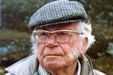
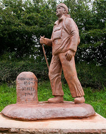
The Coast to Coast Walk was devised by the late Alfred Wainwright and runs from St Bees on the Cumbrian coast to Robin Hood’s Bay in North Yorkshire.
The 309km (192-mile) journey was devised by the guidebook writer using public rights of way.
Although the route is waymarked sporadically by some local authorities as it wends its way through their districts, there is no official symbol for the route.
The Wainwright Society, which was formed to study and promote the reclusive writer’s works, has been in discussion for some time with authorities to have the Coast to Coast Walk waymarked throughout, and announced today it had reached agreement with the authorities concerned.
Its aim, it said, is eventually to have the route recorded on Ordnance Survey maps.
The society’s publicity officer Derek Cockell said: “Parts of the walk have been waymarked already, but a new waymarker, featuring Wainwright’s AW signature, will appear on finger posts where the route crosses a public road.
“The society hopes that the waymarking will be completed during 2013, which is the fortieth anniversary of Wainwright’s guidebook, published in 1973. The society is planning events to celebrate this anniversary in 2013.”
Alfred Wainwright devised the walk, which passes through three national parks, and dedicated the book to ‘the second person (unidentifiable as yet) to walk from St. Bees Head to Robin Hood’s Bay.’
Since then, the walk has become one of the most popular long-distance walks in Britain and it has been estimated that between 5,000 and 7,000 walkers complete the crossing from coast to coast annually.
Wainwright’s original route was updated in 1994 to avoid sections where there was no public right of way.
In 2010, Chris Jesty completed a major revision of the guidebook, updating the text and maps to take account of the changes in the landscape that had occurred.
In the Vale of Mowbray section, eight miles of road walking between Ellerton Hill and Oaktree Hill has been re-routed on to public footpaths. The revision has now been accepted as the definitive line and it is this route that will be waymarked.
Mr Cockell said: “Part of the society’s rationale behind the desire to have the Coast to Coast waymarked is to accord public recognition of the route on the ground.
“It is not intended that the waymarks should mark every step of the way as the essence of the walk is that people should guide themselves across the route using the guidebook and, more importantly, a map and compass.
“The Coast to Coast crosses a number of remote areas of mountain and hill country and knowing how to use a map and compass to guide one’s steps is essential.
“A longer-term objective of the society is to have the route marked on Ordnance Survey maps and there will be further discussions with the relevant authorities once the Coast to Coast Walk has been waymarked.”
Three would-be Coast to Coasters gained notoriety earlier this month when they had to be rescued from Lake District fells on two subsequent days.
Three separate mountain rescue teams plus members of the Lake District Mountain Rescue Search Dogs were involved in operations to find the walkers who in both instances were found off the route.
Rescuers expressed their frustration at the walkers’ failure to heed their advice.
Five years ago, grough undertook the journey in ten days. You can read our account of the trip in our features section.


