Rescuers in the Lake District have warned of the perils of relying on digital mapping software after two callouts on successive days to people following routes on an app.
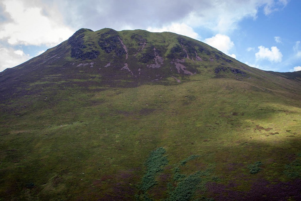
The first was on Monday when Keswick Mountain Rescue Team was alerted about 5.20pm when a walker got into difficulties on Causey Pike.
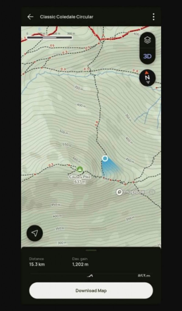
A team spokesperson said: “A man was following a recommended walk around the tops above Braithwaite using the AllTrails mapping software app.
“As it was getting dark he decided to take a shortcut back to his start point by following a path on this app, from the summit of Causey Pike northwards to Stonycroft Beck. With increasing darkness he became confused and subsequently lost as he could not find the path even with his head torch.”
He called 999 to request the help of mountain rescuers.
The spokesperson said: “After he messaged a screenshot of his map showing his position the cause of his confusion became apparent.
“There is no path in this location; the mapping software was incorrect. He was guided over the phone to the correct path and he made his way down to be met by a small Keswick team to ensure he made his way to safety.”
The incident involved five Keswick MRT volunteers and lasted 1¾ hours.
The following day the team was called out to Barf about 3.25pm. The spokesperson said: “There was another reminder that some mapping apps have serious limitations.
“Three women and their dog were following a circular walk to Lord’s Seat from the parking around Powter How using the AllTrails app, which recommended a route via the steep face of Barf.
“There is no path via this route, only lines of scree, which also requires the walker to negotiate the rocky outcrop of Slape Crag – the scene of previous callouts.
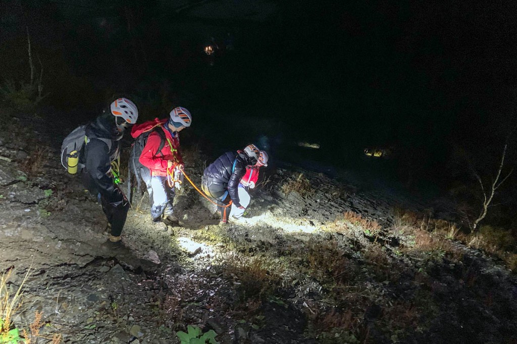
“The three woman were descending their route from the top of Barf and had negotiated the difficult down climb of Slape Crag, but with fading light and poor visibility they became cragfast and wisely dialled 999 to request mountain rescue help.”
A small team of volunteers made their way to the scene and began a search by ascending the slope from the bottom of Barf.
“The party were soon found and were given harnesses and helmets before being tied in to short ropes to help them descend the scree to the parking area.
“Successfully down and uninjured, the three and their dog were able to return home in their own vehicle.”
Alfred Wainwright, in his sixth volume of Pictorial Guides to the Lakeland Fells, describes the route as: “Not a walk. A very stiff scramble, suitable only for people overflowing with animal strength and vigour.”


barry davies
05 January 2023We have people coming to our house with an app that shows they can walk through our land and the other houses gardens when its actually a dead end here in the Ogwen Valley in Snowdonia . No idea where they get the details from ???
Mike
06 January 2023The photo of Causey Pike is misleading because as the map shows the walker didn't head due north from the summit. Instead he went along the ridge until below the crags and then headed down the more gradual stuff at the far left of the picture.
But it does seem that ringing 999 because you can't find a path is a little excessive.
Fell moocher with a plan.
06 January 2023I use Outdooractive and find it amazingly accurate. Before Christmas I did a circuit of relatively 'safe' fells north west of Bassenthwaite by literally having my nose glued to the route I had planned on the app due to low mist and poor visibility. It does help to have a route plan worked out in advance so your progress is live on the app. Outdooractive also has a Buddybeacon facility to enable invited friends/family to check live progress.
Yes, it depends on phone battery. So, I make sure the phone is fully charged before setting out, take two chargers (one just in case) and find I can do up to 8 hours of being tracked without losing a signal. Outdooractive will also give a GPS location that can be given to emergency services.
Another benefit of outdooractive are the range of challenges that can be signed up for, including hiking, mountaineering and mountain biking. Excellent for motivation to get out there and keep fit.
Highly recommend this app. No, I don't have any vested interest in promoting it. I just find it invaluable.
Barry
06 January 2023Or learn to read a map
Ian S
06 January 2023In cold weather the battery of a mobile phone runs out really quickly. Phones cannot be relied on for navigation, so learn to use a map and compass and always carry them on the hills.
Mike
07 January 2023All of these 'new apps'.
How long has Ordnance Survey been mapping the country? Maybe a good place to start, with a good old fashioned paper map and a compass?
Mike
07 January 2023All of these 'new apps'.
How long has Ordnance Survey been mapping the country?
Maybe a good place to start, with a good old fashioned paper map and a compass?
Fell moocher with a plan.
08 January 2023Just to say to the above, I carry two spare battery chargers and OS maps, compass, torch and two headtorches (one with charger facility). They are staples. On an apologetic note, I checked the Outdooractive map and the same paths are shown as in the Alltrek app. In my experience, these paths are minor alternatives to the main paths and can be identified on the ground from the app's live GPS signal, often as links to primary paths. Still, the map/app isn't the terrain. The advantage of these apps is that the map isn't as cluttered as OS maps as only the path lines are shown. Good wet afternoon exercise is to compare both versions.
Ian512
09 January 2023A comment Nigel Williams made in a navigation article he recently wrote might be of interest:
"We have a choice as to how we interact (with a GPS device) on the hill. There is a decision-making continuum;
At one end we can follow the 'dot' 100% of the time and let the GPS control us by making all the decisions.
At the other end we can exercise our spatial awareness, observation and decision-making skills using map and compass, with the GPS used to confirm a decision after it has been made, in that scenario we control the GPS."
Peter Birbeck
20 January 2023Stony Croft Gill.