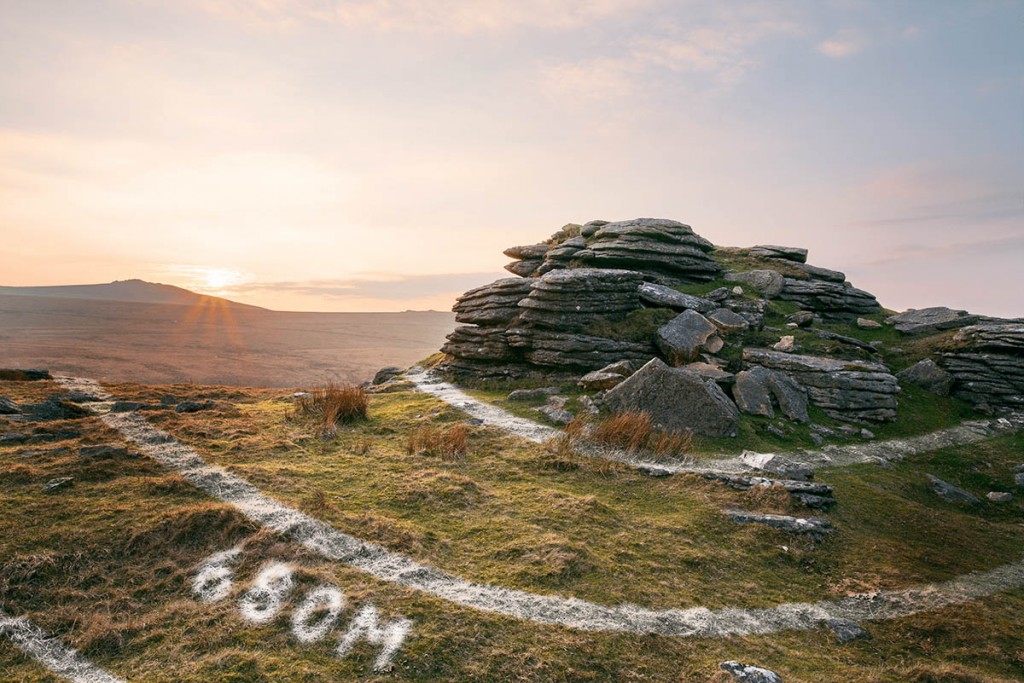
Britain’s national mapping agency is taking to the hills in some of the country’s top walking destinations to create a new aid to help outdoor enthusiasts find their location.
A special projects team from Ordnance Survey will use eco-friendly paint to mark contour lines on the terrain to mark the height of the ground in the area.
An OS spokesperson said: “Contours are a feature of many of our mapping products, and now we’re taking them to the next level with our eco-friendly contour paint.
“A team of volunteers are heading out to some of the most iconic walking spots in the country like Ben Nevis, the Lake District and Snowdonia to make these contour lines, so whether you’re a hiker getting outside to plan a walking route, or a planner plotting a new development – our real-life contours will make visualising the height of landscapes even easier.”
Work on the contours project will begin on Friday 1 April.
The head of special projects at OS said: ”We’re continually innovating and pushing boundaries.
“This is an amazing step towards bridging the gap between technology and reality; taking the maps right off the page into the landscape for a fully immersive experience to #SeeABetterPlace.”

Dave D
01 April 2022You're a bit early... :D
John
01 April 2022and making a complete mess of our beautiful countryside?
Alan
01 April 2022April fool
Ian
01 April 2022I hope they're more accurate up Scafell Pike, East Mill Tor's only 513m...
Paul
01 April 2022The grid references would also be useful :D
Madeleine
01 April 2022Brilliant! :-D
Don
01 April 2022Hopefully this is a joke as Striding Edge has just been GRAFFITIED also by some clowns with a spay can!!!!!!! Be careful what signals you are sending!!
Clive Grievson
01 April 2022Best April fool joke since the BBC showed spaghetti being grown on trees and harvested
Bobs
01 April 2022Brilliant! Had me crying with laughter
Ap Rill Follow-Er
01 April 2022Fluorescent paint in day glow green / orange would be better, particularly as its visible with a few inches os snow on top. :-))
Twpsyn
01 April 2022How about arrows pointing uphill for those who don't do contours?
Bob Ratcliffe
01 April 2022Sweet
Max
01 April 2022I’ve never figured out why you use false eyelashes to indicate crags on maps
Clive Grievson
01 April 2022Best April fool joke since the BBC showed spaghetti being grown on trees and harvested
Matt Dalby
06 April 2022Reply to Clive Grievson.
The best ever April Fool joke was on Ukclimbing in 2016, claiming that the Inn Pinn on Skye was no longer a Munro as lightning had struck the summit and dislodged the large block on the top of the pinnacle, meaning it was now slightly lower than the mountain it abuts. Local mountain guides were said to be considering airlifting, then cementing the block back in place as they earned a lot of money guiding Munro baggers without climbing skills to the summit.