To non-hill-list baggers, the marilyns can seem a strange group.
Conceived from a homonymous linking of Sir Hugh Munro’s list of Scottish 3,000-footers and the stage surname of glamorous actor Norma Jean Mortenson, the marilyns don’t even need to soar too high.
There’s no minimum altitude needed for a hill to join the club, just the necessity of the peak protruding by 150m (492ft) from the surrounding land, or sea.
The marilyns list was devised by Alan Dawson and detailed in his book The Relative Hills of Britain, ranging from the UK’s highest peak Ben Nevis to Crogearraidh na Thobha on North Uist, which is only just over 500ft high.
A complete round of the marilyns is no mean feat, as the list includes remote sea stacks in the St Kilda archipelago.
But seasoned hill sleuths have their eye on the list with a view to adding to it.
Myrddyn Phillips is one such man. He set out in his native Welsh hills in the search for a new marilyn. Here’s his account of the latest discovery.
The marilyns burst upon the hill-listing scene almost 30 years ago with a qualifying criterion that tore up the norm of minimum height and minimum drop and used just one defining definition: minimum drop. This simple one-pronged use of qualification revolutionised how many people view what a worthy and interesting hill can be.
Over subsequent years the list has become well established with many dedicated followers slowly working their way through what was the current total of 1,555 British hills, all of which have a minimum 150m of drop.
With two St Kilda sea stacks to tackle, the marilyns are one of the most sought-after lists. It was not until 13 October 2014 that Rob Woodall, closely followed by Eddie Dealtry, climbed Stac Lee, their final Marilyn. Since then another nine people have climbed all the marilyns.
Recent years have seen a great swathe of surveying activity scrutinising the list and concentrating on those marginal hills, the ones close to or just over that all-important 150m of drop mark. This has resulted in a number of additions since first publication; however these additions are now becoming a rarity as more hills are accurately surveyed and their drop values confirmed.
The last new marilyn entered the list three years ago when Jon Metcalf surveyed Beinn Dearg (NC 279 658) as having 150.7m of drop. The last new Welsh marilyn entered the list eight years ago, this was Mynydd Anelog (SH 151 272) with 151.0m of drop.
Well, guess what, Wales has another new marilyn, its first since 2013!
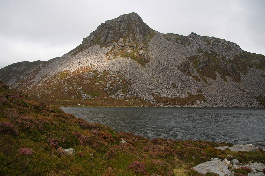
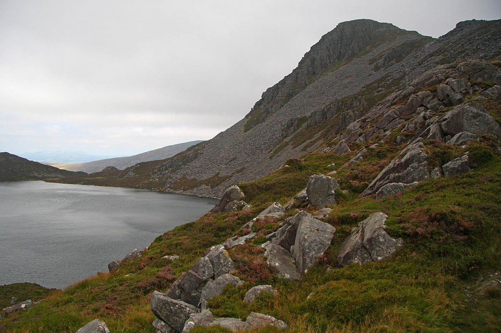
The hill is Rhinog Fach (SH 664 270) which is positioned in west Wales, with the town of Barmouth to its south and the village of Trawsfynydd to its north. The hill forms part of the northern Rhinogydd, one of the toughest, but also one of the most rewarding mountain landscapes anywhere in the country.
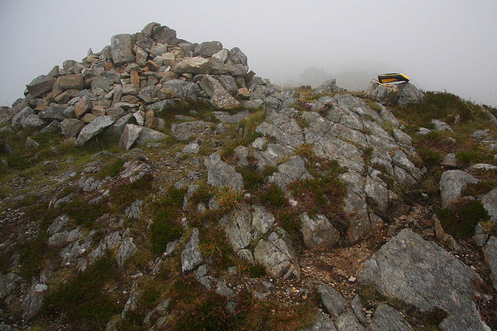
Rhinog Fach was surveyed on 24 August using a Trimble GeoXH 6000, a piece of equipment that gives highly accurate results both in height and position and which has been responsible for a number of status changes to hills over recent years, but never for a marilyn.
Two data sets were taken at the summit, one on the ground with the equipment’s internal antenna aligned to the high point with the end of the Trimble placed on a rock taken from the cairn to give it horizontal alignment, and the second atop my rucksack with the measurement offset duly noted.
For such surveys every centimetre can be vital, so for those of a numerical mind the all-important figures appear below:
Rhinog Fach summit:
711.632m at SH 66485 27017 – Trimble on ground
711.642m at SH 66485 27017 – Trimble on rucksack
Average: 711.637m.
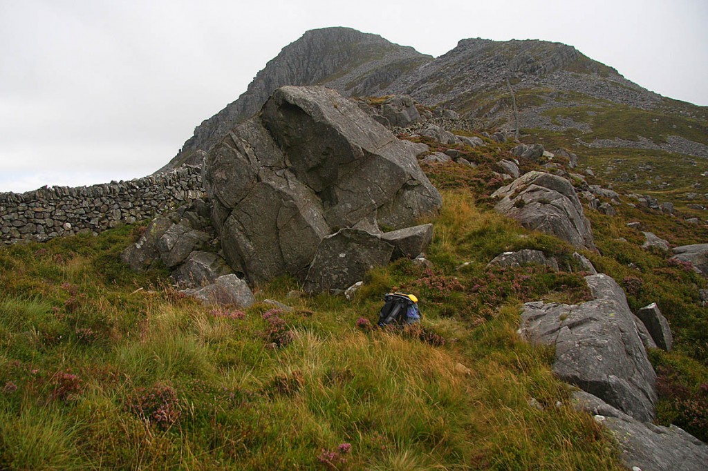
Three data sets were taken from the area of the bwlch, which is positioned just to the east of the solid stone wall traversing these hills. The ground on the west side of the wall and ground at the base on its eastern side is lower compared to where the Trimble was set-up.
Rhinog Fach bwlch:
560.618m at SH 66555 26531 – hill to hill traverse
560.560m at SH 66557 26533 – hill to hill traverse
560.599m at SH 66561 26533 – valley to valley traverse, and what turned out to also be the hill-to-hill traverse.
These values give Rhinog Fach 151.038m of drop.
Once data were processed I notified Alan Dawson who has kindly submitted the following:
“Rhinog Fach has been in need of a survey for many years and it is great news that Myrddyn has done it and made this discovery.
“The only other realistic possibility for a new marilyn is Faan Hill on Shetland Mainland, a mere 173m high. That will not be an easy one to survey.
“Meall an t-Suidhe next to Ben Nevis is estimated to have 147m drop and so it also has a small chance of reaching 150m. There is also the possibility of summits being relocated, as happened recently when Lidar data showed that White Hill near Dumfries was higher than nearby Hightown Hill, though OS maps show it to be a metre lower.”
This now brings the overall total of British Marilyns to 1,556.


Charlie Britten
31 August 2021I have resurveying query here: in June I saw a notice at the Bowden Bridge Car Park in the Peak District saying a resurvey of Kinder Scout had identified a new summit, although at 636 m this was the same stated height as before, suggesting any difference must be by inches.
However, even though this seemed to be a National Park Authority notice, I have seen no news of this anywhere else. Can anyone shed light on this?
John F.
02 September 2021Interesting I did not see this note but recently noticed this whilst walking. I have not found any reference to a change or re-positioning of the summit.
The summit of Kinder Scout is now shown on GPS as being approx 30 mtrs south of the previously accepted place where all the paths converge.
David
09 September 2021The notice you mention wasn't an official document (I'm a volunteer footpath inspector in the area); it's not known who put it there but it certainly wasn't the Peak Park or National Trust, though it was made to look like it.
FYI, there are no paths at the summit, you might be thinking of the Kinder Low Trig Pillar (and area around), which is not the highest point.
John F.
09 September 2021I am not thinking of the trig point ! There are a series of tracks to the previous summit from different directions
Someone has now erected a wooden pole at the newly designated summit. The small stone cairn still exists at the previous high point.