Volunteers have discovered almost 450 previously unmapped paths as part of a Ramblers Scotland project.
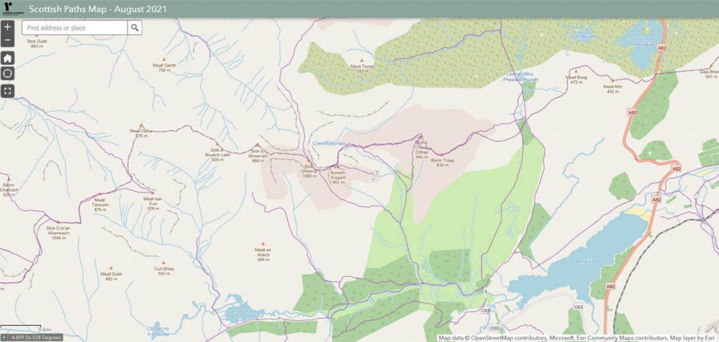
The charity today unveiled an online resource mapping 42,000 miles of routes available for walkers north of the border.
The map shows a variety of paths, from traffic-free city routes to high mountain trails, including many that are not shown on Ordnance Survey maps of Scotland. More than 100 Ramblers volunteers have recorded and audited paths over the past year.
Since 2019 the charity’s volunteers have completed about 1,500 path surveys, adding almost 450 unmapped paths that total more than 85 miles in length.
Ramblers Scotland director Brendan Paddy said: “Scotland has amazing landscapes and world-class access rights, yet sadly many people still lack confidence about where to walk, so mapped paths are key to creating a healthier, happier nation.
“I hope that people will use our Scottish Paths Map to plan walks, find new routes and unearth previously unknown paths on their doorstep.
“While this is the best ever map of Scotland’s paths, we believe that it can be still be improved – so I’d encourage people to volunteer to help us audit data and identify thousands more hidden paths across Scotland.”
Paths are marked in purple on the map until audited by volunteers, when they turn green. Many more paths are expected to be audited in the coming months and years, enabling the public to access useful details such as a path’s surfacing, condition, waymarking and any obstacles.
Ramblers Scotland is also urging walkers to volunteer to help audit its data and record hidden paths in their owns areas via its website.
The map can be used on desktop or mobile devices, wherever there is a signal. Rather than replacing traditional maps, Ramblers Scotland said it is instead designed to help people plan journeys, highlight gaps and promote paths and routes.
It said the map will be regularly updated with volunteers’ new paths and audit information and in future, Ramblers Scotland intends to make its entire Scottish Paths Map dataset downloadable for free in various popular formats.
Ahead of today’s launch, Ramblers Scotland president Lucy Wallace has been voluntarily helping test the technology and audit paths on her home island of Arran.
The Mountain Leader and wildlife guide said: “This is such an exciting project as it brings together existing mapping with new data gathered by volunteers on the ground.
“As it grows it will be a super-useful planning tool with publicly available information about important things like path condition and obstacles such as gates or stiles.
“As one of the volunteer auditors, I’m having a great time walking with purpose in my local area and helping to put this data on the map.”
Ramblers Scotland said it has worked with many partner organisations to include their path data and to agree a definition of what standards a path should meet for it to be mapped. It is also inviting any organisations with path datasets to get in touch about including them in the project.
The project also draws on existing open-source data including OpenStreetMap. In addition to including many previously hidden paths, the new map has the capability for volunteers to record metadata that will be useful to walkers and wheelers such as the path surface, stairs and any obstructions.
The Mapping Scotland’s Paths project has received funding from players of People’s Postcode Lottery.
The maps can be accessed via the Ramblers’ website.


Marion
25 August 2021Can't really see the point of this in Scotland as we already have the right of responsible access. Half the fun of walking is discovering new places for yourself.
Margaret
26 August 2021Marion, yes - almost seems to counter to what exists in Scotland, but the current trend seems to be 'all must have paths'.
Andy Duff
28 August 2021#Margaret
What do you mean the current trend is all must have paths.
It doesn't make any sense
James
30 July 2023Just starting to do walks