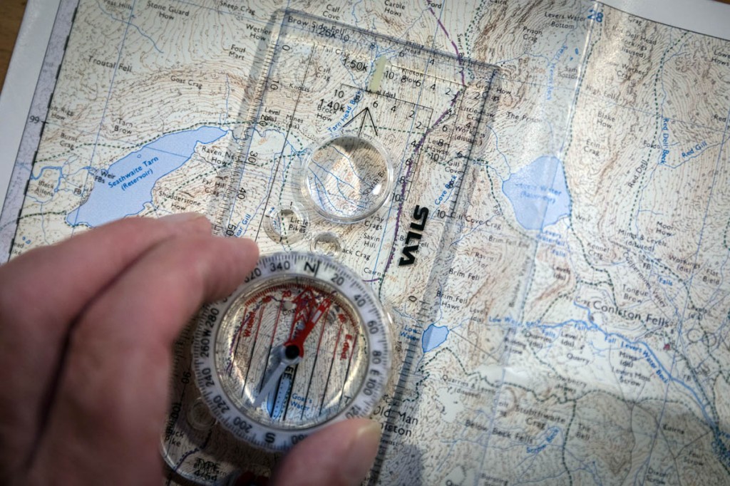
Most young people are confident they can read maps, according to research commissioned by Ordnance Survey.
The UK-Government-owned mapping agency said, surprisingly, seven in 10 ‘Generation Z’ members are confident of their map-reading skills.
This is attributed to their widespread use of mobile phone mapping apps, OS said.
Results of the survey, undertaken by OnePoll, were released to coincide with national map reading week, promoted by Southampton-based OS. The event ended on Sunday.
The agency said the aim was to encourage people of all ages to understand the importance of map reading and how the vital life skill can unlock the outdoors and keep people safe.
Seventy per cent of those in the Gen Z range, which includes young people between nine and 24, said they can confidently read a map when needed, smashing the stereotype of them being a map-illiterate generation.
The study of 2,000 adults found that day-to-day use of mapping apps on their phone has made many young people more confident when it comes to traditional paper maps.
And in a surprise result, 50 per cent could also confidently use a compass – compared to more than the 46 per cent of 45-54 year-olds who said the same.
Ordnance Survey’s managing director for leisure Nick Giles said: “It’s very reassuring to see that so many young people can confidently use a map.
“It has long been thought of as a key life skill, but one which was also dying out.
“However, many young people are now so used to reading maps on their smartphone, with the apps being a key part of day-to-day life, that they are able to confidently transfer these skills to the traditional paper map too.
“It’s something that may come in handy at any time because without a map, you may find yourself in a spot of bother, especially if your sense of direction isn’t up to scratch or your trusty phone runs out of battery.
“It’s why we run national map reading week. We want to encourage people to better understand how good map skills, both paper and digital, can unlock and inspire people to safely discover new places and adventures.”
One of the key reasons for the event is to teach people how to stay safe in the great outdoors. OS is also urging people to ensure they have a paper map or digital mapping downloaded to their phone as part of their travel kit this summer, to help them find places to visit and discover new adventures.
OS mapping is relied upon by emergency services, including mountain rescue, who respond to about 2,500 people in trouble each year.
Mike Park, senior executive officer of Mountain Rescue England and Wales, said: “With the recent restrictions to foreign travel huge numbers of people have taken to the hills for recreation, many for the first time and without the necessary navigation skills.
“As a result we’ve seen a marked increase in the number of callouts to people who were simply lost or poorly equipped for the conditions they found themselves in.”
Three in 10 of those in the 45-54-year range said they ‘never’ use a physical map; this drops to just 16 per cent of Gen Z.
More than a quarter of those in the younger age bracket – 27 per cent – use a paper map a few times a month, compared to just four per cent of 54-65 year olds.
The study also found 71 per cent of adults polled thought that being able to confidently read a map was a key life skill.
But 18-24 year-olds were more likely than any other age group to also consider themselves to have a good sense of direction.
Nearly seven in 10 reckon they would be good at finding their way compared to just 56 per cent of those aged 45-54.
Young adults are also most likely to rely on a smartphone app to navigate their route – 83 per cent. A total of 42 per cent said this was because of its simplicity and 52 per cent that that it is easier to carry.
Whereas 38 per cent of those aged 65 and over admitted to never even thinking about using a navigation app.
The study also revealed the symbols Britons would like to see featured on maps, with cashpoints, electric vehicle charging points and phone charging points among the top suggestions.
A quarter of Gen Z respondents polled would also like to see 5G hotspots marked, while 27 per cent would like a pointer to top Instagram sites.
Recommendations for those heading to the outdoors are:
- Plan ahead. Investigate the route thoroughly and take into account your experience and capabilities and the experience and capabilities of others joining
- Check weather conditions. Weather can change dramatically over the course of a walk, especially in hilly areas. Have a contingency plan in mind in case the walk needs to be cut short
- Practise your navigation skills. Make sure you are confident of interpreting a map and using a compass to navigate. Being able to give the emergency services an accurate grid reference for your location can save valuable time and lives
- Carry and wear the right kit. For the basics, warm and waterproof clothing – multiple thin layers are always better than one thick jumper – walking boots, a map, compass and navigation skills are essential, as are a decent supply of food and water. If you’re heading into the mountains or for longer walks, you really should be thinking about a survival bag, a torch or headtorch, spare batteries, a whistle, spare clothes, hat and gloves, a first-aid kit, spare food and in winter conditions an ice axe and crampons – but know how to use them properly
- Always have a back-up. If you prefer to navigate with a GPS device, do carry a paper map and compass as well. The free app OS Locate will give you an accurate grid reference for your location and does not need a phone signal
- Let people know where you are. Letting someone know where you are going and when you are likely to return is a good idea. Make sure you notify them when you return and agree a timeframe when they should contact the emergency services if you don’t contact them. If possible leave a route card.
Grough’s own route planning system enables you to plot your planned route using Ordnance Survey mapping, print out an A4 sheet of the route on a 1:25,000 or 1:50,000 map, and take it with you on your walk. Grough route offers OS mapping of the whole of Great Britain from Shetland to the Isles of Scilly at both scales. You can also create a comprehensive route card with the system. Prices start at just £5 for a 30-day subscription. A year’s grough route subscription costs only £19.50. More details are on our grough route pages.


Dave
12 July 2021A lot of the comments above are from people who 'said' they could read a map etc. That doesn't mean to say they actually can. Where is the proof in this study?
Dave
12 July 2021A lot of the comments above are from people who 'said' they could read a map etc. That doesn't mean to say they actually can. Where is the proof in this study?
Davy
12 July 2021I am confident that I can command an intergalactic space ship.
Steve Tomlin
12 July 2021Self reporting on your ability is famously flawed
https://en.m.wikipedia.org/wiki/Dunning%E2%80%93Kruger_effect
A local lad
12 July 2021the younger generation of today have been brought up to think they are the best at absolutely everything, and no one is allowed to suggest otherwise. Very sad really because the truth is we are all good at some things, less good at other things and rubbish at some things.
Take away their phones, give them nothing but a map and a compass, drop them off among the shap fells and ask them to walk to Patterdale.
Jonathan Hammond
12 July 2021Navigating around the Lakes or up to any of the popular peaks is easy.... Drop em in the middle of Dartmoor in the fog. That'll teach 'em!
ANN
13 July 2021Can we spare a mention for the work of countless geography teachers, D of E leaders, Outdoors Centers, Scout groups, Ramblers Association, orienteering clubs etc. who might also have something to do with it.
Lee
14 July 2021Yet another case of people setting off with no preparation and ending up getting lost.
People can be so stupid.
Colin
14 July 2021Yeah stupid people, posting on the wrong article.
Lee
14 July 2021Who's posted on the wrong article Colin?
Have you actually read this one.
Mike D
16 July 2021From my experience interacting with the 'youth' out in the hills, this apparent confidence in navigation is misplaced, and seems to be mostly based on 'google maps app' (naturally without offline cache prepared) or following the stream of others in jeans and trainers to the local instagram honeypot, and once their original and lazy strategy breaks down, they'll ask somebody like me where they are/which-way-to.
EastLancsRodeo
17 August 2021Came to have a look at the young-people-bashing comments and, as usual, wasn't disappointed.
I find it fascinating that so many older people think that in 'their day' absolutely everyone was completely self-reliant and the 'youth' respected elders/knew how to read a map blah blah blah.
There have been confident know-it-all teenagers since teenagers existed. And there have been moaning old duffers since moaning old duffers existed. The problem is many people don't notice themselves turning into moaning old duffers.
I find that there's plenty of really switched-on young people around who CAN read a map. There's also plenty who can't. But that's always been the case.