Peakbaggers have a new reason to pull on their boots and get walking.
A charity has come up with a new set of hills to tick off, appropriately in the Peak District.
The Ethels is a list of 95 hilltops with an altitude of 400m, plus a few significant lower prominent hills. The list has been devised by the Peak District and South Yorkshire branch of the countryside charity CPRE and is named after its founder Ethel Haythornthwaite.
The list includes the national park’s three highest peaks: Kinder Scout, Bleaklow and Black Hill plus enough, the charity said, to keep the keenest hillwalkers busy for many months to come.
It adds to challenges such as the Scottish munros and the Lakeland Wainwrights, but is probably more achievable for less adventurous walkers.
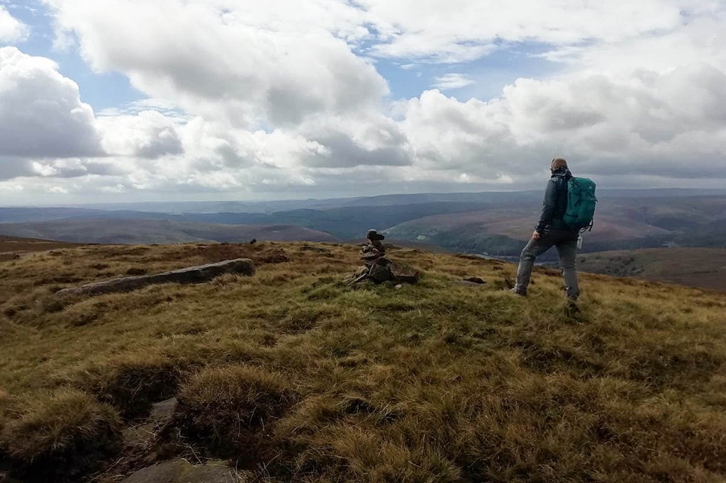
The hills range from the 287m (942ft) summit of Thorpe Cloud at the gateway to Dovedale in the limestone White Peak to the remote moorland summits the northern Dark Peak area.
The highest point is on Kinder Scout, 636m (2,087ft) above sea level.
They’re mapped and listed on a new smartphone app that is being released by CPRE Peak District and South Yorkshire to coincide with its 97th birthday.
The challenge was the idea of CPRE PDSY supporter Doug Colton, who worked with the charity to create an app named Ethel Ready that can now be downloaded for both Apple and Android.
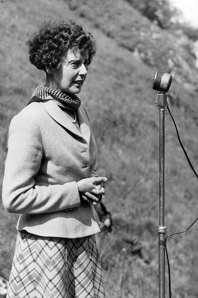
Ethel Haythornthwaite created the charity in 1924. She found refuge in the countryside near her Sheffield home after losing her husband Captain Henry Gallimore in the First World War, when she was only 22.
CPRE PDSY chief executive Tomo Thompson said: “Ethel was lost in grief.
“Her parents suggested that she took restorative walks in the countryside around the city, an area we now know as the Peak District.
“Those walks and landscapes had a profound effect and literally changed her life. She went on to create the countryside charity that we now know as the CPRE.
“She helped protect wild areas like Longshaw and Blackamoor from development by organising their purchase for public access. She was also a key figure in creating the Peak District as Britain’s first national park 70 years ago.
“Today so many more people are finding refuge from Covid lockdown in the countryside on their doorsteps, so we thought it apt to create this new hillwalking challenge in Ethel’s memory.
“On our 97th birthday we wanted to give something back to the communities that have supported us, and to inspire others to come to this remarkable part of England.”
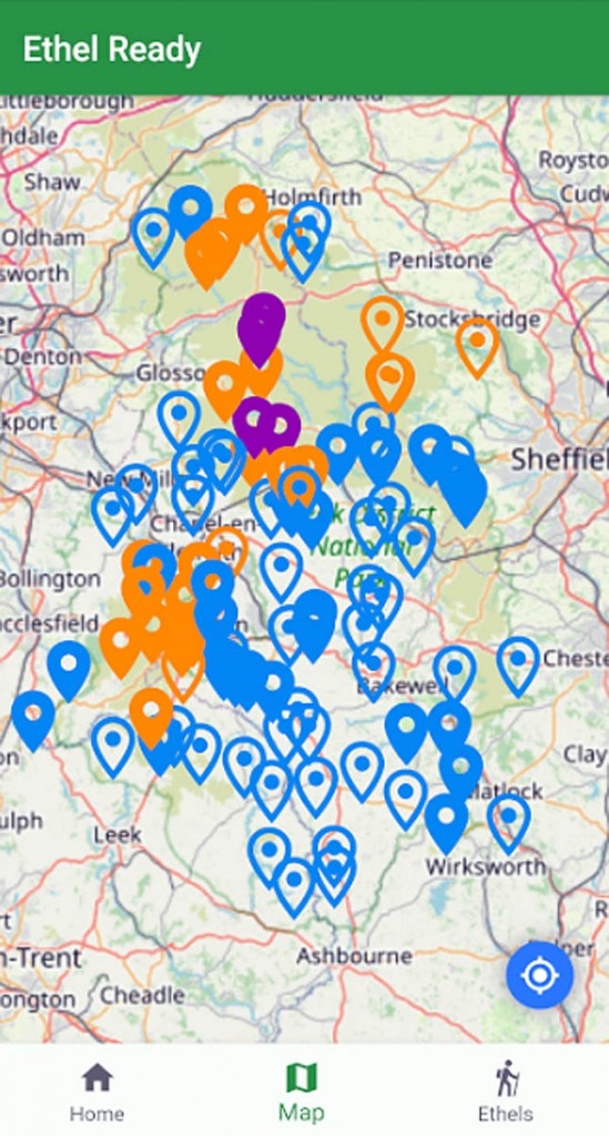
The smartphone app has a map of all 95 Ethels, plus a list of them by name with their height and grid reference.
The app includes a tick-list accumulator that allows people to work their way through the hills at their own speed.
“Some people may want to join them all up in a very long run, and some people might want to take it more steadily, ticking off just one or two a year,” Mr Thompson said.
“The app also has a CPRE tab that links to our website where you can learn more about our work, join our charity as a member, or make a donation to us.
“We have launched the app for free as we don’t actually ‘own’ those hills; we have just made a list of them.
“If you use the app we would be very grateful if you would consider making a donation to us to support our work.”


Are we nearly there
09 May 2021I can sum this up in 1 word "pathetic"
James
10 May 2021To really claim to have ticked a hill shouldn't every ascent start at sea level.
margaret hanson
10 May 2021What a lovely idea, especially for those of us not fit enough for munro climbing.
Martin Jordin
10 May 2021Great idea in the best traditions of open public access
adrian holland
10 May 2021What a great idea to help get people involved and aware of yet another iconic area of our great countryside. I for one will be ticking them off one bye one and photgraphing them along the way
yamyam
10 May 2021James are you saying all hills across the uk should be classed only as hills if you start at sea level. Sea level datum point is at Newlyn and all hill and mountain tops are measured from this point therefor i do not understand your question.
Is this the path to…
10 May 2021Another list for people without enough imagination to come up with their own or enough of an imagination to simply explore
Ridge
10 May 2021They haven't actually unveiled the list, they have unveiled their app which you can download to find out what the list is.
Neil Theasby
10 May 2021Not everybody owns a smartphone so will the locations of the "Ethels" be made available via other means - such as a simple map on a website or a pdf file?
James
11 May 2021yamyam -
For example, many people climb Ben Nevis from sea level [starting at Fort William] therefore I'm suggesting that to have really 'ticked' a hill they should all be climbed from sea level.
Of course 'non tickers' can start where they like.
Dave
11 May 2021As a number of these seem to be on private land creating a 'tick list' that requires people to trespass to complete seems somewhat irresponsible.
Dave
11 May 2021As a number of these appear to be on private land it effectively seems an encouragement for people to trespass. That doesn't seem very responsible?
Sheff Steve
11 May 2021The Peak District is a dissected plateau. It is mostly moorland. It is named after the Pec-saetan Anglo-Saxon tribe that settled it. Not its almost non-existent peaks. It is already teeming with people, their cars can be heard from most places, and the wildness of places like Longshaw is being lost. I
DinoF
11 May 2021Sheff Steve - Pec-saetan means "Peak Dweller".
John P
11 May 2021Mount Everest isn't climbed from sea level!
Dougie
12 May 2021Personally I don't see the need for for another list but if some people do, hey ho. Doesnt seem to be a lit of detail to base argument on and just because something is on private land it doesn't stop you asking permission - this worked for years at Bamford. However the wildness of Longshaw? Dont slag me off I lived in the Peak for years, it is a man made and managed environment we enjoy.
Karyn Buckley
12 May 2021What a wonderful idea, to get people out walking, but also as a wonderful tribute to an amazing woman, without whom many of the beautiful areas around Sheffield wouldn't be there for us.
So important to know our history.
Stephen Slater
13 May 2021A brilliant idea because I thought I knew a great many of the viewpoints in the Peak District but the map highlights a lot of places I don't remember visiting in recent years so I am already planning walks in lesser known areas especially in the White Peak as I live in Stockport so some of the Dark Peak has been accessible to me during lockdown but anything south of Buxton hasn't been realistic during lockdown so it is great to get back to the White Peak. I have a lot of catching up to do!
Paul Grantham
26 May 2021What a ridiculous idea. This is just a list of hills which have no particular criteria to them. You might have well have a list if the "Ps", every hill with a P in its name. Or perhaps a list of all the hills containing a boy's name. Or how about the Macs all hills with Mac in their name. No, there should be a criterion fir every hill to suit. Wainwrights all appear in his book etc etc. PS I've already climbed them all .... see the Hill bagging site.
Mr Serendipity
28 May 2021Let’s stick to the existing walks shall we - nature needs some breathing space - it doesn’t need flocks of walkers in ‘new’ areas. Despite the honourable reasons for creating the idea I can’t imagine the impact on an already under pressure landscape was really thought through.
Steve
28 May 2021Ill conceived idea - there’s pressure enough in the peaks so why start sending people to little used areas. Give nature a break.
Pete
15 July 2021James:
People don't generally climb Ben Nevis from Fort William, but start from the Visitor Centre at 15m above sea level. Even if they start from Fort William, most will not have dipped their toes in the sea to claim a sea-level start.
Peter Riddle
18 October 2021Forget the pedants, the ‘ this is not real mountain walking’ crew and the mealy-mouthed. It’s a great idea and I approve of anything which encourages people to get out and try something new, healthy and active. Plus - I thought ‘Trespass’ was the watchword of the Dark Peak!