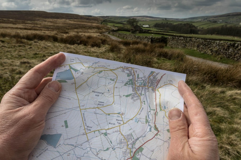
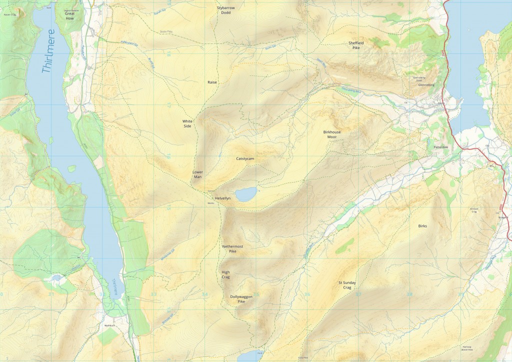
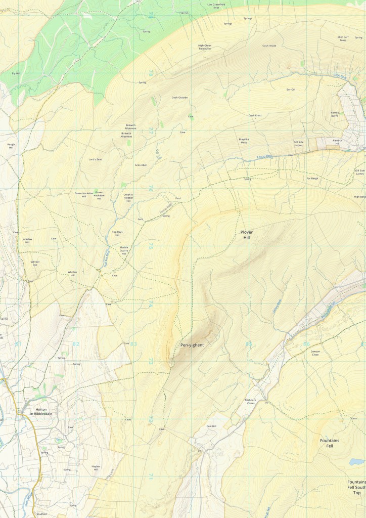
Today, we’re announcing a new mapping project we hope will revolutionise the way people enjoy their trips into the British countryside.
grough map will use crowdsourcing to ensure details on its digital maps are bang-up-to-date and tailored to the growing number of people taking up walking, mountain biking, trail running and other outdoor pursuits.
And the best news is: it will be free to use. There will be no restrictions on re-using the maps, so you will be able to tell your friends where you’ve been, and share grough map maps on your blog and social networks.
Changes to the maps’ 4 million paths and roads can be made in seconds, using information updates from fellow outdoor fans.
The aim is to give walkers, cyclists, runners and other outdoors enthusiasts the best possible maps for them to plan their outings, find their way and enjoy the great British countryside.
Maps can be printed out or exported to smartphones and GPS units and will be customisable to show the most relevant features for the user’s activity.
The new grough map will be offered to users of the existing subscription-based grough route system, but will also be made available to developers to publish and improve as an open-source project.
Luke Smith, technical director of grough, who led the development, said: “We believe everyone should be able to enjoy the outdoors. Finding out where you can walk should be easy.
“Our maps are different. The process is completely automated, and our emphasis is on creating an automated process that delivers high-quality mapping. This allows us to update our maps in seconds, rather than hours, and makes it simple for everyone to contribute towards the map with valuable information.
“This means you can help us to improve the map, by providing information that isn’t included in other mapping products but might be useful for outdoor activities, such as climbing routes or temporary footpath closures. We’ll do our part too, building a database of temporary information –such as footpath repairs and storm damage – and new developments using information our editorial team receives.
“The data that goes into our maps can also be used for other purposes. Our software can use this information to plan routes on your behalf, adapting them for your preferences such as avoiding busy road crossings, exposed edges, or land unsuitable for mountain bikes or those with reduced mobility. We want to make the countryside accessible to everyone.”
grough has set up a website, to enable outdoor enthusiasts and software developers to register an interest in the new mapping, which is expected to go live later this year.
grough map uses a combination of data sources to produce its maps, including open data from Ordnance Survey, OpenStreetMap, Natural England, Natural Resources Wales, 86 local authorities, and the Environment Agency, including LiDAR surveys that use lasers to scan the land.
Incorporated into the database on which grough map runs are 390,000 public rights-of-way records, 15 million outlines of buildings and four million paths and roads available to walkers and cyclists. The whole project has generated about 100GB of data. Maps are produced at a resolution of 200 dots per centimetre, which makes them ideal for printing at home.
Bob Smith, editorial director of grough, said: “This has been a mammoth project but it is nearing the stage where we can make it available for the public to use.
“General-purpose maps produced for outdoor activities in Britain are fabulously detailed, but there is a lot of information on them that’s not relevant to people undertaking walking, cycling, running and climbing trips in the great outdoors.
“grough map has been developed to show clearly the information that’s of most use to outdoors fans, which can be constantly updated by crowdsourcing the latest information from those using it.
“We’re very excited that grough map is nearing the stage where we can release it and see it develop as the prime mapping resource for Britain’s outdoor community.”
More information is on the grough map website.


Steve H
14 April 2016Great stuff, thanks!
Mike V
14 April 2016Sounds very interesting, but the article says that the maps will be available free to use.
It then goes on to say "The new grough map will be offered to users of the existing subscription-based grough route system, but will also be made available to developers to publish and improve as an open-source project".
grough route is subscription based and not free. So why, if the maps to be freely available free to all, is grough only making them directly available to grough route subscribers and developers?
Why won't they be freely available (directly from grough) to all?
Bob
14 April 2016grough map is still in development, so is not yet ready for release. When it is, we will offer it to subscribers to our paid-for grough route system, but we will also offer a free mapping service using the new grough maps.
Some 'value-added' features of our route-planning service will only be available to grough route users, along with licence-controlled OS mapping, but the new maps will be made available to users free of charge outside of the existing grough route service.
But what we really want to do is involve as many people in making the new maps the best possible ones for outdoor pursuits, so we're looking for as much input from users and developers as we can. They will be able to use our data repository on GitHub to do this.
Also, anyone will be able to use our data and tools to create their own maps, if they choose.
Bob Smith
Luke Smith
14 April 2016Hi Mike,
Bob is right, the maps will be available for free. Whilst grough route is currently only available to our subscribers, it will be opened up to everyone including those without a subscription, just as soon as we're ready with grough map. When this happens, you'll only need a subscription to access the more advanced features and the OS mapping which we provide under a paid-for licence. Access to our own mapping will be free.
In time the grough route system will be overhauled too, to allow the maps to be customised in an easy way through our web interface.
For the more technical-minded individual, you'll also be able to download all the tools and systems behind the maps, which will allow you to customise them yourself or further build upon the system.
I hope that explains the plan clearly.
Chris
14 April 2016What is the difference between this and Open Street Map?
Luke Smith
14 April 2016That's explained on the grough map website, under the useful title 'What makes this different to OpenStreetMap?'.
The brief version is that grough map doesn't just use OpenStreetMap data, it is a composite produced using data from more than 90 sources.
chris
15 April 2016Cheers Luke
Andrew Marshall
16 April 2016Seems like a GREAT project and Idea but still prefer OS maps...
Have tried several different map types including Harvey maps and there is something not quite right about them...
But am willing to give them ago and if there was an app for use on Android or away to use them on GPS's such as garmin ones just like you can with OS maps that would make a huge difference and even happy to pay a small fee!!
Hugh Westacott
17 April 2016This is an interesting development but a few points need clarification:
1 Will it be possible for the map-reader to distinguish between what is genuine OS cartography and the amendments provided by crowd-sourcing?
2 Is there not a danger of inaccurate or even malicious amendments being made to the OS mapping? What if a well-meaning amendment is made that proves to be wrong because it could lead walker and climbers onto dangerous ground? Also, what is to prevent landholders deleting or diverting a right of way from Grough mapping that caused them problems?
Luke Smith
17 April 2016Hi Andrew -- totally understandable, we can't deny OS maps are impressive. This project is really all about creating a map that can be customised for different activities, and to suit individual preferences. With regard to using the maps on a Garmin, this is something that should be possible but only for small areas at a time (a restriction imposed by Garmin). So you could plan a walk and transfer the mapping for that area, but you wouldn't be able to have the entire Lake District on your device permanently for example. We will definitely make the maps available on mobile devices though, including downloading them to the device so you don't need a signal.
Hi Hugh -- you raise some important points so I'll try to address them in detail. For clarity, we are not amending OS maps, we are creating an entirely new map from scratch using data from a number of different sources, including OS.
The map itself does not distinguish between crowd-sourced information as such. However, I think we need to be clear what we're crowd-sourcing. I consider there to be four tiers of data:
1) Data from Ordnance Survey, which has consistency of coverage, but isn't always accurate (especially in rural areas). This information is typically always included unless there is strong evidence from a more recent dataset that it should be removed. An example would be the temporary road and path closures in the Lake District following flooding, but might also include buildings which are demolished.
2) Data from government organisations which represents a legal status. This includes public rights of way, and Countryside and Rights of Way Act access rights. We have data from 86 highway authorities which covers about 2/3s of England and Wales, and hope to add more. We will be transparent about where we have this data and where we don't. In an area where we have the data direct from the HA, then this would appear in our mapping regardless of any crowd-sourcing, although the database makes a distinction between a legal right of way only, and a path/track which is visible on the ground.
3) Crowd-sourced information on the location of paths from OpenSteetMap. This is often high quality data insofar as it's been surveyed by someone actually walking along the path, and frequently includes paths which don't appear on OS maps because they're not rights of way. There is nothing to stop a landowner or vandal from deleting this data from OpenStreetMap, but in more than 10 years there has been minimal vandalism of their datasets, and such changes are often noticed and reversed quickly. If we have the PRoW data for the area, the landowner removing their track from OSM would not remove it from our map.
4) Supplementary information we crowd-source directly, which is provided directly to grough through its web services. This will typically be information on how severe a scramble is, short term closures of access land or sites used by the MOD, suitable locations for parking, whether a visible path is present on the ground, and track logs people can choose to provide after their walks. This information will not necessarily be fed into the mapping automatically or straight away. We will make the information available to our users through our web services, but clearly label it as crowd-sourced information that could be erroneous, and in cases where multiple track logs suggest the path deviates from that which exists in our records, our map may eventually change to reflect that. There will be a strong emphasis on reviewing this information where there is any potential that it might adversely affect quality. Information on parking for example though, would be unlikely to create a risk.
In terms of safety, the usual precautions any walker should take apply. Features such as crags and cliffs on our maps come directly from Ordnance Survey and that is unlikely to change. If you plan a walk on our systems which takes you though such an area, it will display a warning and advice on how to stay safe. I would encourage those heading for the mountains or remote areas to take more than one map: a paper OS map and a digital copy of the grough map for example, may be appropriate. We're aiming our maps are a broader audience than serious mountaineers, including for use on lowland and coastal walks.
Greg
16 September 2016Luke, are you able to elaborate on why it is not possible to load Gough Map for all of the UK onto a Garmin GPS?
It is possible to load a full Great Britain set of OS 25k Explorer maps, or to get full UK OSM implementations such as opentopomap. Just curious what it is that makes it impossible in this case.
The work is truly beautiful, by the way.