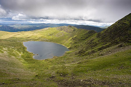
Rescuers spent five hours searching for walkers lost on the slopes of England’s third highest mountain.
Patterdale Mountain Rescue Team was alerted by police about 5.10pm yesterday after the walkers were reported lost in the Lanty’s Tarn area, which overlooks the village.
Team members attempted to contact the missing people by mobile phone but poor coverage meant this was not possible.
The team did manage to send a Sarloc message to the missing walkers. This sends a link to a smartphone which, when followed, allows the system to pinpoint the phone’s location.
This put the walkers at a site 300m from the outflow from Red Tarn on Helvellyn, more than 3km (2 miles) from Lanty’s Tarn. Team members set off towards the location indicated by the Sarloc reading.
A Patterdale MRT spokesperson said: “A second Sarloc was issued to confirm that the persons were descending in the right direction towards Greenside Mine as instructed.
“Unfortunately the revised location placed the missing persons on Swirral Edge. The persons were instructed to stay put. Team members quickly located the persons and after a quick assessment on scene began walking them off back towards Greenside Mine above Glenridding.”
The rescue involved 13 volunteers from Patterdale MRT.

Grumpy Old Man
19 November 2014Yawn .... I get so bored with reading stories like this!
Surely getting lost isn't an excuse to call out MR unless there's an iminent danger to life.
Does not the publishing of such stories endorse and perpetuate the idea that that's what MR teams are there for?
Ady Gray
19 November 2014Lost on Helvellyn? Except they didn't think they were on Helvellyn but, rather, they believed they were somewhere near Lanty's Tarn which is a few km away. However, in the end, they were located on Swirral Edge? So much is wrong with all of this. Firstly, if actually on Swirral Edge were they so inexperienced as to not know the difference between ascending and descending? Secondly, could they not recognise Red Tarn by the simple fact that it is in a bowl created by two of the most distinctive ridges in Lakeland and sited below the 3rd highest Lakeland summit? Lastly, if they are only capable of judging distance travelled by as big a margin of error as a few km, what the hell were they doing on the fells anyway...?
Russ (SARLOC author)
19 November 2014Did they walk uphill?
First SARLOC hit:
Accuracy: 10m
Alt:696m (+-4m)
2014-11-17 18:10:59
NY3532115584
Approx. Sunset 17:07
Second hit:
Accuracy: 10m
Alt:895m (+-0m)
2014-11-17 19:14:44
NY3442715477
Approx. Sunset 17:06