A two-week survey carried out by mountaineers on the UK’s highest mountain may lead geologists to revise their theories on its origins.
A team of scientists and climbers braved the remnants of Hurricane Bertha during the project on the North Face of Ben Nevis.
It was described by one of its organisers as one of the most extensive and logistically challenging surveys to have taken place on a Scottish mountain.
Project manager Tristan Semple of the Nevis Landscape Partnership said: “It has been a real privilege to add to the scientific understanding of our most iconic national landmark.
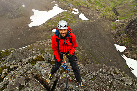
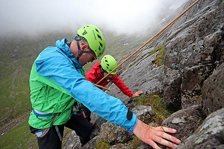
“The multi-disciplinary team of experts have been abseiling hundreds of metres down cliff faces and using new technology to uncover some of the mountain’s remaining secrets.
“This is only the first stage of a three-year survey and we have already made some very significant finds.”
He said botanists, geologists, meteorologists and mountaineers have been drawn to the unique location for more than two centuries, but much of the European-designated special area of conservation had remained inaccessible until the survey.
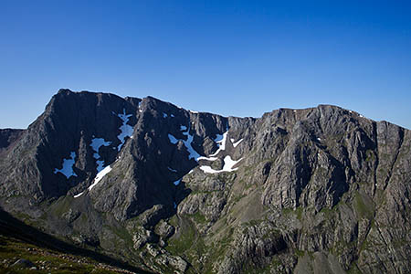
The 125ha (309 acres) of the mountain’s North Face present a formidable barrier with 600m cliffs, gullies and buttresses.
The gigantic monoliths were gouged out during the last Ice Age, when only the highest summits would have protruded above the ice sheet as nunataks. Mr Semple said the present shape of the mountain is geologically very young, perhaps only a few tens of thousands of years old.
However, the rocks that form the steep cliffs of the North Face are much older and were formed during explosive volcanic activity around 420 million years ago during the Devonian period.
Lead survey geologist Roddy Muir of Midland Valley Exploration said: “The team of professional mountaineers has been gathering new data with our recently developed FieldMove Clino app, as well as getting us onto the previously unrecorded cliff faces.
“The emerging data will be used in structural modelling software and will bring greater understanding of the processes which formed and changed the mountain.
“It is likely that we may have to revise the traditional model of a classic caldera collapse.”
A caldera collapse occurred when the magma reservoir feeding a volcano from below the surface emptied and could no longer support the weight of the rock it had thrown up above ground, leading to the volcano’s centre falling in.
The team said abseiling the sheer rock faces which descend from the whaleback summit plateau has resulted in some important and unexpected geological discoveries.
Breccia rocks, formed by explosive eruptions, have been located at significantly higher altitudes than existing geological maps show. The team has also been able to measure the original orientation of the ancient lavas where these rocks flowed out of the volcanic fissure.
The team of professional mountaineers used nearly 3,000m of rope, donated by Mammut, to access the steep terrain. British Mountain Guide Mike Pescod said: “The main logistical challenge has been keeping the scientists safe whilst ensuring minimal impact on the fragile habitats within the site of special scientific interest.
“During the training week we developed an ecologically light-touch approach which incorporates mountain rescue systems alongside Alpine and big-wall climbing techniques.”
The team had to contend with daily hikes up to the summit carrying huge reels of rope and other safety equipment. Mr Semple said: “The combination of altitude, northerly latitude and proximity to the Atlantic imbue Ben Nevis with the fearsome status as one of the most changeable mountaineering environments in the world.
“The tail-end of Hurricane Bertha ensured the mountain lived up to its reputation.”
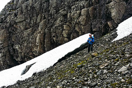
He said the mountain has a distinctly alpine appearance after a winter of record snowfall. Snowfields remain in many gullies and are scattered around the upper scree slopes. These have compacted into dense, ice hard névé which is the first stage in the formation of glaciers.
Sheets weighing hundreds of tons, with bergschrunds – tunnels and fissures – presented another set of challenges. The project manager said such hazards are common in Arctic and Alpine environments but are extremely unusual during a British summer.
Ben Nevis, standing 1,344m (4,409ft) above sea level, supports the greatest altitudinal range of habitats within the British Isles and has been attracting botanists since 1767.
Lead survey botanist Ian Strachan said: “Many of the rare Arctic-Alpine species we are searching for are relics from soon after the last Ice Age.
“Ben Nevis and a few other peaks in the Scottish Highlands provide the most southerly refuge for some of these species which can only survive due to the altitude and presence of semi-permanent snowfields.”
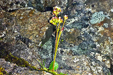
The mountaineers were able to identify new locations for nationally rare and scarce plant species. New populations of species such as Highland Saxifrage, Tufted Saxifrage and Wavy Meadow Grass have been recorded.
Cathy Mayne, of Scottish Natural Heritage, the Government advisory body which supported the project, said: “The survey has exceeded all our expectations.
“Not only have we gathered potentially ground-breaking geological data and significantly added to the known populations of arctic-alpine species, the team also discovered Alpine Saxifrage, which has never been found on the mountain before.
“Who knows what we might uncover over the next two years?”
The survey is also the subject of a film which will be premiered at the Fort William Mountain Festival in 2015.
The project, which is led by the Nevis Landscape Partnership working in collaboration with Midland Valley Exploration, is funded by Scottish Natural Heritage, Heritage Lottery Fund, and Highland Council and is sponsored by equipment manufacturer Mammut.
