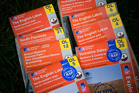
Britain’s national mapping agency said claims in a newspaper report that it was to end routine production of paper maps across the whole of Great Britain are untrue.
A story in the Sunday Telegraph implied Ordnance Survey’s maps were at risk of becoming an outmoded means of finding your way in the great outdoors.
“The humble map appears to be heading the way of the sextant, the north star and other seemingly outmoded navigational aids,” it said, while reporting that OS was to start a process of only printing paper maps on demand, rather than having stocks of 1:25,000 and 1:50,000 maps available of the whole of its area, which covers the northernmost tip of Shetland as far south as the Isles of Scilly.
The Telegraph piece said: “Those which cover popular hiking areas, such as the Lake District, are likely to still be produced.”
OS today released a statement saying: “There have been a number of articles in the media this weekend reporting that Ordnance Survey is to end its policy of routinely producing maps that cover the whole country.
“This is simply not true.
“This is wholly inaccurate and we are committed to maintaining a national series of paper maps for both OS Explorer and OS Landranger Maps. Paper maps are used by millions of outdoor enthusiasts every year, enabling people to explore and enjoy Great Britain.
“Our paper products remain an important part of Ordnance Survey with nearly two million sold over the last year.
“Users will continue to be able to purchase paper maps covering the whole of Great Britain from many outlets, including our own online map shop.”
Ordnance Survey is a Trading Fund of the UK Government, and provided £20.4m to Treasury coffers from profits of more than £30m, according to the latest published figures.
Paper maps provide only seven per cent of OS’s revenue.
The agency said: “Paper maps are an important and iconic part of the Ordnance Survey brand and we strongly feel that they remain an essential part of the outdoors market, working alongside digital products and apps.
“We would always emphasise the importance of carrying a paper map, a compass, and having navigational skills, to support any digital products and apps that are also being used by outdoors enthusiasts.
“As part of our commitment to ensure people have the necessary skills to use a paper map, we run regular map-reading workshops with Cotswold Outdoor each year and have a series of resources available on our website.
“We are disappointed by these media articles and again would like to stress that we are committed to maintaining the national series of paper maps and that we will continue to supply these products to wholesalers, retailers and customers.”
- grough is a commercial partner of Ordnance Survey which supplies mapping data for our grough route service. The online mapping and route-planning grough route service is a commercial competitor to the OS’s own version of route-planning software.

Sheepy
01 April 2014Surely an April Fool's joke. It would be a sad day if it wasn't!