The South Pennines are sandwiched between two national parks, the Peak District to the South and the Yorkshire Dales to the North, and could be viewed as the poor relation in this Pennine triumvirate.
But the area is an interesting hunting ground for walkers: close to many large and small centres of population; desolate, remote-feeling moorland cheek by jowl with impressive civil engineering and industrial relics.
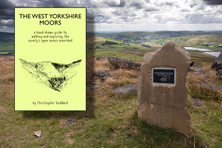
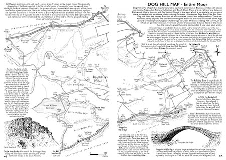
Christopher Goddard, who lives in the heart of the South Pennines, has produced a guidebook that will be familiar in look to anyone who has browsed an Alfred Wainwright tome. His hand-drawn maps and sketches in The West Yorkshire Moors are meticulously produced.
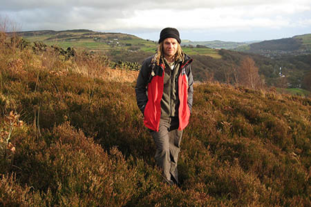
The maps have a wealth of detail and the sketches are augmented by photographs. Chris Goddard said he deliberately didn’t look at Wainwright’s Lakeland guides while he was producing his own maps. “When I finally did, I was shocked at how much detail mine had in comparison,” he said.
Cue a deluge of defensive comments by Wainwright aficionados?
Goddard’s quest is to hunt out and record the feint paths that criss-cross the moors and especially the open access land that has given walkers the chance to explore the areas closed to the public before the implementation of the Countryside and Rights of Way Act.
His starting point is the black pecks on Ordnance Survey maps denoting a visible path. “Forget the pretty colours all over the map, these black dashes and the solid black lines indicating fences and walls are the only things you really need to find your way,” he says.
“The beauty of maps is that they are merely suggestive and there are always blank spaces on them yet to be explored.”
This labour of love actually includes peaks and moors outside of West Yorkshire, including parts of Greater Manchester, South Yorkshire, Lancashire and North Yorkshire, and details the area between Black Hill in the South and Rombalds Moor, including Ilkley Moor, in the North.
The guide includes 21 high points – hills of 400m or more with prominence of 30m or 100ft – and each chapter is built around those summits, with a general introduction followed by suggested routes. The areas detailed are mainly open access land, but the author has extended these to include nearby roads or places likely to be the starting points for walks.
There are also chapters on the history of the moors, their geology and a guide to what you can and can’t do on access land.
The West Yorkshire Moors describes the area on my doorstep, but I still learnt lots about the sites I’ve passed many times or wondered about the provenance of their names. It’s the mark of a good guidebook that even those familiar with the area will find information and suggestions that spark their renewed interest in taking another walk and this publication accomplishes that.
The maps are drawn in a fine and clear style, different enough to Wainwright’s to avoid a charge of imitation, but contain lots of information for walkers heading for the moors. One thing I really miss is any contour information. Yes, it’s obvious that the marked peak is the top of a hill and there is some hatching for significant slopes, but otherwise there’s a lack of detail of the shape of the hills.
Chris Goddard says adding contour detail would have led to cluttered maps, which is a shame as most walkers accustomed to following OS’s products will have cultivated the art of forming a mental image at least of the landform from contour information.
As with all printed publications, information can quickly be overtaken by changes on the ground. For instance the twin police radio masts that have dominated the moors above my home town of Keighley disappeared recently after decades as a landmark at Whetstone Gate. It’s a cartographer’s perennial problem which can usually be overcome in subsequent reprints.
That aside, this book is a little gem for the inhabitants of the northern towns and cities who want to stride out across the moors overlooking the conurbations, or for those visiting the area.
Who knows, it may even tempt new visitors to this intriguing landscape.
The West Yorkshire Moors
£12.99
Published by Northern Heritage Publications
More details are on The West Yorkshire Moors website, where the book can also be ordered.


Tim Widdop
19 January 2016the book is far too large and no good to carry around with you .I think it would be far more sensible on user friendly laminate or a small pocket version of the book would be great.