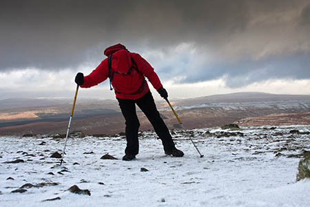
Hurricane-force winds will hit Scotland’s mountains tomorrow as a winter storm grips the UK.
The Mountain Weather Information Service said mobility on mountains will be ‘torturous’ with gusts of up to 120mph in the west Highlands.
Snow will fall right down to lower slopes, with a wind-chill of as low as –21C on the tops.
Temperatures will rise slightly over Christmas, but storms will return on Friday, the independent meteorology service said.
Avalanche risk in all five areas covered by the sportscotland Avalanche Information Service will be high tomorrow. Northern aspects of mountains in Glencoe, Creag Meagaidh, Lochaber and southern and northern Cairngorms will be at high risk, meaning avalanches will occur both naturally and if triggered by walkers or climbers.
In Scotland today, there were numerous road closures due to heavy snow and in Glencoe the ski centre was left without power for part of the day when high winds brought down power lines.
Heavy snow affected the access road to the CairnGorm mountain resort and a ski centre spokesperson said there would be no snowsports on Christmas Eve and Christmas Day because 90mph winds were forecast.
Amber warnings of high winds on Tuesday were issued by the Met Office for the western Highlands and Northern Ireland. The Met Office said speeds of 80 to 90mph were likely. “The public should be prepared for disruption, particularly to travel, as well as interruption to power supplies,” it said.
It also issued an amber warning for rain in south Wales, the South-West and southern England. A spokesperson said: “Spells of heavy rainfall will continue to affect parts of southern England and south Wales during Monday and overnight into Christmas Eve, clearing the southeast of England before dawn.
“This will fall on to saturated ground and lead to a risk of flooding.”

Inside the EA
28 December 2013Environment Agency Flood Defence Assets - Manipulation of Figures - Are they fit for purpose? EA Whistleblower blog explains http://www.insidetheenvironmentagency.co.uk/