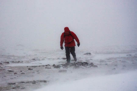
Weather forecasters have issued amber warnings of storm-force winds on hills across northern Britain on Thursday.
The Met Office said the public should be prepared for potentially significant disruption in an area covering the whole of northern England, much of Scotland and some of East Anglia.
A lower, yellow warning is also in place for the northern half of Scotland for snow both on Thursday and Friday.
The UK’s official weather forecasters said: “Westerly gales are expected to spread southwards across northern and central areas of the UK on Thursday, with widespread gusts of 60 to 70 mph.
“However within the area of the amber warning gusts are expected to reach 80 mph in places and perhaps as high as 90 mph in exposed parts of the north and west of Scotland.
“Winds will veer north-westerly and begin to ease during the afternoon, with the strongest winds becoming confined to eastern coastal areas by the evening.
“There is also the potential for significant coastal flooding along the east Coast of England, parts of south-east Scotland, north Wales and north-west England. This may include flooding affecting parts of coastal communities and travel disruption along coastal routes.”
The Met Office mountain forecast warns of severe mountain weather in the west Highlands, with blizzard conditions above 800m and heavy rain below that altitude. In the Lake District, showers above 700m are likely to be wintry.
The chief forecaster said the severe weather is the result of warm Atlantic air meeting cold Arctic air causing a low-pressure system to develop late on Wednesday.
“This low pressure will then deepen rapidly on Wednesday night and Thursday morning, tracking quickly eastwards to the north of Scotland as it does so,” the forecaster said. “As this system moves eastwards into Scandinavia it will to bring very strong westerly winds to northern and central parts of the UK during Thursday.
“The winds will then veer north-westerly and will bring much colder arctic air southwards across northern areas before easing into Friday.
“A combination of large waves, surge and high tides may also give rise to some coastal flooding, especially along the east Coast of England, southeast Scotland, north Wales and northwest England.”
The specialist independent Mountain Weather Information Service said very severe conditions will hit the western Highlands, with hurricane-force winds of up to 120mph, making walking difficult even on lower slopes and near impossible on the tops.
Snow will affect increasingly lower levels in Scotland before the air temperature rises slowly over the weekend to a similar level seen this week, though stronger winds will prevail.
An added peril for Lake District walkers is the possibility of thunder mixed with the storm-force winds and snow on Thursday. Similar conditions are expected in Snowdonia.
An amber warning from the Met Office means the public should be prepared to take action.

Dennis lane
04 December 2013The article could be more specific,naming the towns at risk in particular from flooding and what should be done to safeguard people and property.
Jhimmy
04 December 2013It's YOUR duty to read the Enviroment Agency site if you want specific details, Dennis...took me 10 seconds to find the number....Floodline on 0845 988 1188
I'd advise you to aim your concerns at the experts with all the computer updates from it's monitoring sites.
This site only reports news and articles, I doubt it wants to start panic and legal claims.
WITC
05 December 2013I think Hurricane Force 120mph winds make walking more than "near impossible". It would make staying on the ground pretty tricky...