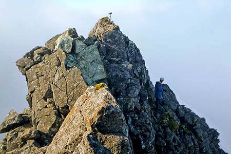
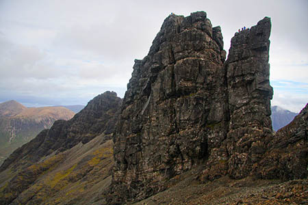
Three hill sleuths tackled their hardest mountaineering task ever to cut a peak down to size.
Amateur surveyors Graham Jackson, John Barnard and Myrddyn Phillips had to rope up to undertake their climb to Knight’s Peak on the Skye Cuillin ridge – which was previously thought to be a 3,000ft munro top.
But measurements taken over two hours at the top of the outlier of munro Sgùrr nan Gillean proved the peak to be 6½ inches short of the magic 3,000ft qualifying mark.
The trio, accompanied by Alan Dawson, used a professional Global Positioning System receiver to gather data for the peak.
The mountain survey was conducted in in September in conjunction with the Scottish Mountaineering Club who are the keepers of the list of munros, and the Munro Society, open to membership by those who have completed the ascent of all the munros.
Mr Jackson said: “When Sir Hugh Munro first listed the 3,000ft mountains of Scotland in the 1891 Scottish Mountaineering Club Journal, I wonder if he ever thought that 130 years later upwards of 6,000 people would have completed the munros’.
“As a munro top, Knight’s Peak is classified as a subsidiary top of a munro.
“Its entrance into the tables was contentious, as for many years it was given a height of 2,994ft (912.6m) and then a new metric height appeared on the Ordnance Survey map which gave it a qualifying height of 915m (3,002ft).
“Many hillwalkers questioned its inclusion due to the contrasting heights on different maps. It was the aim of the surveyors to answer the question: should Knight’s Peak be a munro top?”
Mr Barnard said: “Knight’s Peak is positioned high on the aptly named Pinnacle Ridge.
“We walked from beside the Sligachan Hotel up to a high corrie and used a rope to assist us to the top as the higher section of this mountain has quite dramatic drops in all directions.
“We placed a global navigation satellite system receiver on each of its two tops and gathered two hours of data from each. It proved the most difficult survey we have ever conducted and it is probably the most difficult mountain survey ever conducted in Britain.”
The technology used works in a similar way to a satnav as it receives signals transmitted from satellites that orbit the earth at a height of 22,000km.
Additional technology means that the equipment can determine height and position much more accurately to within a few centimetres.
Once the team was safely down from the mountain the data files were sent to Ordnance Survey for processing and verification of the result.
Andy Nisbet, one of the country’s leading winter climbers and a recent president of the SMC, accompanied the surveyors and controlled the rope for the ascent and descent of the most technical pitch on the climb to Knight’s Peak.
He said: “It was a highly enjoyable day in dramatic surroundings and I can confirm the height of Knight’s Peak is 914.24m (2,999ft 5½ins), and as such the SMC will no longer list it as a munro top.”
Two days later, the trio were able to climb the Bàsteir Tooth, a rocky outlier of nearby munro Am Bàsteir and confirm its existing status as a munro top, with a height of 917.16m (3,009ft).


Sheepy
13 November 2013What's 6 inches among friends?
Please you ladies out there, let's not have any smutty answers.