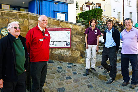
Walkers at the end of a 309km (192-mile) long-distance route will be better informed after the unveiling of a new board containing details of the trail.
The board at Robin Hood’s Bay marks the eastern end of the Coast to Coast Walk devised by Alfred Wainwright.
A similar information board was installed at the Cumbrian end of the route in St Bees in May.
The panel, on the sea wall at the North Yorkshire village, has a depiction of Wainwright’s diagram of the route.
It was unveiled by retired secretary of the Wainwright Society Peter Linney.
The board was jointly paid for by the society, Fylingdales Parish Council and the North York Moors National Park Authority.
Mr Linney said Wainwright regarded the Pennine Way as a masculine walk and the Coast to Coast to Coast as feminine.
Bernie McLinden, head of park management for the North York Moors National Park Authority, spoke at an unveiling ceremony about the great popularity of the long-distance walk, which is completed by between 5,000 and 7,000 walkers annually.
This year is the 40th anniversary of the publication of the Coast to Coast guidebook and the Wainwright Society decided to make the walk its main beneficiary in 2013.
Funds raised from the society’s annual challenge and sales of its calendar are to be used to waymark the route and to provide the information boards at each end of the walk.
Any money remaining after funding Coast to Coast projects will be donated to mountain rescue teams along the route of the walk.
The society said it hopes placing the board at Robin Hood’s Bay will help bring the work of Alfred Wainwright to the attention of the public as well as providing a focal point for walkers completing the walk.
