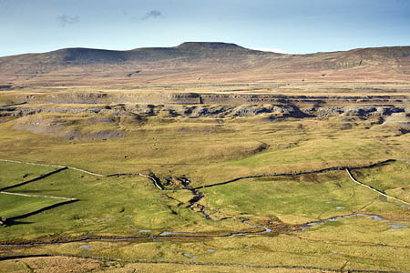
A group of 15 walkers undertaking a challenge had to be rescued after getting lost.
Two separate sets of walkers tackling the Yorkshire Three Peaks were caught out when weather changed on the summit of Ingleborough and low cloud and hill fog enveloped the fell yesterday.
The Cave Rescue Organisation was alerted at 7.25pm on Saturday.
A rescuers’ spokesperson said two groups of walkers, one of four and another of 11 people, met on the 724m (2,375ft) summit of Ingleborough and together tried for find their way down to Horton in Ribblesdale, 7km (4¼ miles) to the East.
The spokesperson said: “They got completely lost and eventually called for help.
“Before their phone died they were able to give enough information to place them, probably, in the Grange Rigg area.
“A CRO search party found all 15 of them above Long Scar, cold and tired, with two suffering from strained leg muscles and sore hips.
“All were transported off the hill and brought down to Clapham in a mixture of team and police vehicles.”
The Yorkshire Three Peaks challenge involves the summiting of Pen-y-ghent, Whernside and Ingleborough and walking the countryside between them in a 39km (24-mile) route.
Cave Rescue Organisation volunteers respond to requests for help both from stricken cavers and fellwalkers and climbers in the Yorkshire Dales and beyond.

I don\'t believe it!
14 April 2013Sounds like total bafoonery to me....... Didn't any one of them have a map and compass?..... Send them the rescue bill......
Jhimmy
14 April 2013Out of 15 not one could navigate off a simple hill? Come-on, there's almost a path from the top to Horton!
Er, sore legs, thobbing feet and sore hips do come to mind on the three peaks walk, that's why it's got a tough reputation, didn't anyone mention that to them?
Again it's the same old problem, no one can navigate and seemingly unfit walkers trying too hard.
RTearle
15 April 2013Thanks for rescuing me. I forgot my gloves.
APearson
15 April 2013Sounds like they came off Ingleborough at the wrong point and then tried to head across the Allotment to get back onto the right path. I suspect many groups would run into problems if they added that sort of extension to the Three Peaks.
Ian Jones
15 April 2013I'm glad the commenters at least are using the correct name for the Three Peaks. There is no other. Any challenge walk/drive of a similar name needs to get a new moniker.
Grimandave
15 April 2013I doubt Ingleborough would have been deserted at 5-6-7pm on a Sunday... couldn't they have asked someone?
J L
16 April 2013Well I have done the Y 3 peaks myself and been on Ingleborough when the fog came down, my GPS started acting odd and finally I found the trig with the x shelter. cold and wet I stopped for a drink, something to eat.
The amount of people getting confused on the top in the fog was surprising and some of them seemed very competent. Just seems to be something about the place that gets people lost or doubting there abilities would be a better word..
Even with map and compass the low cloud/fog and the land seem to confuse folk...
Debbibee
03 September 2024The top of Ingleborough is very disorienting, particularly when you have walked around the shelter to get out of the wind. I always thought that a pointer on each of the arms indicating which village you would descend to would help. Once you get to the right descent point on the edge of the plateau the paths, particularly the one to Horton, are very obvious.