I’m walking down a steep, rock-strewn Lakeland fell. I can’t see a thing and I stumble as my foot slides off a stone.
But my slip is stopped by the rope round my waist, held by a steady hand just inches behind me, guiding me down to safety.
The scene is The Bell, a mini-mountain overlooked by The Old Man of Coniston. And the reason I can’t see is not because I have foolishly forgotten my headtorch, but because I’m blindfolded – not something I’ve ever done before in the hills.
This is an exercise in confidence roping: giving close support to a nervous walker descending steep ground, and it’s day three of the Mountain Leader training course.
Confidence roping is just one tool in the box of techniques a Mountain Leader might be called upon to use when working with groups in the mountains of Britain. The award is for people who want to lead groups in mountains and remote country of the UK.
The training course, lasting six days, is the second stage in gaining the ML qualification. A minimum of 20 personal ‘quality’ mountain days’ walking in the hills, over at least a year, is necessary before anyone undertakes the course. Then you have to register for the scheme.
The course is intensive, drilling skills including navigation, group management, route finding, dealing with steep, broken ground, emergency rope use, emergency procedures and wild camping.
The successful Mountain Leader will also have a good all-round knowledge of the upland environment, access laws, weather, gear, expedition planning and dealing with water hazards such as rivers and streams.
Add the necessity to have a first-aid qualification and the personal and leadership skills to get your group safely through the mountains, and it’s clear a Mountain Leader has a lot to learn.
This is no tick-box course; almost all the training is out on the hills in whatever the weather, day and night, on rugged ground away from paths for most of the time.
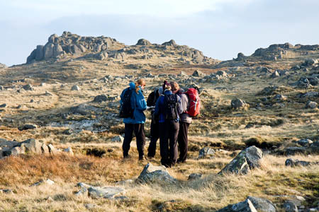
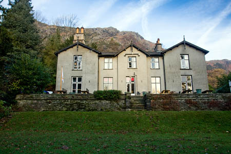
Eight of us gather on a Sunday morning at Coniston Youth Hostel, nestling beneath the Yewdale Fells. Instructors Tony and Simon soon split us into two groups and within a couple of hours we are walking out of the hostel and up on to Rigg Head in unseasonably pleasant weather.
The eight of us vary in age, experience and expectation. There is a sailing instructor, a ski-instructor, a climber who also happens to run a pig farm, a musician, a shop worker in an outdoors store and a seasoned trekker and expeditioner – and me.
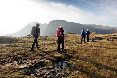
The first day is all about route finding and navigation: up the rocky ravine to the flatter, complex ground of Coniston Moor, searching out, in turn, landforms such as ring contour knolls, small tarns, outcrops and stream junctions.
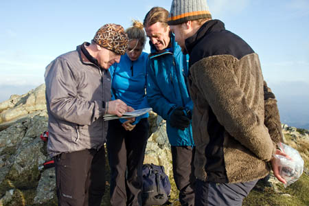
The big emphasis is on relating what you see on the map to the ground below your feet. Micro-navigational techniques such as timing and pacing – counting every second step and measuring off each 100m – are used, but it’s the ability to recognise how the bumps and hollows of the land appear on our maps that are the key to successfully finding our way around.
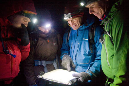
After a bit of a hike without consulting the map, we are all asked where we think we are and there’s a surprising divergence of opinion. Tony gives us his opinion of our location and we set off on the return leg. By the time the lights of Coniston twinkle below us, it’s getting dark and the final descent to the village is made in the dark.
But it’s not over yet. After dinner, we reconvene for an indoor session on mountain weather. We look at the wiggly lines on the synoptic charts, consult Mountain Weather Information Service and try to work out what the weather will bring tomorrow.
Just to make life more interesting, we are in an interesting meteorological phase, with a huge area of high pressure to the East zapping the Atlantic fronts as they try to penetrate. However, in practical terms, that means dry and bright for us in the western Lake District while angry rolls of cloud shroud some of the eastern fells.
But there’s bad news too: a mountaineering club held its annual meeting the previous weekend and drank the youth hostel dry of draught beer, so it’s bottled stuff only at the bar. No-one overindulges though; there’s a hard week ahead.
Day two starts as each will this week: a weather briefing, with more squinting at those isobars and the threatening fronts out west. We are told that when we take the assessment course, it will be us doing the weather forecasting, so it’s best if we pay attention.
Then it’s into a Mountain Goat minibus for the short journey into Great Langdale. Before the trek up the bouldery White Gill there’s a discussion on sheep, the Cumbrian rural economy and tourism. More micro-navigation follows and we head up the ridge towards Sergeant Man, for a spot of lunch.
Even then, there’s questioning on knowledge of topography, history, geography, geology – lots of ologys – and lichen, which seem to figure large through the week. We then discuss whether High Raise is the most boring hill in the Lake District before heading round to Thunacar Knott and the top of Pavey Ark before a final couple of scrambles up Harrison Stickle and Pike of Stickle.
This, Tony explains, is the day we do what most Mountain Leaders do most of the time: a grand day out in the hills. But throughout, we’re being observed for navigation, looking after our party, route finding and techniques such as spotting: positioning yourself to stop a party member’s slip becoming something more serious.
As darkness falls, we head down beside the impressive ravine of Dungeon Ghyll for a final cup of hot chocolate at Stickle Barn.
Back at Coniston, it’s time for the guys on the assessment course to make their presentations in The Freezer, the basement room that’s colder than the top of Scafell Pike.
Topics covered include: what’s in a first-aid kit; is it a rip-off having to join the British Mountaineering Council as well as paying Mountain Leader Training; how detailed should our mountain knowledge be? Needless to say, lichen makes a reappearance.
By day three, we’ve already decided that the weather will stay fine, a prognosis confirmed by the isobars. But what’s that cloud on the horizon for our two-day expedition at the end of the course?
Out come the ropes for the session on technical bits of mountain leadership. My fellow team-mates, Declan, Abbi and Dave all have climbing experience. Mine was brief and unsuccessful and 35 years in the past, so it’s a relief to find out I only have to learn one knot – and I already know it! The overhand knot, the simplest there is, really, is all I need to know for unplanned rope use on rocky ground.
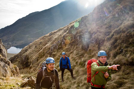
Helmets on, we practise direct belays, indirect belays, lowering down rock, classic abseiling, South African abseiling and descending using the rope in an angel’s wings method.
And we learn about the Thompson Knot, essentially a giant overhand knot in loops of rope that can be used to lower a person down a vertical rockface.
One of the party mentions they have heard the Thompson Knot has a more nefarious use and from that stage on for the rest of the week, the knot is renamed the Sex Sling.
The ridge up The Bell, a 335m pyramid in the Coppermines Valley, is surmounted using various techniques, including an attempt to get up a slab section without using hands. Do elbows count?
Then it’s that surreal descent blind, with only your partner to support and guide, with a tight confidence rope providing the reassurance. We reach the intake wall with no sprains, no breakages, and a better understanding of how slow such a descent with a ‘frozen’ party member might be.
After dinner, during which for the second night Declan’s meal seems to have disappeared down someone else’s throat, gear and clothing are on the menu in The Freezer.
It’s all change on day four, as our team swops Tony for Simon as our instructor. No real change in the weather as the rare high pressure stays in command.
We head out up the Coppermines Valley and are made to put our map memory into practice. Look at the map, work out where we’re going, our timing for getting there, then put the map away. It’s a useful technique for concentrating the mind on looking for those tick-off features on the route.
Helmets on, we make a brief diversion into one of the many levels, and see at first hand just how dangerous these can be. Our headtorch beams are lost in the deep vertical excavations, often filled with water. And up above, rickety old ladders lead up more vertical shafts in the old mine.
Back out in the daylight, we plot our course up the fellside. We follow the route of an old pipeline. “First person I hear disturb a stone buys the beer tonight,” Simon says. It’s not good. “I can hear your foot hitting the ground, never mind moving the rocks!”
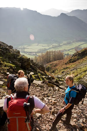
The route is very scrambly and we use all our concentration to find a way up the rocky route leading to the top of Low Water Beck, complete with crampon scratches on the rock which give away its popularity as a winter climbing route, but not today – the water’s flowing in the relative warmth.
A touch of spotting sees everyone through an awkward exposed shoulder then it’s on to a flat section at the tarn before the final ascent to Brim Fell Rake, via more exposed rocky sections.
This type of terrain, Simon explains, is where you might take some clients who wanted a little more excitement from their trip to the hills. There is quite a bit of exposure and the brain needs engaging to find a safe route through the rocks.
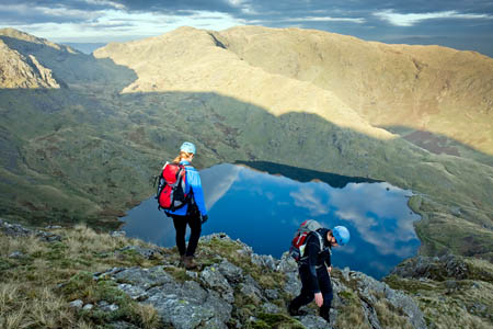
The descent to Levers Water needs careful thought too. Coming down, of course, you can’t see just what’s below you on a convex slope, and there’s a final chance for me to practise a bit more ropework, lowering Dave before he makes the ascent back to us.
We decide that, since it’s highly unlikely anyone would have bothered with this insignificant little climb, it’s a redpoint first ascent. It’s instantly christened Sex Sling.
A bit of scree fun on the old mine spoil heaps completes the route and then it’s back down to Miners Bridge and the stroll back to base.
Expedition and route planning is the evening’s subject and there comes the bad news that our friend the high pressure system is about to head east, allowing those Atlantic fronts to come in, just in time for our expedition.
At breakfast, the assessed team is having a last-minute practice with knots and abseiling from the youth hostel balustrade and, as expected, the clouds are gathering.
We climb into the Mountain Goat for another trip to Langdale, this time to the Old Dungeon Ghyll and the start of our expedition. Simon has weighed our packs, which vary between 14kg and 16kg, with tents, sleeping bag, sleepmat, stove and all the other necessities –such as a trowel – for a night wild camping in the mountains.
There is some concern too: the forecast said 80mph winds are possible. Will my little tent stand up to it?
On the climb up The Band, the rucksack feels every ounce its 35lb, and as the oldest in the team I feel the pace as my fellrunning, climbing, gazelle-like team members stride out.
We’re on 1:50,000 maps and looking for crag features and cols. I kick myself mentally as I steam past the col I should have taken us to and head for one 200m further up. Still at least we’re not on assessment.
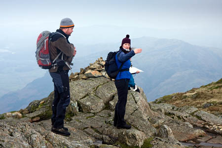
In thick clag we veer off the path and on to the Climber’s Traverse on Bowfell as far as the Sea of Rocks, then it’s a scramble over the boulders up the route on to the summit ridge of the mountain. More navigation discussion follows.
It’s windy, and the halts to check navigation mean everyone’s cooling down, which increases the pressure to come up with a quick strategy to find the target. The stress mounts and my bearing is wrong. Eventually we find the little tarns we were looking for as the gloom starts to envelop us.
A few more attack points later and we stop for tea as it starts to get dark. Simon asks us: do we want to carry on and do our night navigation with full packs on, or would we rather set up camp and then go back out with lighter rucksacks to start our night-nav? Decisions, decisions…
I’m mindful of the weather forecast, which says we’re due rain, so I vote for: navigate first, pitch tents later. That option wins and we make our way down, finding ring contours, pools and other tiny land features on the slopes east of Scafell with varying success.
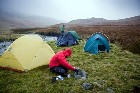
Finally we get down to Lingcove Beck, our chosen camping site. The wind is picking up as the tents go up and the stoves come out.
On the fells above there’s the eerie sound of a high-pitched yodelling and we spot the headtorches of the other team up on the fells. The sound is Helen, a musician in the other team, keeping her promise of giving us a krimanchuli call – a form of Georgian song at which she excels. Either that, or someone needs help.
Declan’s stove decides now is the time for a mini explosion and shards of red-hot metal puncture his Therma-Rest – not the ideal harbinger of a good night’s sleep.
The rain starts and will continue, along with winds – only 60mph thankfully – for the whole night, so it’s a groggy start to the last day, with the grey pall still glowering over the fells.
We have water hazards ‘river crossings, theory and practice’ to look forward to. A quick breakfast and camp is struck. Abbi is complimented for swallowing her toothpaste rather than spitting it out – there really should be as little effect on the environment as possible – and we gear up and head upstream, looking for somewhere safe to cross Lingcove Beck.
We find a narrow stretch that can be crossed, near the confluence of four small becks and find our way on to the right side of the water.
There’s a session on emergency procedures, using rucksacks as improvised stretchers, before we head south and tackle the thorny issue of river crossings.
Thankfully, we manage to keep our feet fairly dry as we practise various techniques using walking poles, ropes, types of improvised ‘scrums’ to get across a river – though we only use the very edge of Lingcove Beck.
A few final navigation legs take us into Moasdale and a couple of kilometres’ worth of soggy terrain to meet the waiting minibus at Cockley Beck Bridge.
Back in the warmth of the youth hostel, showered and cleaned up, the disparate group compares notes, as the assessed team nervously waits to hear whether they will get the coveted ‘pass’ sticker in their logbook.
There is also time to reflect on the six days we have just gone through. What did my fellow would-be Mountain Leaders think?
Abbi, 23, is waiting to see if she has got a job ski instructing. “I think the course is what I expected and more,” she said.
“I think I’ve learnt more than I thought I would. I thought it would be, in some ways, just going up on new ground, because I’ve never been here before and just general hiking from one place to the other.
“Actually, we’ve learnt more but gone a shorter distance than what I thought we would. I thought by the end of each day I’d be feeling very tired because we’d hiked a long way, but it has been much more learning and skill developing than hiking.
“I have a lot of mountain- and hillwalking experience and a lot of Army and Territorial Army-type things. I was a member of the TA for four years.”
“I do skiing, mountain biking; a lot of running; I also surf a lot. When the surf’s good everything else drops.
“If I get this job I will probably go for assessment at the end of next summer. I want to go into outdoor education, so it’s another tick in the box, to be able to have on the CV and use it.”
Dougie is 45 and lives not far away in Kendal.
“It was much what I expected,” he said. “I was very impressed with the quality of the instruction. It was far more professional than I am.
“I’m hoping to go on and do the assessment so I can lead in the hills with either young people or adults.
“I’ve worked with young people in sailing and years ago in outdoor education.”
Helen, 32, of Leeds, was the provider of the yodelling on the course. What prompted her to come on the training? “Mountains are interesting,” she said. “Mountains are nice, and also because people are less confident walking in the mountains and therefore there’s more need for being led there.
“I hope to take the assessment course or maybe I’ll be one of those playing tiddlywinks.
“I’m a musician but I’d like to lead groups in the hills.
“I had no idea what to expect and I didn’t try to think I was going to expect anything, so I’ve learnt a lot of stuff. I didn’t even know how to use a compass properly before I came.
“I was a little bit freaked out on the first day when everybody constantly got their compasses out and started navigating, so that’s been great.
“Night navigation; I haven’t done that before; ropework. It’s been great – a real eye-opening experience because this was an area I wanted to go into.
“If I hadn’t done music I would have done this. So it has been quite a revelation.”
Sam, 28, works in a school in Hertfordshire where she helps run the students’ DofE Awards.
She said: “At school we currently run the gold Duke of Edinburgh’s Award, but due to the teacher who was ML trained leaving, I’ve got my Basic Expedition Leader Award, which qualifies me to take the bronze, but I can organise the gold expeditions and practices, but I have to pay for an ML to come as part of the trip which then causes the school to have a lot more costs than if I was qualified.
“In the long run, it’s going to save the school money sending me on the training and the assessment course.
“I haven’t done activities in this terrain. I’ve done basic countryside walking with Basic Expedition Leader and we did a week in the Peak District in February which was quite severe conditions, and I have been to the Lake District before, but as for the intensity of what we’ve done this week and the kind of skills we’ve learnt, no.
“I wasn’t even expecting to do any rope work, even though I brought a rope. I was thinking we wouldn’t do as much as we did with it, so that’s probably the area I developed the most. I’m still not very confident in it. I need to get confident with that.
“And I feel the night nav developed my overall navigation, and it just generally helped with leadership, I suppose.
“If I was ever going to take a group of adults out, it’s helped me with that. I’m obviously only ever looking at taking groups of teenagers out so it helped me with understanding different needs and different personalities.
“It’s been brilliant.”
All that remains to be done now is to ‘consolidate’ our knowledge and skills – that’s to say, practise them until they become second nature, and get our tally up to 40 quality mountain days before we book ourselves in for assessment.
So if you spot a few souls wandering round the Lakeland fells seemingly lost, they may just be looking for that elusive ring contour, or scanning the skies for an approaching warm front.
Details of the Mountain Leader training scheme, and other awards, from Walking Group Leader right up to Mountain Instructor Certificate, are on the Mountain Leader Training website.
Darren Hunt
05 March 2012A fantastic article thank you for sharing. I'm taking the plunge and removing all the past 11 years of excuses and start my ML training at the end of march. It's reassuring that, not only outdoor professionals or those working in the outdoors are working towards the ML. All the best to all of you on your ML. Darren
Hal
06 March 2012I recognise the hostel in Coniston. I did my ML there with Apex. Was an amazing course and the mountains around it were fantastic. However by day three or four I was shattered. The course and content were spot on for me.
This article brought it all home for me. Excellent.
Tim Davies
06 March 2012Sounds very familar. I did an ML taring course last year, Now I've got to get enough experience to do the assessment. Thats the hard part for me!
Paul B
07 March 2012Keep going you trainees!
Get them logbook days (and nights!) in and the more the merrier.
Get out assisting ML's with groups if you can.
Top Tip: Do some orienteering to polish up you navigation, it helped me a lot.
Tom Shorrock
07 July 2015An absolutely amazing article! I am doing training in a few weeks and I have all these fears! I am also a teacher so good to see the reasons from the teacher in this article. Honestly, a truly brilliant piece... so refreshing to see someone being honest and not trying to be macho about it. It is what it is! Thank you!!!
Laura
23 July 2016Great article, thanks! I'm due to begin my training this August and this has provided some much needed insight. I think it simultaneously heightens my anxiety levels and my excitement - it's going to be a challenge for sure, but it sounds like you had a great time and hopefully I will too.