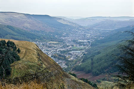
A couple were tracked down after a rescuer’s local knowledge located them miles from where their mobile phone told them they were.
The alarm was just before 7pm yesterday, Saturday, after the pair failed to return from walking above the Rhondda Valley in south Wales.
Central Beacons Mountain Rescue Team, Western Beacons Mountain Search and Rescue Team and members of the Search and Rescue Dogs Association South Wales responded and a search mounted for the couple, who had been reported overdue.
Rob Jones of the Central Beacons team said: “The young couple from Cardiff had begun walking from Treherbert railway station and their route had taken them via the waterfalls on Nant Lluest in Blaencwm.
“After following a stone wall for some time they found the Skyline paths and followed them but the weather turned very poor with snow and sleet, and soon it became dark. They were reported overdue and the mountain rescue teams were alerted.
“The walkers were navigating using a smartphone which positioned them to the North of the valley floor, but upon questioning their route by a local member of CBMRT it was concluded that this information was very wrong and they were actually on fire roads of the forestry South of Treherbert.”
Rescuers used their vehicles to search the forestry tracks and found the couple. The grateful walkers were taken to the team control vehicle, warmed up and given team. South Wales Police then took them home.
Team leader Penny Brockman said 25 volunteer mountain rescuers took part in the incident, which lasted four hours. She said: “We would advise all walkers to be equipped with map and compass and a torch for each person.”
Rescuers thanked the villagers of Blaencwm for their assistance during the incident, and offers of help with the search.

John Pasmore
06 February 2012Can you say what type of "smartphone" they were using? The details could be helpful in preventing similar incident...
Tim Cooper
09 February 2012Agree with John, above. Would like to know if the phone was using GPS or cell triangulation for its location info. Also what kind of software was in use, and how much experience the users had in its use.
TBH, these 'getting lost because they didn't have/use the right navigation equipment' stories have been around for years, long before the first GPS satellites were sent into space. But picking on GPS, especially in smartphones, seems to have become an easy target.
Like any other nav aid, GPS devices are only as good as the people who use them. I'm sure there are as many people who get lost using a map and compass, assuming they even took one with them, but we don't seem to hear about them. Why is that?