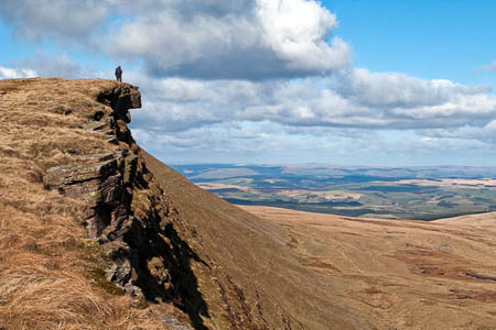
Mountain rescuers used specialist software and a smartphone to find two walkers lost in a remote part of a national park.
The two men called for help from Fan Hir, in the Black Mountain area of the Brecon Beacons national park after they became lost in low cloud.
Police alerted Brecon Mountain Rescue Team and the Western Beacons Mountain Search and Rescue Team yesterday, Friday.
The pair, both in their 30s and from Caerphilly, were told by the Brecon team to download a rescue application to their phone, which then tells rescuers their exact location.
Mark Jones from Brecon MRT said: “Despite it being dark when our teams assembled we were able to locate exactly where the men were, using a web-based mobile phone location program called Sarloc.
“The software works by sending a web link to the missing person’s phone. Once they click on the link their location is sent to the mountain rescue map servers and flashes up on the computer system being used by the search manager at the scene.”
It was the second time in 10 days rescuers from Brecon MRT used the Sarloc system to pinpoint lost hillgoers.
The software, developed by Ogwen Valley Mountain Rescue Organisation member Russ Hore, has been used by teams in Wales and England to save time searching for lost walkers.
The two rescue teams were able to go straight to the missing men and walk them off the hill in a three-hour operation. They were both exhausted but allowed to go home after being examined by rescue medics.
Mr Jones added: “This software is a great help to us, but should in no way replace the use of a map and compass by the walkers on the hill.
“It may help us locate the missing persons more quickly than traditional search techniques, but basic mountain skills are still essential.”
Teams used similar technology on 21 December to find a couple lost on south Wales’s highest mountain Pen y Fan. The couple downloaded an app which revealed they more than a mile from where they thought they were.
The most recent callout was the 97th this year for Brecon Mountain Rescue Team, making it their busiest year in its 43-year-history.
Mr Jones said: “All our members are volunteers and come from all walks of life. But when the call comes, no matter what the time and what weather conditions, they never let us down.
“We’re funded entirely by voluntary contributions and we’d like to thank everyone who has helped in any way over the past year to make sure we can carry on doing such vital work.”

Gerald Davison
01 January 2012This is a fantastic system built by Russ Hore which many teams (including my own) are using with great success.
However as Mark Jones says, it doesn't replace good mountain skills, including the ability to navigate in bad weather or darkness.
This also won't work if the person only has a basic phone.
It requires a "smartphone" with a web browser with a built in GPS to work properly. You also have to have "web access" on your phone and the signal strength to support web browsing. It also doesn't work on every smartphone as they don't all support the required application (not Russ' fault!).
However if everything is in place it SHOULD help to pin point people.
But I wouldn't want people thinking "ooh, if I get lost the MR team can just find me from my phone". It is not quite that simple!
Learn to navigate, carry the tools to make sure you can navigate (map, compass, head torch and spare batteries) and practice regularly when it isn't required. Then when the weather turns you can have an "adventure", rather than an "emergency"!
I'd suggest people go on a course for navigation, I occasionally instruct on this type of course and almost universally people enjoy themselves, learn a lot and get a life skill along the way. This is not an advert by the way!!
Dave Rusiy
17 August 2012what is the best app to have on a iphone as there are so many out there, its always good to have a back up in case of emergency