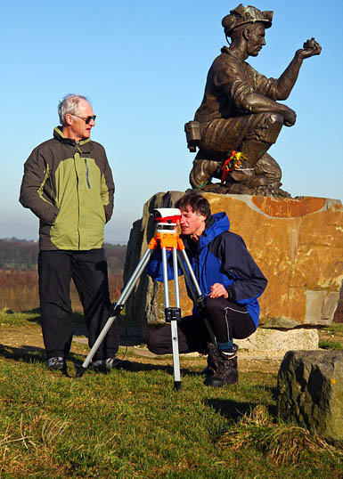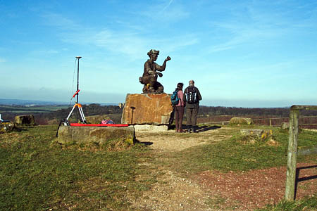
The surveyors on Silverhill, Nottinghamshire, which the county council claims is the highest point in the county. Photo: Myrddyn Phillips
On 15 October 1992, Roy Lynk, the controversial leader of the breakaway miners’ organisation the Union of Democratic Mineworkers began a sit-in 366m (1,200ft) below the rolling Nottinghamshire countryside.
He was protesting at the closure of the pit he once worked in, and the perceived betrayal by Michael Heseltine and his Conservative Government in shutting the coal mines that were the heartland of the UDM, seen by many miners, members of the bigger National Union of Mineworkers, as themselves traitors to the cause during the bitter miners’ strike of 1984-5.
Lynk eventually lost his leadership of the UDM and returned his OBE, which had been awarded by the Tory Government for ‘services to trade unionism’. The irony was not lost on many NUM members.
Silverhill, the site of Lynk’s protest, did close, and the only remnant is the large slag heap, now landscaped and topped by a statue of a miner, along with a plaque detailing all the Nottinghamshire mines that have been closed.
The site, touted by the county council as the highest point in Nottinghamshire, continues to court controversy. Purists say the man-made hill cannot be considered as the county top; only naturally occurring geographic features qualify.
It’s a point not lost on those attempting various records. Jonny Muir, while undertaking his Heights of Madness tour of Britain’s highest county points, said: “I did visit Silverhill in Nottinghamshire for the first time, having previously taken land off Newtonwood Lane as the county’s high point.
“Silverhill is a solitary metre higher, but – as the purists quite rightly argue – the summit has been created from the slag heap of a redundant colliery, so the high point is unnatural. Silverhill, which is topped by an Antony Dufort sculpture of a coal miner, is infinitely more interesting than Newtonwood Lane, so, for the sake of the guidebook, I’ve elevated it to the ranks of the county tops.
“Over time it will surely be considered as such, usurping Newtonwood Lane?”
Just 2km (1¼ miles) away, the unprepossessing Newtonwood Lane, right on the boundary between Derbyshire and Nottinghamshire, was chosen by Alan Hinkes as the target for the Nottinghamshire section during his record-breaking round of the 39 shire county tops last year.
Wikipedia says Silverhill is Nottinghamshire’s highest point at 205m high, while nearby Strawberry Bank in Huthwaite is, it says, believed to be the highest natural point in the county at 203m.
Enter into the fray the trio of amateur hill sleuths, who have put beyond doubt many topographical arguments, from munro statuses to county high tops.
Armed with surveying levels, highly accurate Global Positioning System units and Ordnance Survey maps, John Barnard, Graham Jackson and Myrddyn Phillips set out to settle the argument.
John Barnard explained the mission: “Nottinghamshire Council have ‘created’ the highest point in Nottinghamshire, Silverhill, from the main spoil heap that is a legacy from the coal mines that used to operate in that area.
“They have created a nice landscape and recreational area with many footpaths giving excellent access. The summit has a ring of stones on it that designate the points of the compass and there is a statue of a miner on the summit to remind all of the history of the area.”
Antony Dufort’s Testing for Gas was commissioned at a cost of £50,000 after a council-run competition, which saw local people voting for their favourite design, though the miner sadly now seems to have lost the top of his Davy lamp.
Nottinghamshire County Council said at the time of its unveiling in 2005: “It stands at Silverhill Wood, the highest point in Nottinghamshire, overlooking the Nottinghamshire coalfields.
“Silverhill Wood was created after the closure of the Teversal and Silverhill collieries to help regenerate the area. The views from the highest point are commanding. They include such sites as Hardwick Hall, Bolsover Castle, the Crich Monument, Clipstone Colliery Headstocks, Trent Valley Power Stations and on a good day, Lincoln Cathedral.
“The statue incorporates a commemorative plaque, listing all of the principal coal mines operating in Nottinghamshire between 1819 and 2005, with their respective opening and closing dates.”
John Barnard confirmed: “Notices at the base of the hill clearly state that Silverhill is the highest point in Nottinghamshire.
“A number of colleagues who have climbed this hill have questioned whether Silverhill is in fact the county top. We took the opportunity to talk to locals while we were surveying and they told us that before Silverhill was constructed, the highest point was recognised as Strawberry Bank.
“This is topped with a housing estate but there is a plaque near a seat there that mentions this point. Also there is another high point off Newtonwood Lane on the border with Derbyshire about 1km from each of the other hills that looks like a contender for the highest point.
“Therefore, on 8 February 2011 we decided to survey these three hills to find out which is the highest.”
Mr Barnard said the trio started at the top of Silverhill and used an optical level to observe the other two hills. He said it was immediately clear that the high point off Newtonwood Lane was a contender and would need an accurate height measurement.
Strawberry Bank was lower, he added, and although they couldn’t see the highest ground, the horizontal line of the level was ‘cutting’ the first floor windows on the houses there suggesting the ground was more than 2m lower.
Mr Barnard continued: “It is always a matter of judgment to choose the survey point and we considered the summit of Silverhill to be the flat area at the base of the statue.
“It does not seem sensible to consider it as the top of the miner’s statue! Our GPS height measurement for this was 204.3m with an estimated accuracy within 0.1m.”
The trio then headed west, to within 700m of the motorway travellers breaking their journey at the nearby Tibshelf services, to measure what they believed to be the high point of Nottinghamshire, just short of the county boundary.
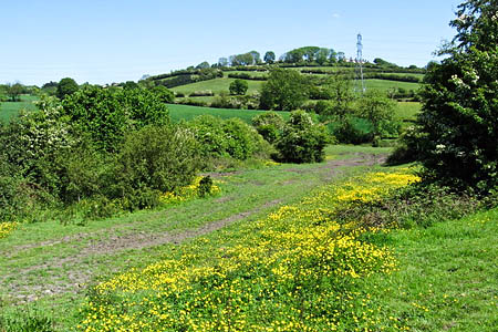
“The highest point of the ground off Newtonwood Lane is under the hedge and is very close to the border of Derbyshire and Nottinghamshire,” John explained.
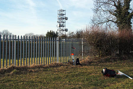
“For practical reasons, we could not place the GPS at the exact highest point here but we were able to use a level and staff to make a correction from the highest point to our survey point. The height measured for this hill was 205.0m with an uncertainty of within 0.3m.
“We have also checked the large scale Ordnance Survey Maps of this area, and although close to the county border, they indicate the points we measured are just in Nottinghamshire.”
So even allowing for error margins, Newtonwood Lane takes the county crown.

Strawberry Bank, which once claimed the title of Nottinghamshire's high point. Photo: Dave Bevis CC-BY-SA-2.0
“Although we did not measure the highest point of Strawberry Bank, our measurement of a high point there at the end of one of the cul-de-sacs was 202.3m which agrees with our optical observations made from Silverhill that this area was about 2m lower than Silverhill,” the amateur surveyor added.
“So our conclusion here is that the highest point in Nottinghamshire is not Silverhill but the high ground off Newtonwood Lane.
“Therefore, it seems that Nottinghamshire Council have not created the highest point in the county. However, it would be true to say that Silverhill is the highest ‘hill’ totally in Nottinghamshire.
“We have tried to talk to a number of people at the council to discuss our results but they have all declined a meeting with us.”
All of which leaves the controversial Silverhill site lacking in stature with regard to the county council’s claims.
As Mr Barnard said: “So what is the solution? A few more tonnes of soil on the top of Silverhill to raise it by about a metre should do the trick but quite rightly would not be the highest priority in the current economic climate. So get your shovels out lads!”
Otherwise, a nondescript bump at the side of Severn Trent’s Whiteborough water-treatment works is destined to become the official roof of Nottinghamshire. Surely Silverhill, with its turbulent, if anthropgenic, geographic history is a more suitable contender?
Strawberry Bank was lower, he added, and although they couldn’t see the highest ground, the horizontal line of the level was ‘cutting’ the first floor windows on the houses there suggesting the ground was more than 2m lower.
Mr Barnard continued: “It is always a matter of judgment to choose the survey point and we considered the summit of Silverhill to be the flat area at the base of the statue.
“It does not seem sensible to consider it as the top of the miner’s statue! Our GPS height measurement for this was 204.3m with an estimated accuracy within 0.1m.”
The trio then headed west, to within 700m of the motorway travellers breaking their journey at the nearby Tibshelf services, to measure what they believed to be the high point of Nottinghamshire, just short of the county boundary.
“The highest point of the ground off Newtonwood Lane is under the hedge and is very close to the border of Derbyshire and Nottinghamshire,” John explained.
“For practical reasons, we could not place the GPS at the exact highest point here but we were able to use a level and staff to make a correction from the highest point to our survey point. The height measured for this hill was 205.0m with an uncertainty of within 0.3m.
“We have also checked the large scale Ordnance Survey Maps of this area, and although close to the county border, they indicate the points we measured are just in Nottinghamshire.”
So even allowing for error margins, Newtonwood Lane takes the county crown.
“Although we did not measure the highest point of Strawberry Bank, our measurement of a high point there at the end of one of the cul-de-sacs was 202.3m which agrees with our optical observations made from Silverhill that this area was about 2m lower than Silverhill,” the amateur surveyor added.
“So our conclusion here is that the highest point in Nottinghamshire is not Silverhill but the high ground off Newtonwood Lane.
“Therefore, it seems that Nottinghamshire Council have not created the highest point in the county. However, it would be true to say that Silverhill is the highest ‘hill’ totally in Nottinghamshire.
“We have tried to talk to a number of people at the council to discuss our results but they have all declined a meeting with us.”
All of which leads the controversial Silverhill site lacking in stature with regard to the county council’s claims.
As Mr Barnard said: “So what is the solution? A few more tonnes of soil on the top of Silverhill to raise it by about a metre should do the trick but quite rightly would not be the highest priority in the current economic climate. So get your shovels out lads!”
Otherwise, a nondescript bump at the side of Severn Trent’s Whiteborough water treatment works is destined to become the official roof of Nottinghamshire. Surely Silverhill, with its turbulent, if anthropgenic, geographic history is a more suitable contender.


steve
22 May 2011I remember when mansfield crown farm pit tip was the highest point around where I grew up in Notts. Then someone realised that coal extraction wasn't that efficient when it was made, and the tip was full of good quality coal, now its a flat spot.
Here today, gone tomorrow.
Adam
23 May 2011An great article with lots of interesting facts.
Thanks,
Adam @ Ordnance Survey
Adam
23 May 2011That should have been 'a great article' not 'an'! Sorry.
R Webb
27 June 2011Before the 'net and when we did our own hill lists, I remember a couple of visits here (after football at Mansfield) trying to work out where the top of Notts. was.
Thanks for sorting it out.
Will they send the bulldozers back in?