Distance: 17.2km (10⅔ miles)
Ascent: 475m (1,558ft)
Navigation: good navigation skills required – summit plateau can be very confusing. Stick to Pennine Way if in any doubt
Strenuousness: gradual climb along Pennine Way; boggy paths on descent are strength-sapping. Surprisingly tough
Trickiness: no exposure, but take care on slippery paths above steep slopes of Near Black Clough
Mapping: this walk is available on grough route. Keywords: Bleaklow and Longdendale.
Pity poor Bleaklow. Few have a good word to say about this boggy hulk, glowering above the busy valley of Longdendale, itself a victim of human engineering endeavours.
It presents an even greater navigational challenge than Kinder Scout and is a place of death. Its black peat moorlands shelter the wreckage of six aircraft which have crashed into its unforgiving slopes, and more than 20 aircrew have lost their lives on its uplands.
So why make the ascent? Well, one could take the George Mallory view: ‘Because it’s there’; but there are plenty more reasons for tackling the second highest hill in the Peak District.
It is the middle hill of the three peaks that make up the trio of Dark Peak uplands – both geographically and in altitude. Sitting between Black Hill to the North and the more visited Kinder Scout to the South, it is beaten into second place in the height stakes by a mere 3m (10ft) by its southern neighbour.
But as Andrew Bibby points out in The Backbone of England (Frances Lincoln, 2008) much of Bleaklow has lead contamination double the official measure at which corresponding urban land could be reused without scouring off the topsoil. And its dark pools approach the pH of battery acid.
The heavy industries of Sheffield and Manchester have had their effect on their upland neighbour. And countless sheep have also denuded its top, leading to peat shorn of any vegetation and prone to further erosion. The Moors for the Future partnership is tackling this with reseeding of sphagnum moss and a huge 31km (19-mile) anti-sheep fence has been erected around the summit plateau, though an occasional ovine interloper still makes her way under the fence to feast on the heather.
A massive moorland fire in 2003 also devastated 844ha (2,086 acres) of Bleaklow and killed most of the mammalian wildlife on the summit, including the mountain hares for which it is famous. The fire was believed to have human origins, either deliberate or accidental, and eight years later the upland is still struggling to recover.
Alfred Wainwright, in his Pennine Way Companion (Westmorland Gazette 1968) said: “Nobody loves Bleaklow. All who get on it are glad to get off it.
“This section is commonly considered the toughest part of the Pennine Way. It is certainly mucky, too often belaboured by rain and wind and frightening in mist.”
Now that, to me sounds like a challenge. So, in Wainwright’s words: “Roll your pants up above your knees” and get out the map and compass.
Our route starts in Longdendale, north of Bleaklow, on the Longdendale Trail, which uses the old trackbed of the disused Sheffield to Manchester railway and makes a pleasant start to get the legs warmed up on a nice, flat walk before tackling the wild lands of Bleaklow.
Pay-and-display parking is available at the Torside visitor centre, SK 068 983 (£3.50 per day in February 2011), where there are toilets and occasionally a chuck wagon. For early birds wishing to avoid paying to park, there are a few parking places at the old Crowden station, at the western end of the Woodhead Reservoir, SK 081 993.
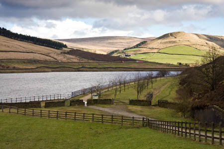
Being indigent, we chose to start at Crowden. The route alternately passes through woodland and open countryside, the huge electricity pylons and thundering traffic of the trans-Pennine road a constant companion, as are a few great tits and blackbirds along the route, which also forms part of the 346km (215-mile) Transpennine Trail leading from Hornsea to Southport.
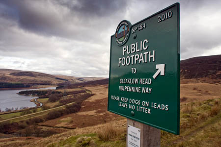
Ignore the signposted route via Wildboar Clough and continue for 1.5km to the Pennine Way, where a couple of stiles give access to the track leading to Reaps farm. Just before the farm, a handsome sign placed by the Peak & Northern Footpaths Society points the way as the path heads uphill to a fence and stile, then climbs on to the western and southern lip of the deep ravine of Torside Clough.
A young red grouse chose to accompany us for five minutes up the path. Let’s hope, come August, he learns to be less trusting of humanity.
Near the top of the clough, the map shows the raised mound of Torside Castle and a 300m diversion can be made following a tributary gill to the unremarkable rise on the 480m contour. Walkers expecting a dramatic crenulated edifice will be disappointed. In fact, though early speculation had the castle as a Bronze Age remnant, latest opinion seems to be that the mound is probably a purely natural glacial feature.
A partly duckboarded path leads back to meet the Pennine Way where Wildboar Grain meets the waters of Torside Clough. Descend to the confluence and cross the brook, then follow the left (northern) side of the grain, on an easy-to-navigate path, part of which is paved by stone flags.
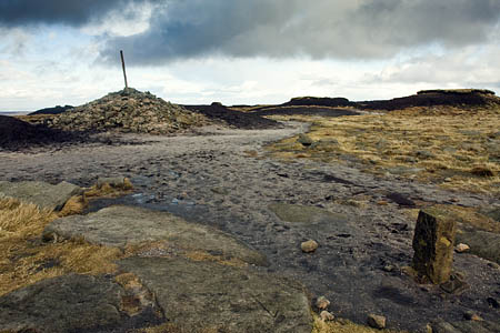
The Pennine Way curves round to the right, turning south, to arrive at the cairn, surmounted by a pole, at Bleaklow Head.
If you are fortunate to have a clear day, this is the point at which to enjoy it. North-eastwards, the hills of the North York Moors can be seen. Northwards lie Pendle Hill and the Yorkshire Dales. In the North-West, Manchester’s Beetham Tower stands out among the high-rise buildings of the city centre and, in the far South-West, the peaks of Snowdonia, including Snowdon itself, can be seen on a good day.
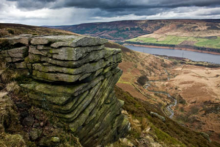
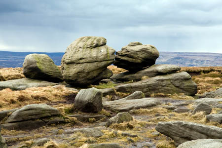
Continue for a couple of hundred metres south-west to admire the romantic, kissing gritstone pair at the Wain Stones, probably the only romantic reference you will ever hear used on Bleaklow.
Retrace your steps to the cairn at Bleaklow then search out a feint path leading on a rough bearing of 60 degrees. Prepare to get your boots well and truly muddy.
If you are in any doubt about your navigational ability this is probably the point to make a decision to retrace your ascent route and make your way back to the valley via the Pennine Way and Torside Clough.
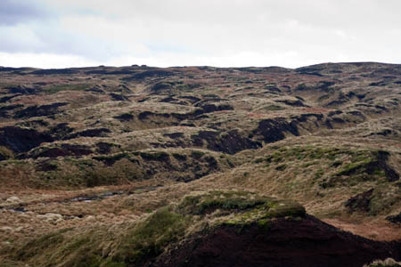
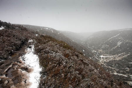
The path is difficult to follow in parts as it attempts to find its way across the deep peat and groughs of the summit plateau but after 300m or so, the running waters of Black Clough are reached. Cross to the left (western) bank and use the deepening clough, which eventually becomes Near Black Clough, north-eastwards.
The path is distinct, but also distinctly muddy and a test of stamina as the slidy, gloopy, black mud of Bleaklow saps the strength of even the best leg muscles. However, with the words of Wainwright – ‘All who get on it are glad to get off it’ – offering emotional comfort, descend the unmistakable handrail of the clough until it meets some scrubby saplings at the top of Birchen Bank Wood.
Admire the view of Longdendale then follow the path as it cuts back right, down a steep slope to meet the waters of the nascent River Etherow.
Follow the track to the left which leads to a bridge over the river to meet the Longdendale Trail at the western portals of the Woodhead Tunnels. These three tunnels formerly carried the busy rail tracks of the trans-Pennine railway but the most recent, southerly, larger bore is presently the site of major engineering works by contractors working for National Grid.
The original single-bore Victorian tunnels were bought by the company’s predecessor the Central Electricity Generating Board to carry its 400kV lines from the power stations of south and east Yorkshire to the Manchester conurbation.
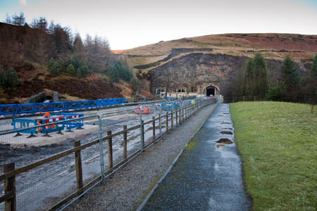
The Woodhead Tunnels' western portals from the old platform of the former Woodhead station on the Longdendale Trail
The old bores are deteriorating so in the early 1990s the company bought the 1953 tunnel for its replacement cables. The former castellations on the tunnel portals have been removed and mesh covers the rock faces presumably to protect the workforce, and the equally ornate mock-castle station has long since been demolished to make way for the new tunnel bore.
After admiring the human civil engineering efforts, continue westwards along the old railway line, passing the former platforms of the Woodhead station.
An easy stroll along the flat route of the Longdendale Trail to the starting point completes the walk.
Colin Ashcroft
21 February 2011I really enjoyed reading this article about my local hills
Poor Bleaklow indeed, it really does get some bad press.
Much as I love Longdendale (even with its Pylons) and the spectacular Torside Clough I would suggest a different route. Any first time visitor will leave with a more positive memory by walking on the the 'Sunny side'
One starting point on the 'Sunny side' is Shepley Street, Old Glosoop. Plan a circuit of Bleaklow from there.
For example, walk past Mossy Lea Farm on the Doctor's Gate path- Shelf Benches - James's Thorn then on to the rocky Higher Shelf Stones - Hern Stones (via the aircraft wreck 'Overexposed') - Pennine Way - Bleaklow Head - Wain Stones return via a pleasant ridge walk above Dowstone Clough and Yellowslacks back to Old Glossop.
note: this is just an outline NOT a route to follow (detailed descriptions of this walk can be found in books and on-line).
I strongly support one of the authors suggestions - if in doubt on the top, stick to the Pennine Way. Even for my suggested route use the Pennine Way in BOTH directions between Hern Stones - Bleaklow Head and Wain Stones.
btw You would be very unlucky not to spot some Mountain Hares on this walk
Give Kinder Scout a day off - walk Bleaklow.
Andy Wilson
21 February 2011This is a very confusing area, especially in poor visibility. The Wain Stones lie South West of the cairn and pole, not South East as the article suggests. It is worth noting that the waymarks for the PW do not go to the Wain Stones as the map suggests, and these can be tricky to follow for the first couple of hundred metres in thick weather when going S
I once reversed this route as far as the cairn on a very poor day to await a DoE group. 3 RAF guys approached the cairn and we chatted a while, they having bivvied out somewhere to the west. They duly departed and, for a little exercise, I navigated to the Wain Stones and returned. Shortly after I was approached by 3 guys in military dress. "Are you the guy that was sat here 30 minutes ago?", "Yes!". They had gone round in a circle completely oblivious to the fact. I met another group going East when the leader claimed to have been heading to the Snake Pass, which is South. My asking if he was going the long way round alerted him to his complacency.
Bob
21 February 2011Andy, it's confusing enough up there without me adding any more. We've amended the description: you're quite right, the Wain Stones are south-WEST of the summit cairn and post.
Boib
ernest
08 August 2015These pics bring back memories as I lived on Crowden station for the first 10 years of my life from 1942 to 1953.
Steam trains thundering thro and my own signal box and real railway that as a 10yr old I could run and did under supervision of course