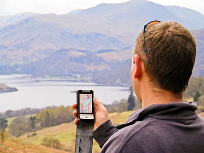
The Lake District’s tourism body has teamed up with a leading smartphone mapping company to provide downloadable walking and cycling routes.
Cumbria Tourism’s link with ViewRanger means walking routes such as the Fairfield Horseshoe and the Old Man of Coniston can be displayed on compatible phones.
Users will need to download the ViewRanger software and buy mapping for the routes, which will also include tourist information such as pubs, cafes and visitor attractions.
Cumbria Tourism has produced 30 walking and cycling routes for the system.
Cumbria Tourism spokesman Ellis Butcher said: “Increasing numbers of Lake District walkers are bringing their smartphones with them so we need to ensure walking and cycling routes are available by app as well as map.
“To get the best from this new service we suggest that people download the application before they arrive so they have it stored to their phone and can browse the routes and familiarise themselves with the terrain.
“From a safety standpoint, clearly it is important to always carry a proper map and compass and know how to use it in case their battery runs out or their phone breaks.”
Craig Wareham, chief executive of Augmentra, the company that develops ViewRanger, said: “This is a great partnership. Cumbria Tourism has been really forward thinking about this project.
“They have unparalleled local knowledge and we have offered them a way to ensure it is made available to a wider audience. I believe this will encourage more people to visit the Lake District and Cumbria over the next 12 months and I believe many other tourist boards across the UK will follow suit.”
Richard Warren, chair of the Lake District Search and Mountain Rescue Association reiterated the need to carry conventional maps when venturing on to the fells. He said: “The Lake District mountain rescue community encourages members of the public to enjoy all the outdoor experiences available within the Lake District provided a responsible approach is adopted and people are properly prepared.
“Use of technology such as ViewRanger can be a great help and although reliable must never be totally relied upon. Your safety is important to everyone and the ability to navigate with map and compass and a back up torch will always provide that necessary safety net when venturing out on the hills.”
Prices of the application for various phones, plus mapping costs and a list of available routes, are on the Cumbria Tourism website.
- grough’s route-planning and GPS import and export system is available along with 1:25,000 and 1:50,000 Ordnance Survey mapping of the whole of Britain for just £2.00 per month. See our grough route page for details.

mike halpin
15 February 2011I am very concerned that you are backing this venture.
Walking is a pastime very close to my heart and I encourage people whenever possible to get out into the great outdoors.
However to suggest that people can do a walk like the Fairfield Horseshoe following a map on a mobile phone appears to an accident waiting to happen.
The battery life on phones is notoriously poor when running mapping programs, I know because my phone has the capability and I would not even trust it to go on a local 3 mile walk.
I would like to know if you have sought the guidance of any of the local rescue teams whose lives you are putting at risk by this venture.
Bob
15 February 2011Hi Mike
We're a news website, we're not backing this venture nor condemning it; merely reporting on it.
Our own grough route system is separate entirely from the ViewRanger software and mapping and our users are able to print out their maps at home then take them with them on to the fells.
We mentioned it as it is another addition to the walker's navigation toolbox, as are the ViewRanger software and the Cumbria Tourism routes.
I think Richard Warren's statement in the above story is an admirable view with which I entirely agree.
Bob Smith
Editor
Ian Pond
15 February 2011Mike
In responding to your comment on behalf of ViewRanger, who are working with Cumbria Tourism to publish their walking and biking routes, I feel it’s important to state that we and Cumbria Tourism have taken steps, both in the news statement (see the comments by Cumbria Tourism’s spokesperson) and in information published on our website - see http://www.viewranger.com/lakes, to stress the importance of safety. Further, we also fully agree with the statement by Richard Warren in the article.
Our application is a tool which a growing number of people are using as a complement, alongside map & compass, to get more from their time in the Outdoors. But it is also a service that is being increasingly adopted for professional use by MREW Search and Rescue teams themselves – please see http://www.viewranger.com/SAR/.
Finally we would say that battery life - which continues to be improved by device makers - where anticipated to be an issue can be easily extended through the use of non-mains chargers or secondary batteries - as recommended in our safety advice.
Ian Pond
Marketing Director - ViewRanger
TheGuyUK
15 February 2011Phones with GPS should come with the feature to give Long-Lat or uk grid referance built in as a help button. Then they can help where ever you find yourself in difficulty and need assistance on hills, paths or roads etc.
Simon Lofthouse
19 February 2011I have an HTC desire iphone with the android operating system and i have down loaded for free OS maps for the whole of the UK. There is a pay version for a one off payment of £5 for which you get unlimited access but i have used the free version all day long with no problems. It is a great addition as a back up to map and compass