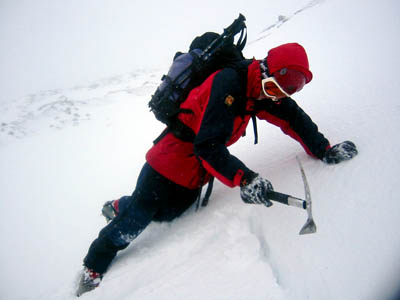
Mountaineers in the Cairngorms will need to assess avalanche risk
Walkers, climbers and mountaineers heading for the northern Cairngorms are being warned that the risk if avalanche is considerable.
The sportscotland Avalanche Information Service swung into full action for the first time this winter yesterday, with assessors on the mountains in the five areas covered by the service.
The highest risk of avalanche is on the southern slopes of hills, with considerable risk, meaning naturally occurring releases of the snowpack could occur. Aspects from west, through south-west, south, south-east and east are all at risk.
Weakly bonded windslab was forming yesterday in conditions of –10C and 50mph (80kph) winds above 750m.
Gully flanks and exits in north-facing corries will also be affected, though there is good snow cover at all levels, with good snow ice on northern aspects.
It’s a similar picture in the southern Cairngorms, with considerable risk of avalanche above 900m on south-west, southern and south-east aspects.
Localised areas of considerable risk also exist in Lochaber, from eastern through to southern slopes with fresh snow expected today carried on a strong north-westerly wind.
Glencoe and Craig Meagaidh both have moderate avalanche risk, meaning releases could be triggered by human presence.
The Mountain Weather Information Service says there will be widespread gales on Britain’s mountains, with a –9C temperature feeling more like –25C with the windchill.
There will be frequent snow showers on many northern and western mountains with whiteout conditions and lightning likely, though many of Britain’s central hills will escape with only light flurries and mainly dry weather.
The MWIS says Britain’s mountain tops will remain frozen until Christmas, with intermittent snow likely from time to time, though a thaw is probable after the festive period.
The Lake District National Park Authority’s felltop assessor was driven back without reaching the top of Helvellyn yesterday, in the face of extreme winds, but on Helvellyn Lower Man a gust of 82mph was recorded.
Paths are very slippery, with fresh snow sitting on ice. The snowpack from the south-east to south-west facing aspects will be unstable, and steep, compacted snow, along with verglas, will be encountered on the exits of Striding Edge and Swirral Edge, meaning ice axe and crampons are essential.
Walkers and mountaineers heading out to the hills should get full forecasts from the SAIS, MWIS or the Weatherline for the Lake District.