The route of A Pennine Journey follows Wainwright's route north, then south
There are, according to the Long Distance Walkers Association, more than 1,000 long-distance paths criss-crossing Britain.
Among these are the 15 official national trails in England and Wales and the four designated long-distance routes in Scotland and many with a theme, such as the Bronte Way, following paths taken by the literary Yorkshire sisters, or the Reivers’ Way in Northumberland, commemorating the border raiders.

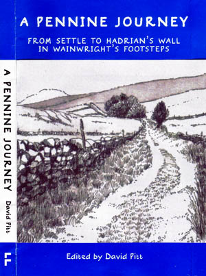
A Pennine Journey is out now
Now, members of the Wainwright Society, formed to keep alive the works of the late chronicler of the Lakeland fells Alfred Wainwright, have collaborated on a distinctive 398km (247-mile) long-distance route based on the author’s solitary walk on the eve of the Second World War.
A Pennine Journey – the Story of a Long Walk in 1938, lay unpublished for more than 50 years and the idea of writing a guide book following an updated route that Wainwright might follow now – with access to much of the upland areas legally possible and more established rights of way – was put by David Pitt to the first annual meeting of the society in 2004. Pitt and his wife Heather made their own journey following in the writer’s footsteps in 1998 and, with his retirement providing more time to devote to the project, the planning and checking began in earnest.
The result is A Pennine Journey: from Settle to Hadrian’s Wall in Wainwright’s Footsteps, a hardback pocket guide in a format that will be instantly familiar to lovers of Wainwright’s Pictorial Guides to the Lakeland Fells.
It’s unusual for a long-distance route, in that it starts and ends at the same place: Settle railway station, just outside the southern boundary of the Yorkshire Dales national park. The route wends its way north, along the eastern side of the Pennines, to reach Hadrian’s Wall at Planetrees, north of Hexham. It then follows the Roman wall westwards for 32km (20 miles) before turning south along the western edge of the Pennines.

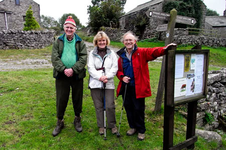
David and Heather Pitt with Ron Scholes, left, at Feizor, on the Pennine Journey route
The guide book assumes the walker will need 18 days to complete the Pennine Journey, and its chapters are divided accordingly. There are hand-drawn maps by Ron Scholes much in the style of Wainwright, with their familiar dotted lines denoting contours, and the kind of differentiation you won’t find on OS maps, with different denoting of walls, fences and even hedges, along with specialised symbols for the remnants left by the Mediterranean visitors 2,000 or so years ago such as a vallum and ditch.
Everything is firmly unmetricated – something Wainwright would no doubt have approved – with contours in feet and distances in miles. Each subsequent mile from the Settle starting point is marked in the same fashion as the Kendal writer’s Coast to Coast Walk, and there are useful additions including the description of the terrain underfoot at various locations.

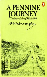
Wainwright's original account of his journey
The route comes within a mile the highest point on the mountain chain – Cross Fell – and calls at England’s highest pub, the Tan Hill Inn. Other notable sights for the Pennine Journeyman include the High Force waterfall and Housesteads the Roman fort on Hadrian’s Wall, though it misses a trick by not diverting the 2½km (1½ miles) from Hull Pot to Pen-y-ghent’s summit. Walkers on the route could then boast of also completing the Yorkshire Three Peaks, albeit taking 16 days to achieve the feat!
Keld, the hamlet at the head of Swaledale, may become a Wainwright Mecca as it now has three major routes with a connection to him converging at the tiny settlement. The Pennine Way, subject of his Companion book, the Coast to Coast Walk and now the Pennine Journey all converge here and fleetingly follow the same footsteps.
Colin Bywater has produced the black-and-white drawings of scenery on the route and each chapter has a description of sights on the leg, followed by a turn-by-turn guide to following the Pennine Journey.
The ideal would be to walk this route with the guide book in one hand and Wainwright’s original in the other – just don’t trip up! A Pennine Journey was very much a period piece in its own way – descriptive of an age of relative innocence and bucolic peace in 1938 that would soon be shattered by the horrors of war. This walk in the footsteps of the irascible writer would give the route a purpose lacking from many other walking challenges – a comparison of two worlds, 70 years apart, but belonging to two very different eras.
The majority of the profits from sales of the Pennine Journey guidebook will go towards David Pitt’s and the Wainwright Society’s campaign to have the whole route waymarked.
A Pennine Journey, edited by David Pitt, is published by Frances Lincoln, priced £13.99.
A Pennine Journey, edited by David Pitt, is published by Frances Lincoln, priced £13.99.
grough readers can win a copy of A Pennine Journey in our competition.