The long-awaited results of the Government’s Ordnance Survey consultation were announced today.
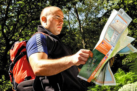
Walkers and outdoor enthusiasts had hoped for a bonanza, with free mapping at the favoured scales used in Explorer maps. They are likely to be deeply disappointed.
The setting up of the OpenData portal is being touted by the Government as a historic milestone towards transforming Britain into a 21st century digital economy, it will leave most outdoor mapping firmly where it was previously.
There will be no free ‘raster’ mapping at 1:25,000 scale – one of the eagerly awaited innovations tantalisingly hinted at in Gordon Brown’s pronouncements in the lead-up to the three-month consultation and at its closure.
Instead, Ordnance Survey will in May launch VectorMap District, which will include midscale data and replaces the 1:25,000 and 1:50,000 originally proposed in the consultation document but, grough can reveal, will not have footpaths and other detail vital to walkers, mountain bikers and other outdoor enthusiasts.
It will include, according to an OS spokesperson, ‘roads, buildings, railway lines, vegetation, hill spot heights and community amenities such as schools, hospitals and leisure centres’, but which isn’t designed for outdoor leisure.
The spokesperson said it is specifically meant for displaying information on the web. Leisure information could be added by users, the spokesperson said. However, this would mean gathering such information from field observations, surveys and aerial photography. On mapping not included in OpenData, current restrictive OS ‘derived data’ rules – long a bone of contention for map re-users – will continue for the present. Mapping released under OpenData will now be free from such rules.
The Government said in its response to the consultation : “This change addresses two concerns expressed by respondents about both the inclusion of 1:25,000 and 1:50,000 raster products. These were the potential damage to the national coverage of Ordnance Survey Landranger and Explorer paper maps and the absence of a mid-scale vector product to enable further innovation by developers.”
The outcome of the OS consultation is aimed almost exclusively at promoting innovative use of geographic information on websites and other electronic means of using these data.
The Department for Communities and Local Government said the changes will enable members of the public, entrepreneurs and social organisations to be able to access certain Ordnance Survey data and use it for applications such ‘Fix My Street’ or crime mapping.
Communities Secretary John Denham said: “Increasing access to Ordnance Survey data will attract a new wave of entrepreneurs and result in new solutions to old problems that will benefit us all. It will also drive a new industry, creating new jobs and driving future growth.
“The changes signal a wider cultural change in Government based on an assumption that information should be in the public domain unless there is a good reason not to – not the other way around. Greater openness, accountability and transparency in Government will give people greater choice and make it easier for individuals to get more directly involved in issues that matter to them.”
Vanessa Lawrence, director general and chief executive of Ordnance Survey, said: “Over the past few months we have been working extremely hard to put in place all the steps which were necessary in order to deliver the Prime Minister’s objective.
“I believe that OS OpenData delivers on that vision, providing a wide range of Ordnance Survey mapping for reuse and without restriction.
“Since the release of the public consultation we have seen the launch of Data.gov.uk which demonstrates how important high quality and well maintained geography is in enabling data from different sources to be linked, used and understood.
“I am therefore pleased that Ordnance Survey data , long recognised as world class, for currency, accuracy and quality, has been identified as having a fundamental role to play as key to underpinning in the future growth of the Smarter Government and Making Public Data Public initiatives.”
The 1:50,000 gazetteer, which enables place-name searches, and 1:250,000 scale colour raster mapping will be free, along with digital height-data.
grough, which is a partner of OS in its grough route planning and mapping system, is currently examining possibilities for development of its system after the Government’s announcement, and will announce its plans shortly.


Andy Wightman
01 April 2010A welcome step in the right direction but no use for the www.whoownsscotland.org.uk project where I am forced to continue using 1930s mapping due to the exorbitant cost (over £10,000 per year) of OS 1:25,000 and 1:50,000 raster data.
Owen
01 April 2010I would be great if OS foot paths and bridleway data were included. Even if you had to pay a small fee monthly to access it! Imagine an iPhone app (or other platform) that had the mapping data on it that you could plan routes on etc!
Bit of a pipe dream though
Meredith
01 April 2010Owen, couldn't agree with you more! - I believe there to be no technical reason why this couldn't work. This is a real wasted opportunity by the government and a big disappointment for many.
Dave
01 April 2010Typicle 'hot air' from government. The people provide the funds for the governments Ordnance Survey Organisation. The info which OS Opendata makes available to the general public is pretty useless. We have a right, having already paid for it, to Free, unrestricted access to map data at a resolution at least 1.25000
NickW
01 April 2010Agree about the footpath data. There isn't really a lot, to be honest, in this release that isn't already covered well, or could be covered well, in OpenStreetMap. On the other hand, countryside info such as footpaths, field boundaries, wood boundaries etc would be most useful to have as they can be difficult to gather using GPS surveys, particularly field boundaries etc. This seems very much a token gesture of little meaning. Oh well.
steve
01 April 2010Yet another non-delivery from this government, to think I actually believed the PM for a few moments back there.
The faceless bureaucrats win again.
Will
05 April 2010This is a disappointment. I have maps over 10 years old where, of course, the footpath and bridleway data is still as accurate as it was back then (bar a few). This would serve walkers and bikers well, and fine, seeing as any major changes one is likely to know about beforehand. Anyhow, what I am saying is why don't they release maps which are 10 years old, fully, it would be little loss to them!
Mark
12 April 2010It's not down to OS to release the Rights of Way data, that will be for the councils to release (as they are the ones legally responsible for them) if the derived data issue is resolved, which it hopefully will be. If that is resolved, massive amounts of public data will be released into the public domain which will have much more impact than just the OS maps.
Notosdg
13 June 2018Oh dear you think Vanessa Lawrence is still at OS????