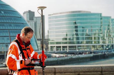
The gathering of OS data would be separated if certain proposals go ahead
Tomorrow is the final date for submissions to the Government’s consultation on freeing Ordnance Survey data.
The process, which began just before last Christmas, could see OS mapping being provided free to walkers, mountaineers, cyclists, mountain bikers and other outdoor enthusiasts. The Government has given strong hints that it would like to offer free mapping as part of a radical overhaul of the national mapping agency.
The results of the consultation are due to be published next month and implementation should then begin, which may see 1:25,000 and 1:50,000 maps provided free for outdoor leisure users.
Communities and Local Government Secretary John Denham, who has overall responsibility for OS, said: “The Government is setting out here what it sees as the strategic options for Ordnance Survey to support Making Public Data Public and enable a thriving private sector market as well as sustainable provision in the public sector.
“We are minded to make available for free and without restriction on re-use certain Ordnance Survey datasets and we invite comments on any aspect of this report [the consultation document].
“We recognise that Ordnance Survey operates in a commercial marketplace and so any change must be implemented carefully to manage the impact on Ordnance Survey customers and partners.”
Freeing up mapping and gazetteer data would have potentially serious implications for traditional retailers and producers of both hard-copy maps and digital mapping. grough route, this magazine’s own route planning and map system, uses licensed OS data. grough has pledged to offer a free version of the service if the Government decides to make mapping available to re-users without charge.
grough route’s prices have already been more than halved in anticipation of any changes and subscription periods reduced as the results of the consultation are awaited.
The Government has proposed three models: keeping the present regime; moving to free large- and small-scale mapping; and a staged move towards free mapping, including initially medium- and large-scale maps.
The last two options would require substantial Government funding as OS would lose much of its revenue from commercial licensing.
The Department for Communities and Local Government is accepting submissions by email up to 17 March. Details are on the DCLG website.