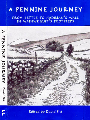
Long Lane, Helwith Bridge, Ribblesdale, on the route of the Pennine Journey
September 1938, and the dark cloud of National Socialism cast its shadow over Europe as Britain prepared for war with Hitler’s growing army.
The gloom and foreboding was mirrored by the weather as a 21-year-old man set forth into storms and downpours as he embarked on a walk through the countryside of northern England beset by the dark trepidation of the forthcoming conflict. The account of that walk would not be published for another 48 years, by which time the young council clerk had become feted as one of the most avidly followed writers on the English fells.

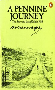
The cover of Wainwright's A Pennine Journey
Alfred Wainwright’s A Pennine Journey was the famed Lakeland chronicler’s first foray into descriptive writing of what would become his life’s passion: the hills of Britain. It describes his journey north from Settle in North Yorkshire to Hadrian’s Wall and the return leg, both along the Pennine backbone of England. It’s a curious mixture of travelogue and philosophy, shot through with sometimes troubling insights into the young man’s psyche and observations on the upland landscape and its people.
As a piece of outdoor writing, its importance lies in what would follow, with the publication 17 years later of his first Pictorial Guide to the Lakeland Fells and subsequent Coast to Coast Walk. The Pennine Journey never figured again in his writings, save for parts of it which coincide with the Pennine Way, which of course featured in his illustrated Companion.
But now, the Pennine Journey is set for a revival, if a group of Wainwright aficionados has its way. The plan is to establish a trail roughly covering the route he took more than 70 years ago.
A guide book, produced in a style similar to Wainwright’s, is set for publication in April this year and a campaign is afoot to establish the route as an official long-distance trail.

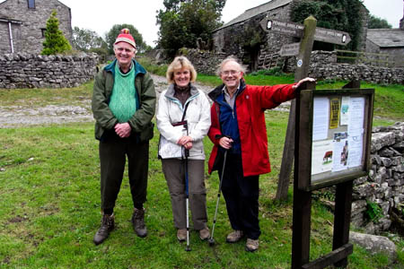
David and Heather Pitt at Feizor, with Ron Scholes, left, who has collaborated on the guide
The move is being led by Shap-based David and Heather Pitt, who completed their own pilgrimage following Wainwright’s itinerary in 1998, landing back in Settle on the 60th anniversary of Alfred’s departure. Four years later the Wainwright Society was formed by followers of the late Kendal-based author, and the idea of putting together the route and a guide book was again mooted.
The Pitts enlisted Colin Bywater to create the illustrations and Wainwright Society members to walk the route and update descriptions.
Society members undertook the route to coincide with the 70th anniversary of Wainwright’s original journey and the Wainwright Society adopted an additional object to its constitution: ‘To foster and enhance Alfred Wainwright’s standing in the field of long distance footpath walking’.
There has been some reluctance from one of the authorities on the route to waymark it. Others are more enthusiastic. David Pitt told grough: “90 per cent of the royalties from the guide book will go into a waymarking fund. I have started a campaign to get the whole of the route waymarked.”
He paid tribute to Wainwright Society members for their help. Although not an official society project, it has had enthusiastic backing. “Without the help of the Wainwright Society, it would have been very difficult,” Mr Pitt said. The project also received the ‘nod’ from Wainwright’s widow Betty before her death.

The Pennine Journey guide is due for publication in April
The Pennine Journey will be an unusual long-distance route in that it is circular, starting and finishing at Settle railway station. 398km (247 miles) in length, it makes its way up the eastern edge of the Pennines via Ribblesdale, upper Wharfedale, Swaledale, Teesdale and north to Hexham and Hadrian’s Wall. The return leg south comes down the west side of the Pennines after following the wall westwards. It traverses the South Tyne valley, Cross Fell, the Eden valley, Mallerstang, Dentdale, Whernside and Ingleborough before returning to Settle.
The route involves a total of 11,260m (36,942ft) of ascent.
The guide book is due to be published by Frances Lincoln in April. Further details are on the Pennine Journey website.
Peter Stuart
19 January 2010Perhaps the royalties should go to the up keep of the footpaths that will be created, unlike the royalties from his pictorial guides.
Ron Scholes
03 February 2010A Pennine Journey.
I enjoyed the article on the forthcoming book. Please may I add some more detail. All the pen and ink route maps and vignettes have been done in the Wainwright style, and in so doing I have walked every step of the way; if you like, I could be considered the first Pennine Journeyman.
A Pennine Journey. Maps and vignettes by Ron Scholes.
Ron Scholes Author of Coast to Coast on the Ravenber Way and Walking in Eden.
NB: A 3rd Edition of The Ravenber Way will be published in September 2010.
David Pitt
27 May 2010I have just read your review and would like to point out that with around 500 copies of the guide pre-ordered and in circulation before the guide's official launch then the route will soon be being walked and enjoyed.
I cannot praise too highly Ron Scholes' contribution. His 2.5 inch/mile rote maps in an AW-like style almost make the need for OS maps superflous.
Comments on the walk together with any queries will be welcomed via the route's website www.penninejourney.org.uk which gives the background to the project and is being revised to include, eventually, an accommodation register
David Pitt
Editor
David Pitt
27 May 2010I should be grateful if you could include details of the project's website together with that of the Wainwright Society's website.
I can also say that the Waymarking Fund has now been established by the Wainwright Society.
David Pitt