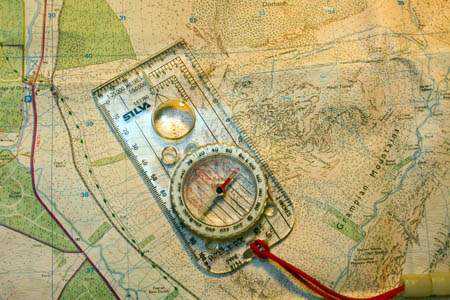
Walkers and other outdoor enthusiasts could be in for a bonanza with free mapping
Outdoor enthusiasts were handed an early Christmas present today with the announcement that the Government could make leisure mapping free to users.
In a dramatic u-turn that could save walkers a small fortune, Downing Street announced that leisure maps used by walkers, runners, cyclists and mountain bikers could be free to download from next spring.
The about-face comes less than a month since the Department for Communities and Local Government denied that leisure mapping would be included, saying that it would be larger-scale data, typically used in planning matters and by utilities, that would be liberalised.
A spokesperson told grough in November the free mapping would not be the ‘type of map you would use for a walk in the Peak District’.
But a consultation, launched by the Government this week, is proposing exactly that: 1:25,000 and 1:50,000 maps could be available online for no charge.
The plan is likely to face stiff opposition from digital mapping providers and retailers as it would severely affect their income. Manufacturers of global positioning system devices also face losing revenue from digital maps for their units.
Companies such as Navteq, owned by Nokia, and TeleAtlas, a subsidiary of TomTom, could provide stiff opposition to the Government plans. Both provide digital map data to a wide variety of firms.
Retailers selling traditional OS paper maps also face losing High Street sales.
grough’s own system, grough route, uses Ordnance Survey data under licence from the national mapping agency. We have been anticipating the move and have been developing our own free route planning system to build on the existing service through which subscribers have access to Ordnance Survey maps and the unique online grough route planning system. If, at the end of the consultation, expected in March 2010, the Government decides to free 1:25,000 and 1:50,000 map data, grough will mirror the liberalisation and provide free access to its system too.
grough is also restructuring its existing service so users can take out reduced-price monthly subscriptions in the run-up to the potential changes.

The OS has for a long time jealously guarded its mapping data, gathered by surveyors since the 18th century
The liberalisation of Ordnance Survey data was announced by Gordon Brown and worldwide web inventor Tim Berners-Lee, along with Nigel Shadbolt, a Southampton University boffin, last month as part of the Making Public Data Public project, in a move that seemed to take the national mapping agency by surprise.
Ordnance Survey is run as a Trading Fund, which means it receives no financial support from the Government for its business and is expected to stand on its own feet as a business concern. Losing the revenue from the popular leisure mapping will mean other Government departments will have to compensate OS.
Announcing the start of the consultation, communities minister, Ian Austin, said: “The Prime Minister has set out the importance of an open data policy as part of broader efforts to strengthen democracy – creating a culture in which Government information is accessible and useful to as many people as possible in order to increase transparency and accountability, improve public services and create new economic and social value.
“Freely available facts and figures are essential for driving improvements in public services. It puts information, and therefore power, in the hands of the public and the service providers to challenge or demand innovation in public services.
“We are now consulting on proposals to make certain products from Ordnance Survey freely available so it can be used for digital innovation and to support democratic accountability.”
Sir Rob Margetts, chairman of Ordnance Survey said: “I am pleased that the Government is today consulting on proposals to release for free some of Ordnance Survey’s data to support innovation, accountability and growth. I also very much welcome the commitments made by Government to determine how the necessary funding required to underpin this initiative can be provided. An ongoing funding commitment is fundamental to maintaining the sustained quality of Ordnance Survey’s data that has made the organisation a world leader in its field.”

Vanessa Lawrence, the OS director-general
Vanessa Lawrence, director-general and chief executive of OS, said: “We welcome the publication of the consultation document and the opportunity it offers for our partners, customers, stakeholders, interested individuals and users of our data to offer their views.”
The possible range of products under consideration for release as part of the ‘Ordnance Survey Free’ includes:
- ‘Raster’ products in a range of scales from 1:10,000 to 1:1 000 000 that will enable developers to produce an application that overlays their information on a map and to zoom-in from a national view down to the street level
- Definitive gazetteer, boundary and postcode information that will enable widespread use of these commonly used geographies and act as a link between other government data sets which reference the same geography
- Small-scale vector mapping products which would enable developers to link between boundary, postcode and mapping data.
The OS data is likely to be released under a ‘Creative Commons’ type of agreement. Businesses that are currently commercial partners of OS will be consulted to determine the impact of the proposals on their operations and how to manage or mitigate this.
The large-scale MasterMap data will continue to be charged for. The 1:25,000 and 1:50,000 colour raster sets familiar to outdoor enthusiasts will be released via the web, most likely through the Open Space application programming interface, which is currently capped at 40,000 mapping tiles daily for non-commercial use. Raw data will also be opened up, allowing companies to develop mapping and other geographic information systems.
The freeing of the OS data is a major departure for the agency, which has previously claimed copyright not only of the mapping but also of ‘derived data’ produced from it. The introduction of a Creative Commons ethos would potentially encourage more innovative use of mapping products.
Secretary of State John Denham said of the move: “An open data policy for the UK is a key part of this transformation. It is nothing less than a radical change in the relationship between the citizen and State.”
The move to free OS mapping data also makes a move to privatise Ordnance Survey, touted as part of a Government cash-raising exercise to mitigate its massive debt, less likely. This was emphasised in its operational efficiency programme document. This does say, however, that private partnerships are likely to figure more in OS’s future. Ordnance Survey minister Ian Wright is on record as saying he has no plans to privatise the organisation and no useful purpose would be served by doing so.
But union Prospect, whose members jobs in sales and licensing at OS are at risk from the move to freeing data, says the Government’s strategy is confused and they have failed to consult stakeholders.
Prospect negotiator Ben Middleton said: “The announcement on Twitter of Gordon Brown’s intention to make some OS data free may well mark a development in the Government’s use of up-to-date technology but also shows a sneering disregard for the proper protocols of engagement with stakeholders when contemplating such significant changes.
“The government’s approach has, to date, been woeful. There has been no meaningful consultation with key stakeholders prior to proposals being brought forward for public consultation and, it appears, little if any thought, given to how the issues of freeing up data, ownership and business model might be brought sensibly into balance.
“As [Liberal Democrat treasury spokesman] Vince Cable questioned in the Commons, it seems difficult to imagine how an organisation that is required to give away freely the data it produces could sensibly be privatised.
“Yet the asset portfolio document speaks of business transformation options potentially benefiting from the assistance and experience of the private sector, of joint ventures, outsourcing of functions and partial or full sale.”
Mr Middleton also said the move to free data would leave a hole in the OS finances. He said: “This measure will cost Ordnance Survey millions of pounds. The question for OS must be how it will make up that loss.
Government data such as that being liberalised under the new OS regime has been free in the United States for some time. Advocates point to the economic benefits of this system, with corporation tax revenues from new business applications potentially more than outweighing the loss of Government income to treasury coffers.