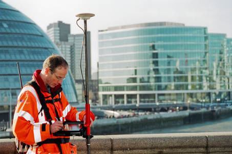
Surveying for OS using GPS
Prime Minister Gordon Brown today announced an opening up of public access to Ordnance Survey maps.
Speaking at a Downing Street seminar, Mr Brown outlined the plans to make more data from the Government’s official mapping agency free to users. OS maps are widely used by walkers, mountaineers, mountain bikers and cyclists for their leisure activities.
The gathering at Number 10, attended by Tim Berners-Lee, credited with the invention of the Internet, was told that opening up OS data would encourage digital innovation.
But outdoor enthusiasts looking forward to acres of free online Explorer and Landranger maps may be disappointed. Enquiries by grough today suggest it is larger-scale mapping along with postcode and local authority boundary data that is at the heart of the planned OS liberalisation.
A spokesperson for the Department for Communities and Local Government said: “The proposals will harness the world-class expertise that Ordnance Survey has in the production, maintenance and application of high-quality geospatial information.
“They build on reforms already delivered in the organisation and would ensure that it is right at the heart of digital innovation in Britain.
“Freely available facts and figures are essential for driving improvements in public services. It puts information, and therefore power, in the hands of the public and the service providers to challenge or demand innovation in public services.”
The Guardian newspaper has long campaigned, under its Free Our Data banner, for official information produced by bodies such as the OS and other central and local government agencies to be freely available, as it is in the USA.
There has also been speculation that the Ordnance Survey might by part privatised either by Labour or, if there is a change of Government next year, by a Conservative administration.
The DCLG spokesperson continued: “The Prime Minister has set out the importance of an open data policy as part of broader efforts to strengthen democracy – creating a culture in which Government information is accessible and useful to as many people as possible in order to increase transparency and accountability, improve public services and create new economic and social value.”

Prime Minister Gordon Brown. Photo: World Economic Forum
Mr Brown told the Downing Street seminar: “We live in exciting times; a digital age of high-speed communications and information just a click away that is transforming our daily routines. Technological advances and rising customer expectations are revolutionising how we all do things.
“Today’s announcement responds to the demands for better use and access to data held by government. In this new world, smarter government is not an option but a necessity.”
There will be a public consultation on the proposals, starting in December.

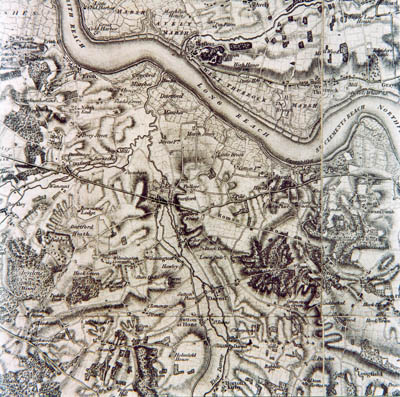
The OS's first map
Communities Secretary, John Denham, added: “Any public service reforms must be open about what is going on so that those outside it can examine what is happening and to propose alternative ways of doing things if necessary.
“This can only happen if the necessary information and data about what is currently delivered is easily and readily available. Ordnance Survey is a world renowned mapping expert and making the data they hold about local areas, like council boundaries and postcodes, readily available is an important first step to a more open government.
“We want people to be able to compare the outcomes and the costs for their own local services with the services delivered elsewhere, and suggest means of improving and driving change that help cut out duplication and waste, and make sure that every pound of public money is working as hard as it can.”
Minister for Digital Britain, Stephen Timms, who has responsibility for the Making Public Data Public project, said: “This is an important step in our public data strategy. About 80 per cent of public sector data mentions a place. Making Ordnance Survey data more freely available will encourage more effective exploitation of public data by businesses, individuals and community organisations.”

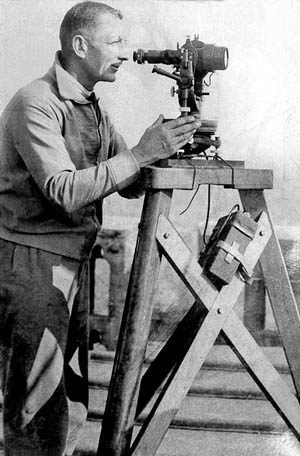
OS surveying, old style
When grough contacted an Ordnance Survey spokesman, we were told that all enquiries on the matter were being dealt with by the DCLG. The OS issued a statement that said: “The detail of this is still being worked through and a formal consultation period will begin in December to look at how these changes will be implemented.
“Ordnance Survey is committed to working with colleagues across government on developing these proposals. In the meantime we are focused on continuing to collect and maintain the most accurate mapping data of Great Britain as well as delivering an excellent service to our customers and partners.
“Since May 2009 we have been in the process of implementing our new business strategy and we believe that much of this is still very relevant as we move forward.”
There has been an expansion of digital mapping products using OS data in recent years. grough’s own grough route system uses 1:25,000, 1:50,000 and 1:250,000 scale mapping for its route planning community, licensed by Ordnance Survey.
OS has also allowed limited use of its leisure mapping under its Open Space application programming interface, but it seems unlikely there will be an expansion of this in the near future.
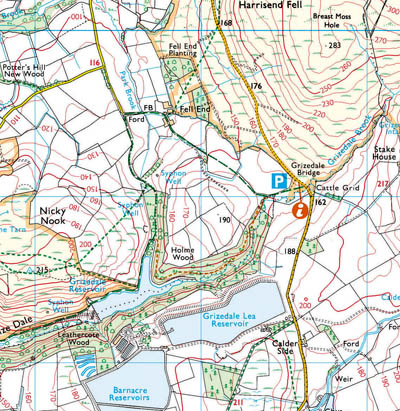
A spokeswoman for the Department for Communities and Local Government said it was intended the free mapping would be 1:10,000-scale or larger. It was not about the ‘type of map you would use for a walk in the Peak District’, she said. The Government would fund gaps for OS by the plans.

Sales of traditional paper maps such as this 1:25,000 Explorer series, are declining
These days, less than eight per cent of OS revenue comes from traditional paper maps, the majority of its income deriving from licensing, topping £102m in the last financial year. These licences, along with the growth in GPS navigation devices, have grown while the sales of paper maps declines.
Ordnance Survey is both a Government executive agency and a trading fund, meaning it must stand on its own financial feet. In the 2008-9 term, it produced a surplus of more than £16m and returned £4.8m to the DCLG.
The roots of the OS lie in the needs of the military to have accurate topographic information with which to continue the subjugation of Scottish clans in the 18th century. Its work in mapping Britain continued during the Napoleonic Wars and culminated in the great task of building the numerous concrete pillars to be found on hill and mountain tops throughout Britain. They were used in the 1930s to resurvey the country. Nowadays, super-accurate Global Positioning System equipment is used to survey the land.
David Medyckyj-Scott
17 November 2009The announcement refers to mid-scale digital mapping. According to the OS web site mid-scale are products in the scale range 1:10,000 - 1:49,999. OS products falling into this scale range include OS VectorMap™ Local, 1:10 000 Scale Raster and 1:25 000 Scale Colour Raster i.e. a scanned image of OS Explorer Map.
Paul Webster
17 November 2009"A spokeswoman for the Department for Communities and Local Government said it was intended the free mapping would be 1:10,000-scale or larger" - that does include 1:25,000 and 1:50,000 then?
I'm expecting 1:50,000 will be included at least
Anthony Walker
17 November 2009Sadly, by "larger" I think she means larger-scale, which implies 1:10000 and less.
Tom Smith
17 November 20091:10,000 scale or larger does not include 1:25,000 or 1:50,000. The smaller scale a map is the larger area it covers and vice versa.
Think of them as fractions. 1/10,000th of a unit is much larger than 1/250,000th of the same unit.
Paul Webster
18 November 2009She will have meant smaller, honest. The OS receives far more revenue from the extreme large scale maps (as used in planning applications etc.) - there has been no focus on freeing these. They aren't going to free very large scale maps but keep the road atlas for themselves!
As the previous poster said, their definition of 'mid-scale' is 10:000 and larger. This would then include the digital versions of the OS's consumer paper maps.
Remember that 1:50 000 and 1:10 000 (but not 1:25k) is already available free via OpenSpace, and the tile limit was recently increased to a level such as it makes no odds.
Paul Webster
18 November 2009Sorry, middle paragraph of my last comment, should read
"As the previous poster said, their definition of 'mid-scale' is 10:000 and smaller. This would then include the digital versions of the OS's consumer paper maps."
Gordon Brown said the proposal went down to 1:10 000 - that means 1:10 000 and smaller, surely.
Luke Smith (grough)
19 November 2009I spoke to the DCLG and OS yesterday again seeking some clarification on the scales to be made available.
The woman at the DCLG said she had no further information to give, and a spokesperson for Ordnance Survey said the finer details, including which scales will be included are subject to the consultation.
The consultation should begin around the middle of December, and should last around 90 days.
Matt
30 November 2009Small but important point: Tim Berners-Lee invented the web, not the internet, which had already been around for 20 years at the time.
instant payday loans
07 June 2012nkFIb
loans online
08 June 2012WTuqh
cash advance
28 July 2012=
fast loans
19 August 2012=
fast cash loans
20 August 2012=