grough route is your gateway to our great new online mapping community
Imagine having top-quality maps of the whole of Britain at your fingertips, so you can plan your outings from the Isles of Scilly to Shetland; from East Anglia to the Isle of Man.
With grough route, you can!
grough route is our the brand-new web-based community for planning your activities in the great outdoors, whether it’s a five-mile stroll, a hardcore mountain biking trip or a hillwalking expedition.
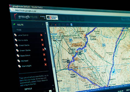
With access to Ordnance Survey mapping, outdoor enthusiasts can search for destinations, plan their route and print a map showing their planned course.
Not only that, grough route contains a wealth of extra information on your chosen track: how far; how much you’ll climb; how long it will take you; what speed you’re likely to travel at, and just how steep those hills are.
You can also benefit from other members’ local knowledge as they share their routes, points of interest and knowledge of Britain’s countryside to enhance your time in the great outdoors.
grough route has signed a deal with Ordnance Survey, Britain’s official mapping agency, to offer maps at the most popular scales: 1:50,000 and 1:25,000. These are ideal for outdoor enthusiasts, from walkers and climbers to fellrunners and mountain bikers. The service also offers small scale OS maps at 1:250,000 to view a whole area and plan how to get to your starting point.

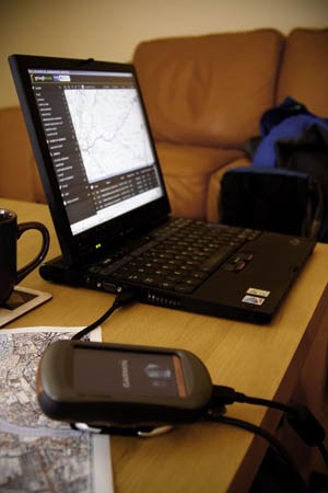
Plan your trips from the comfort of your home, print maps and route cards and export your route to a GPS unit
There is no software to download – grough route uses your internet browser to view maps and create or load routes – which means the service works on Macs as well as PCs. And the mapping is all online, so your hard-drive won’t get cluttered up by lots of data. All you need is a broadband internet connection and a supported browser to use grough route.
Updates to mapping come at no extra charge, as Ordnance Survey releases its revisions, so grough route online maps will never go out-of-date.
grough route members can also export their routes to handheld GPS units and import tracks from their GPS into the system to see exactly where they have been. For top-level members, routes can be viewed on aerial photography.
grough route will also create a route card for you to follow or leave at your base for safety, so others know where you’re going.
The service is ideal for outdoor enthusiasts and is great value. No need to buy paper maps or download extra data for those one-off trips to a new area – just create your route and print it before setting out.
grough editorial director Bob Smith said: “The staff at grough are all outdoors enthusiasts so we’ve set our sights high. We know what walkers and other lovers of Britain’s countryside need from a mapping and route system, and we’ve tailored it to their needs.
“The beauty of having the whole of Britain at your fingertips is that you don’t need to buy extra mapping if you’re planning a day out somewhere you haven’t visited before – it’s all included.”
grough route membership starts at just £27. All users get access to unlimited mapping of Britain at the most popular scales used on Ordnance Survey Explorer and Landranger maps.

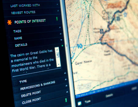
Members of the grough route community can add information to points of interest to enhance the experience of using the route
Bob Smith added: “Another unique feature of grough is the ability to draw on other enthusiasts’ knowledge.
“Often, walkers and bikers will have local insights into aspects you can’t see on maps: the best cafe; a good place to park; great pubs – all of these can be added to grough route to share with other users.
“We see the system building into a great community, where you can share your favourite routes and tips to get the most out of Britain’s countryside. grough route is launching with pre-loaded walking routes in various areas of the country, all of which have been pre-walked by our staff, so the information is spot-on.”
For full details of grough route and how to join, see our grough route page.
Eric Rothery
22 October 2009This seem a very good system.
If a group of say 3 or 4 subscribed wiil they be able to share the routes without giving access to all other users.
Luke Smith
22 October 2009Hi Eric,
The short answer is no, at present - but such a feature (controlled access lists and more specifically, group sharing) is planned for the near future.
The nearest thing at present would be sharing the route, and then each member of the team creating a copy of the route and saving it private to themselves - then unsharing the route. This isn't ideal, group permissions would be much better.
If you'd like us to let you know when this feature is made available, let us know.
Luke
Technical Director