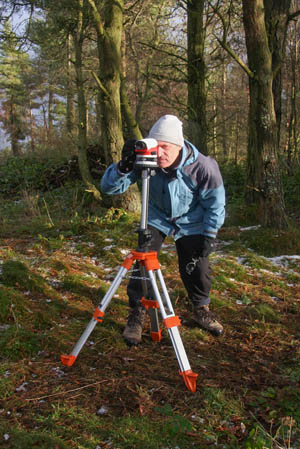
John Barnard surveying with the level on the summit of Mynydd y Cwm
They’re at it again! Not satisfied with promoting a Welsh hill to mountain status and elevating an Arran peak to the list of marilyns, three intrepid surveyors have been taking a close look at three hills on the Wales-England border – with mixed results.
John Barnard, Graham Jackson and Myrddyn Phillips last year determined that the previously sub-2,000ft Mynydd Graig Goch could proudly boast its status as a mountain, and that Arran’s Sail Chalmadale qualified as a marilyn. Now, the trio has been exploring the wilds of ploughed fields, canal tow paths and the occasional summit of a sub-marilyn in their quest to determine the definite status for three hills that are listed by Alan Dawson as having close to the minimum of 150m drop to count as a marilyn.
And the result is: one up, one down, and one no-score draw.
John Barnard takes up the story: “We’ve recently surveyed Mynydd y Cwm, Raw Head and Earls Hill, with some interesting results being achieved.”
Barnard told grough that each hill’s col and summit were accurately surveyed with their Leica 500 series GPS equipment.
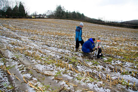
Examining the 305m previously listed Welsh sub-marilyn of Mynydd y Cwm consisted of surveying a ploughed field next to the A541 north-west of Mold to ascertain the absolute height of its connecting col to next higher ground.

John Barnard and Graham Jackson operating the GPS at the col of Mynydd y Cwm
Mr Barnard continued; “As the re-ascent was so close to the 150m benchmark height required for it to qualify as a marilyn, we visited the col and summit on two separate occasions, each time taking various detailed measurements.
“We took two separate surveys on the col and five separate surveys from different points close to the summit and then line-surveyed the difference in height to the summit itself.
“The resulting data were then averaged to give us the mean figure. Incredibly, the figure we ascertained could not be closer to the criterion required to enter the marilyn list.”
The result of this perseverance is that the wooded summit of this hill has now been accepted into the marilyn ranks, just sneaking in with no more and no less than 150m of rise from col to summit. In the trade we know this kind of result as a BCC – a bloody close call.

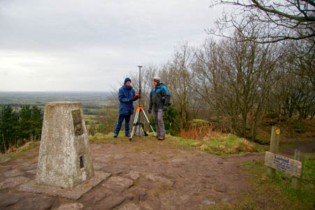
Graham Jackson and Myrddyn Phillips operating the differential GPS on the summit of Raw Head
Raw Head was not so fortunate and was found wanting. Its col is positioned on the outskirts of Grindley Brook and its status after more than 11½ hours of wandering on canal tow paths, investigating frozen fields and following the course of drainage ditches and even venturing up to its summit, proves its unfortunate demise as hours of detailed surveying prompted the outcome that this one time 227m (745ft) marilyn is now demoted to sub-marilyn status, having only 148.4m of rise from col to summit.
Jackson was concerned as he told grough: “My wife Janet is bereft. She’s completed most of the Sandstone Trail, the 34-mile walk from Frodsham to Whitchurch and Raw Head, as well as being the highest part of the walk, is undoubtedly also the highlight.

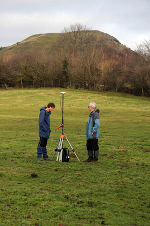
Graham Jackson and John Barnard operating the differential GPS at the col of Earl’s Hill. The summit of the hill is in the background
“She is not very pleased that I have had a hand in its unfortunate demotion.” Janet may be bereft but let’s bear a thought for the county of Cheshire, as after one fell swoop of detailed surveying the population of its marilyn count has been decimated by an astonishing 33 per cent.
One promoted and one demoted, so what about the 320m-high Earls Hill? It’s as it was. It was and still is a sub-marilyn; it’s a fine hill that rises above the hamlet of Habberley in Shropshire, but with only 146.1m of rise from col to summit, its relative height decreases by three metres when compared to its listed figure.
Finally the trio told grough that 2009 held big plans for them, with more surveying and probably more peak reclassifications on the way.
Keep checking the grough site for up-to-date news as we have been promised to be kept informed of future summit reclassifications when they happen.
A marilyn is a hill of any height with a drop of 150m (492ft) on all sides, and a sub-marilyn one which just fails the mark by up to 10m, that is, having a drop of between 140m (459ft) and 150m. They are detailed in Alan Dawson’s book The Relative Hills of Britain and the name is a jokey back-formation from their more illustrious cousins the munros – Marilyn Monroe – geddit?
The highest marilyn is, of course, also the highest munro, Ben Nevis, the 1,344m (4,409ft) king of British mountains. The lowest is Maol Dòmhnaich or Muldoanich on the uninhabited island just east of Vatarsay which, at a mere 153m (502ft) is fortunate to be surrounded by the sea which enables it to be squeezed into the list.
© John Barnard, Graham Jackson, Myrddyn Philips
The Piglit
16 April 2009Just a reminder of my own project to identify horrible boring little summits of no geographical or scenic merit and name them "The Piglits"
I shall of course do this in a blaze of publicity and with a full blog lots of pics and then be famous as the only person to do all "The Piglits"
Cracking project eh?
Eryl Selly
16 April 2009Cracking article.Keep up the good work. Hats off to The Undertakers!
RobW
27 April 2009Great project. Quite a bit of hand-levelling work goes on in the US but this takes it to a different ...er... level. Respect, from the Marilyn-bagging community :-) Looking forward to news of further promotions - and hopefully not too many demotions!
R webb
27 April 2009There are some great wee hills out there, all the better for being devoid of the height blinkered masses. This list, being quantitative, exists whether anyone lists it or not - the hills ARE.
Why the assumption that a small hill is boring? Good luck with your enterprise, and very good luck in actually finding a boring hill.
It is of course not unfortunate for a hill like Raw Head not to be on some arbitrary prominence based list. The hill is still there, and folk are having a good time adding to geographical knowledge.
agentmancuso
28 April 2009Keep up the good work!
viagra online
10 December 2014Thank you for sharing your info. I really appreciate your efforts and I will be waiting for your next post thank you once again