 Distance: 16.6km (10⅓ miles)
Ascent: 340m (1,115ft)
Time: allow 5 hours
Map: Ordnance Survey Explorer, OL21, South Pennines
Note: grough routes should be used in conjunction with maps, a compass and other navigational aids. Routes often use access land and involve finding your route off footpaths. Knowledge of and competence in using a map and compass is essential when using the routes. Carry the correct equipment for the conditions and be aware of hazards in the outdoor and upland environment.
The South Pennine moors lie on the doorstep of some of the most industrialised towns and cities of northern England. They are the green lungs where millworkers once escaped the pollution and grime of some of the grimmest environments imaginable, and where millowners erected mock baronial piles with the fruits of their workers’ labour.
The mills are mainly silent now, either converted into flats and galleries or demolished. But mankind’s influence is still everywhere to be seen, from the civil engineering works which brought clean water to the Victorian industrial towns, to the new engineering which, like it or not, is harnessing wind power on the prominent moorlands overlooking Calderdale.
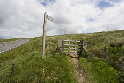 Our walk starts at a small parking area, a disused delph or quarry, on the A6033 road between Hebden Bridge and Oxenhope. Hebden Bridge was the first town in Britain to gain Walkers Are Welcome status and the area around the distinctive town has some well waymarked and maintained paths.
It also has large areas of Countryside and Rights of Way open access land, which this walk uses.
The start point is opposite a bus turning circle at SE 000 312. Don’t park on the bus circle, but use the old delph or one of the other rough laybys nearby. Walk for 100m SW towards Hebden Bridge, taking care on the busy road. A path leaves the road to the left at a finger post to Limers Gate. Gate in this case means, not a five-bar obstacle to progress, but a street, from the Old Danish gata. So the route would have been used by packhorse trains bringing lime to the acidic moorland to sweeten its ground.
The path climbs up the moor, past a bench dedicated to Councillor Harold Ryder, who, according to the inscription, dedicated over four decades of his life to the parish of Wadsworth.
As the ground rises, there are views south to the Napoleonic monument on Stoodley Pike and beyond that to Windy Hill, the high point of the M62 motorway. Black Hill and Holme Moss mark the beginning of the Peak District hills further south.
To the North, the University of Bradford’s telescope dominates. It was formerly known as RAF Oxenhope and was used as a radio navigation establishment. In the far distance are the Yorkshire Dales hills, with Great Whernside prominent.
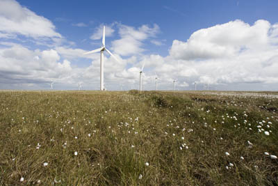
Continue to the triangulation pillar (trig point) on High Brown Knoll, 009 303, taking time to note, if visibility allows, the huge influence of humans on the landscape up here. Holme Moss and Emley Moor television transmitters soar skywards; ahead is the Ovenden Moor windfarm which will be on our route; in fact, this is windfarm country, with lazily rotating vanes dominating so many horizons. This is definitely a man-made environment, yet at the same time has a remote feel.
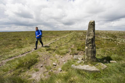 Take the path leading directly east from the trig point towards a solitary standing stone. Follow the left-hand path, sticking to higher ground heading towards Warley Moor Reservoir.
The standing stone beyond the trig point
Follow the path to where it meets the catchwater drain, using the small bridge to cross. Turn immediately left and follow the conduit as it contours round the large bowl at the head of Luddenden Dean and heads towards Warley Moor Reservoir, which most locals know better as Fly Flat Reservoir.
At the reed bed marking the top of the deep clough leading down to Upper Dean Head Reservoir, the catchwater drain jinks to the right. The path accompanies the water course, heading towards the radio masts at the old Withens pub, which used to carry the proud boast of being West Yorkshire’s highest, at 424m (1,392ft).
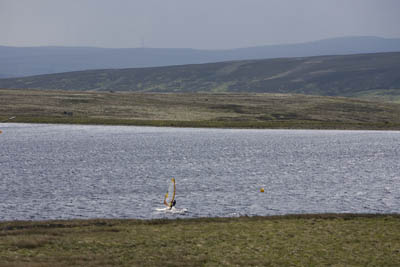 On reaching Warley Moor Reservoir, turn left over the catchwater drain and then immediately right; cross a wooden footbridge and follow the northern edge of the reservoir. Mountain bikers were much in evidence during our visit.
The wettest parts have been bridged by the water company. Pick up the track leading up to the potholed road which forms the old route from Oxenhope to Wainstalls.
Cross the road, clamber over the fence and follow the sunken track which has recently been infilled and will be soft when wet. It may be wiser to keep to the higher mounds of the old quarry workings in this case. The goal is the trig point at 036 323, which stands proud on a small knoll amid former quarry workings. There are a couple of tracks leading from the old road into Fly Delph. Keep clear of the large quarry to the left, and head for the white concrete column of the triangulation pillar, immediately to the left of the last wind turbine.
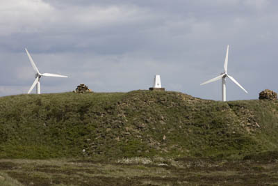 Pick your way carefully across the lunar landscape of the infilled quarry works to the trig, from where the views are extensive. To the East lie the sprawling conurbations of Leeds and Bradford, with the power stations of lower Airedale out on the plain near Selby. North is Ilkley Moor and the lower reaches of the Dales; the Peak District high ground fills the southern horizon. For somewhere of modest 451m height, the Fly Flat trig has a good panorama.
The Fly Flat trig stands on a knoll next to the windfarm
From the column, make your way to the fence at the edge of the wind farm and follow the fence until you reach a section which is breached, allowing access into the wind farm itself, which is on open access land.
The wind farm has 23 turbines and has been in operation since 1993. Each tower is 32m high and the turbines are 49m to the tip of the blade when at the top its cycle. The owners of the site claim it saves more than 10,000 tonnes of carbon dioxide emissions each year and generates 9.2MW of power.
 Energy company E.ON says the turbines are already coming to the end of their life and need replacing. In September 2008, it plans to submit an application to replace the existing 23 structures with ten new ones, each of which will be double the height of the current turbines.
Head for the western row of turbines to pick up the hardcore maintenance track that leads through the wind farm.
Follow the access track to its end, to the information board beyond the gate and cross the road. Follow the farm track opposite, but don’t take the track to the left, leading to Withens Head Farm, but carry straight on, keeping the wall to your left.
It’s clear on the approach to Slade Farm that this is not a walker-friendly place. Various 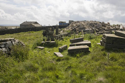 obstacles have been placed across the public footpath and there are large dogs roaming round the fenced-in compound. The whole place is finished in bad-taste 21st century new-money style and is best circumvented quickly. This is easily done by walking round the right-hand wall of the whole compound and on to the open land beyond.
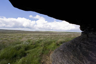
The footpath follows wet moorland heading towards Rocking Stone, a collection of gritstone boulders which are worth a small detour from the path. They would certainly make a shelter for a lunch break on a wet day.
We paid a visit to Rocking Stone Flat during a prolonged dry period, but it was clear this section will be very boggy and wet during less favourable weather. Be prepared to get your feet wet here.
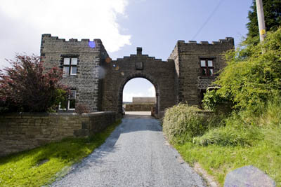
 Ignore the path crossing diagonally, and carry straight on, over a small water course. The path drops steeply down to meet Castle Carr Road at an improbably crenulated lodge.
Rocking Stone
The road beyond the lodge leads to the ruins of Castle Carr, a Victorian mansion built by Capt Joseph Priestley Edwards, who had the mock castle built and surrounded by extensive landscaped gardens and a 30m-high fountain. The building fell into disrepair and was demolished in the 1960s. Only traces of it remain, but the gardens and fountain are occasionally opened for charity days. Otherwise, the Schofield family which owns it firmly denies access to the land.
Turn left on the road for a few metres then immediately right, following the fingerposted public footpath around Lower Height Farm.
Luddenden Dean is one of the most secluded valleys in Calderdale. Just 3km (2 miles) from the edge of the town, it feels a world apart from the urban bustle of Halifax.
 Cross the field to the broken stile; go through it and continue down the field. The path starts to drop steeply. Follow the little finger posts as it zigzags down to meet the next minor road. Turn right on to the road, passing Lowe Cottage and follow the road to the bottom of the hill, crossing Luddenden Brook by the bridge.
The lodge on Castle Carr Road
The castellated theme continues at The Lowe Farm, at which take the track to the right for a few metres and then go through the stile on the left on to the footpath that will take the route on its most strenuous section of the whole walk as it climbs up the steep side of the dean.
Prepare to get your lungs and legs in action as the path climbs, keeping the fence to the right. This is clearly the moneyed end of Calderdale. As we panted up the path, the sound of a helicopter’s engine being started echoed from the other side of the valley and a private craft took to the air.
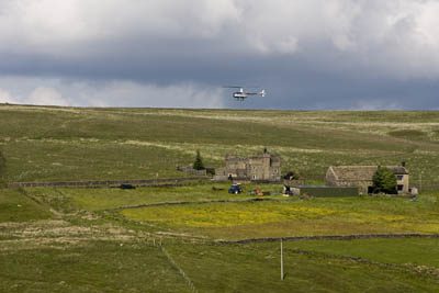 Finally, the gradient eases as you reach the top of the bracken. Heather replaces the bracken and a path is met which contours along the upper side of the valley.
A helicopter takes to the air in Luddenden Dean
Turn right along this path to the head of Back Clough. Where the path crosses the stream which enters the clough, we have a choice. Either take the path, marked by yellow paint blobs on rocks, leading forward, leaving the wall and heading towards the point at which Limers Gate meets the catchwater drain at 014 300, and complete where we crossed by the little bridge earlier on our route, or, if your navigation skills are up to it, take to the moors to investigate two strange shafts in the middle of Low Brown Knoll Hollow.
Turn left at Back Clough and follow the course of the beck, as it rises to the first of two visible shaft heads. It is very wet underfoot, with sections of quaking bog, which give the impression of walking on a very wet trampoline.
These stone circles seem an anomaly on the moorland. There are no railways here so why should there be tunnel shafts?
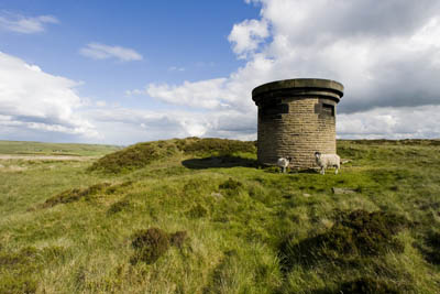 The answer may be had if it’s a calm day and you keep a listening ear out. Deep underground can be heard running water. You are standing above the subterranean conduit which carries supplies from the Widdop Reservoir, 8km to the West, to the old Halifax Waterworks, yet another example of man’s mark made on this otherwise wild landscape.
The first air shaft near Dimmin Dale
Leave the first air shaft and after about 250m look for a very feint path leaving on the right. It makes its way across the heather and is intermittently visible, so it may be wise to take a compass bearing before striking on to the path and use that.
After 400m, the intermittent route meets a much more defined one along Deer Stones Edge. Follow this as it rises gently. Keep to the right-hand fork, which is the more defined of the two paths. 200m before the trig point on High Brown Knoll is reached, take to the narrower path on the left, waymarked by short posts. This misses out the trig and leads back on to Limers Gate.
Walking back to the start point down Limers Gate, to the North-West, the bulk of Pen-y-ghent is visible on the far horizon.
Continue down Limers Gate to meet the A6033 and turn right, returning to the start point.
mick chatham
25 July 2008thename of the land owner of Castle Carr is Mr SCHOLEFIELD much better to get the name right of probably Calderdales 4th biggest landowner!
Guest
26 July 2008We walked part of this route. And 'Slade Farm' IS A NIGHTMARE!! Congratulations to the owners who have completely ruined a lovely right-of way - savage dogs and misleading signs - obstacles - and I guess - tyre burning fests are next!! And the most ugly building ever. How did it get planning??
Angie
30 November 2008I first did this walk quite a long time ago, when Slade Farm was still a ruin. It was lovely. The last time I went there, I felt so oppressed by the horrendous compound and strutting dogs, I decided never to go back. I suppose that is what they want and I wish it were not so, but I don't go on a walk to experience terror.
Tim Blanks
23 April 2009While not connected in any way to the current owners of Slade Farm, my ancestors lived there in the early mid-1800's. I visited while in the UK and saw all the horrible rubble around, I was hoping one of your readers/walkers may have a photo of the farm prior to the great mess.
If anyone has a photo, could they please contact me at timonsafari {at} hotmail.com
Kind regards,
Tim
Simon F
21 April 2010The 'air shafts' on hill lead down to the Wadsworth Tunnel - One of the shafts is over 5oo feet deep - Its one part of a raw water aqueduct system that takes water form the resevoirs above Hebden to be treated at Halifax - all thanks to gravity and Victorian water engineering know- how
My Homepage
05 April 2012... [Trackback]...
[...] Informations on that Topic: grough.co.uk/magazine/2008/07/23/calderdales-moorland-green-lungs [...]...
Bob Clare
27 June 2013Interesting reading all the comments,I mountaitn bike up there quite often,i must admit Slade farm is a blot on the landscape.Along with all the rubbish that scum bag fly tippers dump,spoiling rugged wild countryside.How do they get away with it,If i saw them i would shop em,you never see em though they must do a night shift.Anyhow will keep my eyes open when up there.
click
09 December 2014My family and i, are planning an prolonged tour of Greece afterwards this year with our movie trailer tent. Can anyone recommend me on the best form of gas to get?
cnn.com
30 December 2014get best news on public relations anywhere
ac repair companies
31 December 2014The best news on heatingandcoolingservices.org/} available
jordan 11
03 June 2015Actually, we have hosted a welcome back party for the last few years and have had great success with it. Available for around $60, (down from a rec retail of $73), it represents outstanding value for money. In fact, by the time my mail in vote for him was counted in the California Primary of 2008, he already had dropped out of the race.
jordan white cements for sale
08 June 2015Thankyou all. All three girls knew each other.. It's funny how those that decry negative campaigning the loudest in case you are wondering, that would be the liberals always seem to be the first to resort to name calling. [Charles] I say, go with what it tells you it is.