 Distance: 12km (7½ miles)
Ascent: 340m (1,115ft)
Time: allow 3½ hours
Map: Ordnance Survey Explorer, OL2, Yorkshire Dales southern and western areas or Harvey’s Superwalker Yorkshire Dales Three Peaks
Note: grough routes should be used in conjunction with maps, a compass and other navigational aids. Routes often use access land and involve finding your route off footpaths. Knowledge of and competence in using a map and compass is essential when using the routes. Carry the correct equipment for the conditions and be aware of hazards in the outdoor and mountain environment.
In the winter months, daylight hours are at a premium and getting in a long walk means careful planning and an early start if you are not to end the day walking in darkness or, worse still benighted and calling for help.
So it’s useful to have a few shorter routes up the Gore-tex sleeve, so you don’t have to get up at the crack of dawn, nor worry about being caught on the fells at night. This walk takes us into an upland wonderland of strange unearthly terrain, with the bonus of some fabulous views. Another real bonus is that the hill is of modest height, so the labour expended to get to its summit is not too great either.
Much of our walk is on Countryside and Rights of Way Act open access land and makes use of sections where there is little or no visible path, so competence with a map and compass is essential for anyone tackling it.
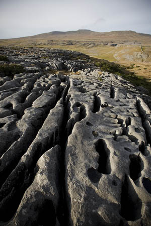
Our destination is Moughton, an extended lump of raised limestone whose summit is a mere 427m (1,401ft) above sea level but the position of which, in the shadow of both Ingleborough and Pen-y-ghent, affords fantastic day-long vistas of the two hills. The terrain can be confusing, with a preponderance of limestone clints and grikes, near-invisible paths and only an odd cairn to give much in the way of hints if you lose your bearings. For these reasons, the ascent of this little gem is best reserved for a day of good visibility.
And, in case you were wondering, it is pronounced Moo-tun.
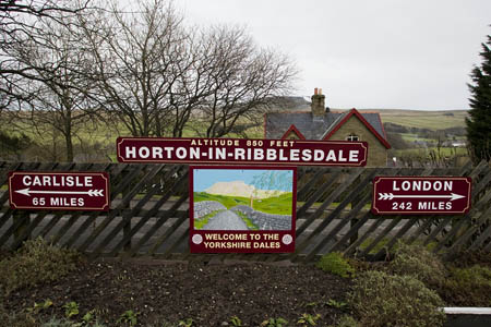 The walk begins at Horton-in-Ribblesdale railway station in the Yorkshire Dales.
Horton station, proudly boasting its height, 850ft above sea level
Travel by train will be the preferred means of getting to Horton for anyone who cares about keeping their pollution to a minimum. Horton station is on the renowned Settle to Carlisle line, so visitors from the North can also enjoy a scenic trip through some fabulous country. Those from the South may feel cheated at having to get off the train just as it was starting to get interesting. But surely, it’s better to be on the hills than gazing at them through a dirty double-glazed window.
For those arriving by car, there is a pricey national park authority car park, but it is often possible to park on the road on the long straight between the Crown pub (formerly the New Inn and still confusingly so called on OS maps) and the station. On fine weekends, expect to compete for parking space with the hordes out to tackle the challenge of the 24-mile Three Peaks Walk – Pen-y-ghent, Whernside and Ingleborough in one go – with whom we share the very start of the walk.
Horton is not the most picturesque village in the Dales by a long chalk – it’s a straggling collection of houses strung out for a mile along the B6479. Its most notable building is St Oswald’s church, a squat, solid building which must have figured as the foreground for thousands of tourist photographs of Pen-y-ghent. Its earliest parts date from Norman times.
Opposite the church is the Golden Lion pub, once more licensed premises after a spell as an outdoor centre. The pub has recently opened a bunkbarn. There is also a campsite in the centre of Horton, a post office (which was up for sale when grough visited) and the famed Pen-y-ghent cafe, which contains the clocking-in machine for those who wish to have their cards punched at the start and end of the Three Peaks walk and which was visited by Griff Rhys Jones who, rather cheekily we think, clocked in before doing only one of the three hills.
The footpath leaves Horton station by a gate on its western side (the northbound platform), so if you’re coming from the village or the southbound platform, be careful not to get splatted by a diesel as you cross the line, otherwise you won’t complete the walk. Take heed of the warning sign: Stop, Look, Listen.
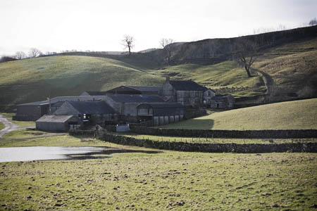 It’s likely that the first kilometre of the walk will be the muddiest. The well-trodden path (this is the Three Peaks route, remember), crosses the pasture of Beecroft Hall before reaching the sanctuary of the karst country. Beecroft Hall (left) itself is a ramshackle collection of outbuildings surrounding a typical Dales farmhouse that has seen better days. Its situation is not helped by the backdrop of the massive works of the limestone Horton Quarry, though thankfully, much of the desecration is masked by earthworks and newly planted saplings.
Beyond the quagmires of the pastureland, the gated entrance is marked by a Natural England information board, designed to tempt the boots of walkers away from the overtrodden Three Peaks route. Fret not: we won’t be in their company much longer.
The entry into open access land also marks the stark boundary between pasture and limestone country. Immediately, the pale rock is evident underfoot and the grass is somehow springier, shorter and, joyously, less wet! This route is ideal for periods when there has been heavy rain. Most of our walk will be on well-drained terrain which holds very little water so, when other paths have degenerated into a muddy mess, Moughton’s are still a pleasure to tread.
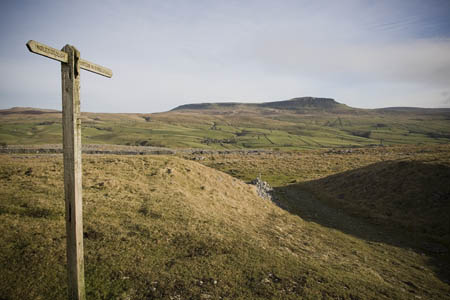 The path wends its way gently upwards until it crosses a broken wall at SD 791 731. A hundred metres further, a grassy path diverges left at the finger post which points to Horton one way and Ingleborough the other. Follow this path and make for the wall corner.
A newish sign points back to Horton and, in our direction, to Austwick. Follow the path alongside the wall, across heather moorland, a rarity in today’s walk. After 500m, look for a stile (789 722) to the right, crossing the wall. On the other side of the wall, follow the path, passing grouse butts, until it takes a marked turn to the left.
At this point, we start to test our navigation! We’re going cross-country on a bearing. Take a compass bearing to the triangulation pillar (trig point) at 786 711. Follow this bearing, which should be somewhere around a southerly direction, up the gentle hill towards the top of Moughton.
The trig is one kilometre from this point, but the ground is not easy to follow in a straight line. It’s pure karst territory here, with lots of limestone outcropping making pathfinding difficult. You may pick up an odd feint path, but these are easily lost, so keep to your bearing.
The traverse of this strange, lunar landscape has to be undertaken with care. Limestone is very slippery when wet, and many of the stone blocks are loose, either wobbling as you step on to them or even giving way completely. This is potential broken-ankle territory, so walk with care.
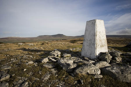 There are great views across to Pen-y-ghent in the East and in the opposite direction to the table-top profile of Ingleborough. Moughton may be small, but its flattish top means there’s a great panorama to be had.
The summit trig point, looking towards Pen-y-ghent
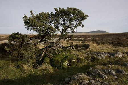
You might think this land of stone would be a barren desert, but there is a mass of juniper bushes here, their squat, spiky shapes sometimes proving a barrier to easy progress. The berries of these members of the cypress family are, of course famous for flavouring gin. You shouldn’t, however, need such tonic at this stage, as the rise to Moughton’s broad, rounded top is not at all strenuous.
Other plants, such as the hart’s tongue fern, inhabit the dark, damp, slits of Moughton’s grikes. This is definitely not a desert.
This 300 million-year-old landscape has evolved from a time when Yorkshire’s dwellers were decidedly more southern in their attitude, or even tropical. The primitive bodies of trillions of sea creatures gradually deposited these vast layers of calcites then came north by tectonic movement and were heaved out of the sea as continental masses collided and formed the Pennines.
Over thousands of years, the slightly acidic rain of the Yorkshire Dales has weathered and dissolved the limestone to form the fabulous fractured and sculpted terrain of Moughton. It’s Dales upland at its best, and one of its best aspects is that it doesn’t see the crowds that its near neighbours do. On a good day, even without binoculars, the parade of walkers heading up Ingleborough looks like an army of ants swarming around its slopes.
 So keep it quiet!
Take some time on the summit to admire the extensive panorama: to the East, Pen-y-ghent, northwards Park Fell and Whernside, in the South, the Bowland Fells and the Vale of Lune and Morecambe Bay and, of course, to the West, the shapely form of Ingleborough.
From the trig, make off in a westerly direction. If it is visible, Ingleborough’s summit is the heading, otherwise take a bearing and head towards the wall junction at Hunterstye (782 713). There are one or two little crags to circumnavigate; be careful you don’t come a cropper on them. There are easy ways around them to avoid a scramble down. Don’t drop down all the way to the wall below the escarpment. Head right and find the fairly well defined path that contours round into the head of the bowl east of Capple Bank.
There are great views down into Crummack Dale, with the spring of Moughton Whetstone Hole glistening below. Continue along the grassy path following the escarpment, meeting the path from Wharfe, which leaves the walled track of Moughton Lane to climb to the plateau. This is Wainwright’s suggested route on to the hill, so this is a probable place to encounter fellow Earth-dwellers in this alien landscape.
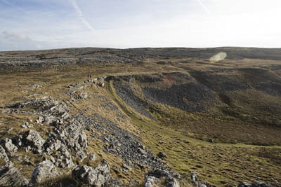 Continue round to the left, following the lip of the escarpment, past the cairn at Capple Bank, perched precariously on a limestone block. The escarpment edge will be our handrail for the next kilometre or so.
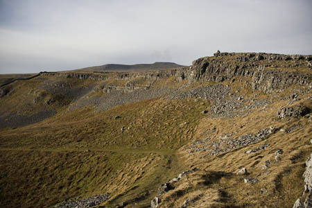
Capple Bank, with the great bowl at the head of Crummack Dale
A wall comes up to meet the path for a couple of hundred metres, then disappears again, leaving an unobstructed view of the head of Crummack Dale. Keep a close watch on the path’s direction, as it is easy to lose it where it threads its way through the limestone rock outcroppings.
Moughton Scars, to our left along this section, though not vertiginous, are high enough to cause injury if a slip occurs, so take care, particularly if the ground is wet and the limestone prone to slippage.
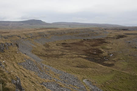
At Beggar’s Stile, 777 725, the path meets the broader grassy track coming up from Crummack itself. The route then heads in to the right, towards the flat bog of Thieves Moss. It is easy to imagine travellers in centuries past being jumped by footpads in this hidden, remote depression. There’s never much anticipation in approaching anything with moss in its title, but the path is surprisingly bog free, as it cuts through the rising limestone and across the small moss before rising up to the gate in the wall to join Sulber Gate.
 Gate, in this instance and most other examples in the northern countryside, means road, and is a Viking term, from the Old Norse gata.
Thieves Moss, from Sulber Gate
The track we now join would have been, in previous times, the main route between Clapham and Horton and Selside. These days, the only traffic it carries, other than walkers and cyclists, are the off-road bikers and motorists defying the incongruously placed no motor vehicles road signs scattered along its length.
Four hundred metres after joining Sulber Gate, the fellside ‘crossroads’ is reached where the track meets the one coming down from Ingleborough. Turn right here, eastwards, to take the track through Sulber Nick.
If time permits, and if energy levels are still high, athletic walkers can divert to take in the route to Ingleborough’s summit, though this will mean a return along the same path. It means an extra 8km (5 miles) of walking, with 370m of ascent, so you would need to have at least 3½ hours of daylight left at this point. Don’t get caught out if you decide on this option.
 Sulber Nick is familiar to anyone who has trudged wearily its long, straight passage through a dip in the flat limestone on the final leg of the Three Peaks walk. It’s easy going, but a touch muddy in parts and prone to slippery rocks with the number of boots polishing its limestone.
The path from Wharfe, Wainwright’s route to Moughton’s summit
After 1.3km (0.8 miles), we find ourselves back at the point where we diverged initially, to explore Moughton, at the finger post denoting the path junction. Carry on down the hillside to the muddy ending across the fields of Beecroft Hall.
You may be a little weary, but have the presence of mind to look out for those trains as you use the crossing. Remember: Stop, Look and Listen, otherwise how are you going to tell your friends about the barren glories of this little jewel of the Yorkshire Dales?
Guest
05 May 2008OK - lots of articles mention Moughton Whetstone but none really gives any useful explanation about the origin of the rock. A gap to be filled.
grough editor
05 May 2008Feel free to fill the gap, Guest, and enlighten our readers
The Piglit
02 July 2008The rock originated when the earth was created is my guess. The gap can be easily filled by purchasing a sufficient quantity of rubble from the builders merchants in Skipton.
Graham Moughton
02 November 2008Thank you for an inspiring artical and some nice photographs.
DoctorDee
31 December 2008These are great articles. It's a shame the pictures don't click through to show larger copies. It's sometimes hard to make out any detail on the small versions embedded in the copy.
Black Rocks
14 November 2011Moughton whetstone is nothing more than an oxidised siltstone / sandstone, the chemical make up of which produces these liesgang rings. This banding makes it an excellent whetstone, as the oxides cement the silt/very fine sand make-up of the rock together making it very resistant -and is the correct grain size for sharpening metal . The formation was orignally laid down during the Lower Silurian about 438million years ago, (some 3.5bn years after the creation of the earth), in a series of turbidity currents - usually seen below a sea-shelf area. These flow consist of sediments of all sizes and are seperated out as they settle. These Liesgang rings were formed (as I mentioned - by oxidation of some of the iron oxides) following the uplift and erosion events which followed the builing of the Caledoinian Mountains, during the Devonian period (360-400ma). Hope this helps
P.K.
24 August 2013In the above piece by Black Rocks it implies that this is a post-lithification process. I have specimens of this rock which, due to the distortions in the rings (picture the icing on top of a cake where two different colours of icing have had a fork dragged though them Mr Kipling style) leave little doubt that the sediments contained these rings while they were still in a semi- liquid state. I have shown these specimens to other geologists and they concur on this point. I confess that i am fascinated with this rock and have visited the site on many occasions. Anyone who has seen an undisturbed outcrop can not help but wonder at the complexity of the patterns these rings form.