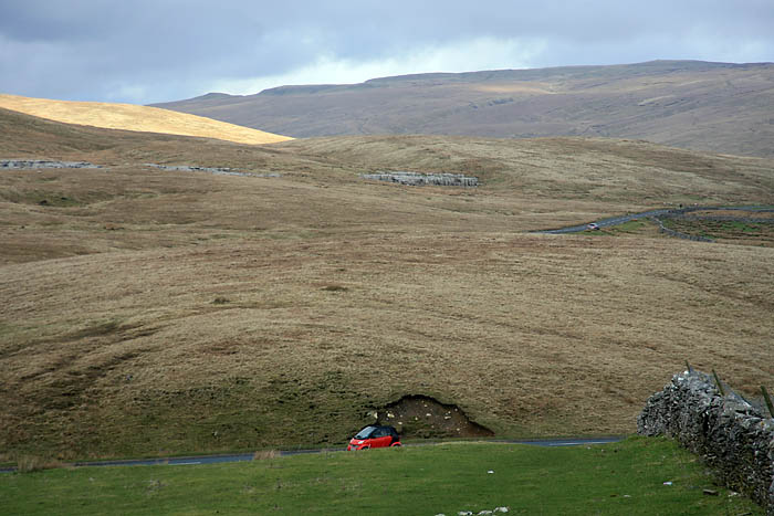
 Picture this: a private company wants to build a massive new transport route through some of England’s wildest country.
Right: on the route, wild Pennine scenery
Thousands of foreign workers will be employed during the construction project, and local resources will be plundered to provide stone and other raw materials for building.
It will be necessary to build a temporary town to house the workers as well as a factory on an upland moor close to limestone pavement and cave systems. The finished 72-mile-long structure will be visible from many of northern England’s high fells and moorland. 14 tunnels will need to be dug in addition to numerous cuttings and embankments to enable completion of the route, which cuts through some of the remotest Pennine landscape.
Traffic using the route will add significantly to carbon emissions and important ice-age geology will be destroyed when the scheme is constructed. Critics say the route is unnecessary because it duplicates two existing north-south alternatives.
Crazy to even contemplate something causing such destruction? Never get built?
Well, it did. In 1865, at the height of railway mania – yes, it’s nothing new – the Midland Railway decided it wanted its own route to compete with the Anglo-Scottish lines operated by the London & North Western Railway and the North Eastern Railway. The problem was: those two had the best routes sewn up, the flatter plains either side of the Pennines, so the only way north was up the middle.
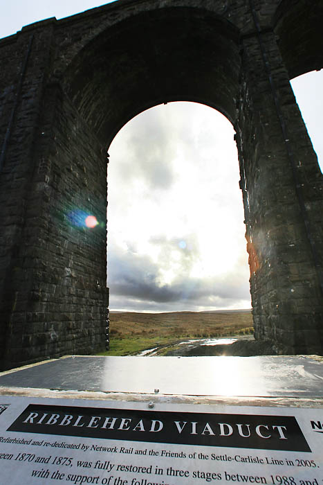 Which, for a railway, is a barmy route. Trains don’t take kindly to going up and down steep slopes, and the Midland Railway chose the backbone of England to drive its track towards Glasgow. Nowhere on the Midland route is the terrain less suitable for a railway than the section between Settle and Carlisle. But suitable or not, the railway barons persisted and, more than 130 years after its opening, we have what’s generally agreed to be the most scenic railway in England.
Left: Ribblehead viaduct
At Ribblehead we can see probably the best known of all the structures on the line. The 24-arch viaduct curves gracefully across the delightfully named Batty Wife Moss, in the shadow of Whernside and Ingleborough, two of Yorkshire’s Three Peaks, before the line ducks under the rising ground of Blea Moor. Ribblehead is quiet now, the peace occasionally shattered by a roar of a motorcyclist testing his acceleration or the rumble of a freight train crossing the viaduct, or even the giggles and screams of a party of schoolchildren emerging back into the light from an excursion into the dark confines of Runscar Cave.
But for seven years in the latter half of the 19th century, this place was an industrial town, complete with brick factory, hospital, shops, locomotive sheds and stoneyards. Death was not uncommon among the 6,000 men who worked building the railway and their families who lived with them in the makeshift town. Accidents were frequent and smallpox outbreaks regular. Many are buried in nearby Chapel le Dale, where the graveyard had to be enlarged to cope with extra customers.
Take a trip to Ribblehead now and it’s difficult to contemplate the scene that must have met the eye in the 1870s. Help is at hand. Download the nine-minute podcast prepared by the Settle-Carlisle Partnership along with the Yorkshire Dales National Park Authority and Drystone Radio, and you can enjoy a guided tour, in your own time, across the site of the Ribblehead works.
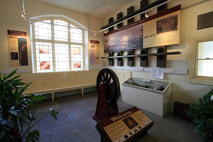 The route starts at Ribblehead station, adjacent to the viaduct, and the partnership is keen to encourage you to travel there by train. Trouble is, when grough paid its visit, there were no trains running because of engineering work and a shuttle of buses and coaches was running between stations on the route.
Right: inside the visitor centre at Ribblehead station
The station now houses a visitor centre, with displays and the chance to buy a few goodies. Its curator lives in the refurbished building, which must be one of the lonelier properties in Yorkshire once the trains have stopped running. Plug in your MP3 player and set your commentary running. First port of call is the Station Inn, recently taken over by Skipton-based Copper Dragon brewery. The railway station has an automatic weather station, and you can access its readings on the Internet. It’s very informative, giving wind direction, speed, humidity, chill factor, pressure, shape of clouds… Ok, not the last one, but it may be worth checking before you set out for an idea of what to expect meteorologically.
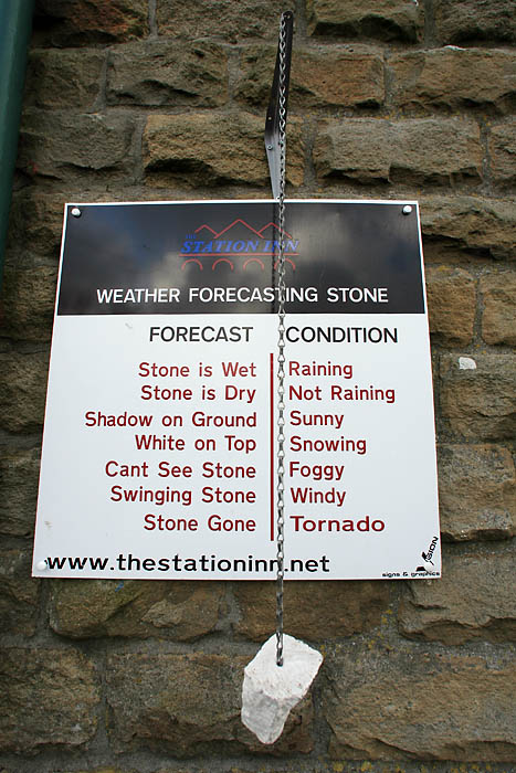 But fear not, if you forget, for the pub also has a weather-forecasting system on its front wall. More rudimentary, but more amusing. It’s not mentioned on the podcast, but pay a visit anyway.
Leftt: the weather-forecasting stone at the Station Inn
There’s a downloadable sketch map to accompany the commentary, so armed with that and the podcast, make your way along the route pausing at various points. If grough has a criticism, it’s that the interpretation is a little vague on precise locations and a bit of distance information would have been useful.
The motorists sipping their tea at the roadside caravan probably have no idea they’re standing close to a former smallpox hospital. It’s now just a grassy mound, passed by grough on numerous occasions with no knowledge of its former status. Already we’re being educated.
The route then takes us across on to the moss itself, towards the viaduct. The archaeology is there if you look carefully, with odd bumps and mounds, the remnants of the foundations of what was mainly a wooden settlement. The MP3 file leads us along the route of former tramways used to move stone and other materials around. grough gets a few odd looks from fellow walkers as we cope with keeping the earpieces in our lugholes while not getting strangled by the leads as the wind whips through the viaduct arches.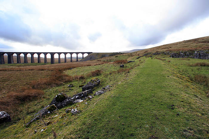
We make our way up to Belgravia, the upwardly mobile suburb of the shanty town.
Right: the old tramway and discarded stones
The trackbed of the old tramway is clearly evident, with reject blocks of stone which proved unusable during the viaduct construction. There’s a curious mixture of nature and the hand of man at work here, with the limestone carvings created by millennia of wind and weather competing with the cavalier cast-offs of the stonemasons. Ultimately though, nature is winning, with the archaeology slowly but inexorably blending back into the greenery of the site.
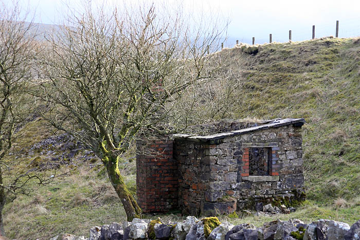 Even the more recent addition, a derelict platelayers’ hut, beside the railway track, (left) is taking on a more natural aspect as vegetation envelops its decaying walls. We pass under the railway itself, in a dank culvert which is described in the commentary. We’re now in close company with the viaduct and its massive blocks beg the question of how this huge structure was actually constructed. Steam is the answer of course, with cranes lifting the heavy stones to create the graceful arches and wooden scaffolding enveloping the viaduct.
The viaduct faced closure and demolition in the late 80s after decades of neglect. grough can recall a time when the structure was liberally decorated with dire warning signs advising wary walkers not to approach the arches for fear of getting falling stones on their heads. Happily now, the viaduct is in rude health and makes for an imposing if incongruous piece of landscape in such a wild and open moss.
Rude health, as we mentioned earlier, was not always the norm for the navvies working on the railway and there are plaques in memory of the inhabitants of the shanties with names dripping with Victorian pride: Sabastopol [sic], Inkerman, Jerusalem, Jericho, Salt Lake. Salt Lake? Was there a big Mormon contingent?
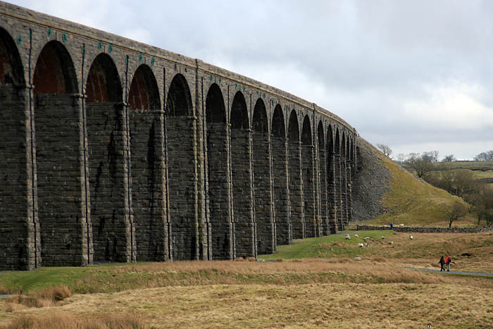 Our tour of Ribblehead is over and there’s just the gentle walk back towards the station. The podcast is a great idea and the walk it takes you on is neither strenuous nor long. It’s easily walkable by children and, depending on how long you want to linger or dash, will take between an hour and a quarter and two hours. If you’re feeling energetic after your tour of the former Ribblehead shanty towns, you can have a sprint up Whernside too.
Above: the curve of Ribblehead viaduct
One further small criticism of the podcast is just that a little more detail would be helpful. The idea of the MP3 way of delivering the route is to cut down on the interpretation boards scattered across the site, so we think there’s scope for a lengthier commentary.
And grough’s ears don’t accommodate our damned earpieces properly. We’re off in search of an MP3 player that’s as odd as our ears.
See also
Ribblehead viaduct walk is confirmed
Walk the line: July date for Ribblehead crossing
New podcast to guide Ribblehead visitors
Karen
09 March 2007[smiley=happy]Thanks for this Grough - I'm glad you like the trail and your suggestions for improvement are very helpful. I am having two more history trails done at the moment - again for inclusion on the Out of Oblivion website so watch out for the press release soon Karen Griffiths YDNPA Interpretation Officer