Map: Ordnance Survey Explorer OL2, Yorkshire Dales southern and western areas or Harvey’s Superwalker Three Peaks
Note: groughRoutes should be used in conjunction with maps, a compass and other navigational aids. Routes often use access land and involve finding your route off footpaths. Knowledge of and competence in using a map and compass is essential when using the routes. Carry the correct equipment for the conditions and be aware of hazards in the outdoor and mountain environment.
Our route to the summit of Ingleborough follows the grough ethos of: love the outdoors; hate the crowds.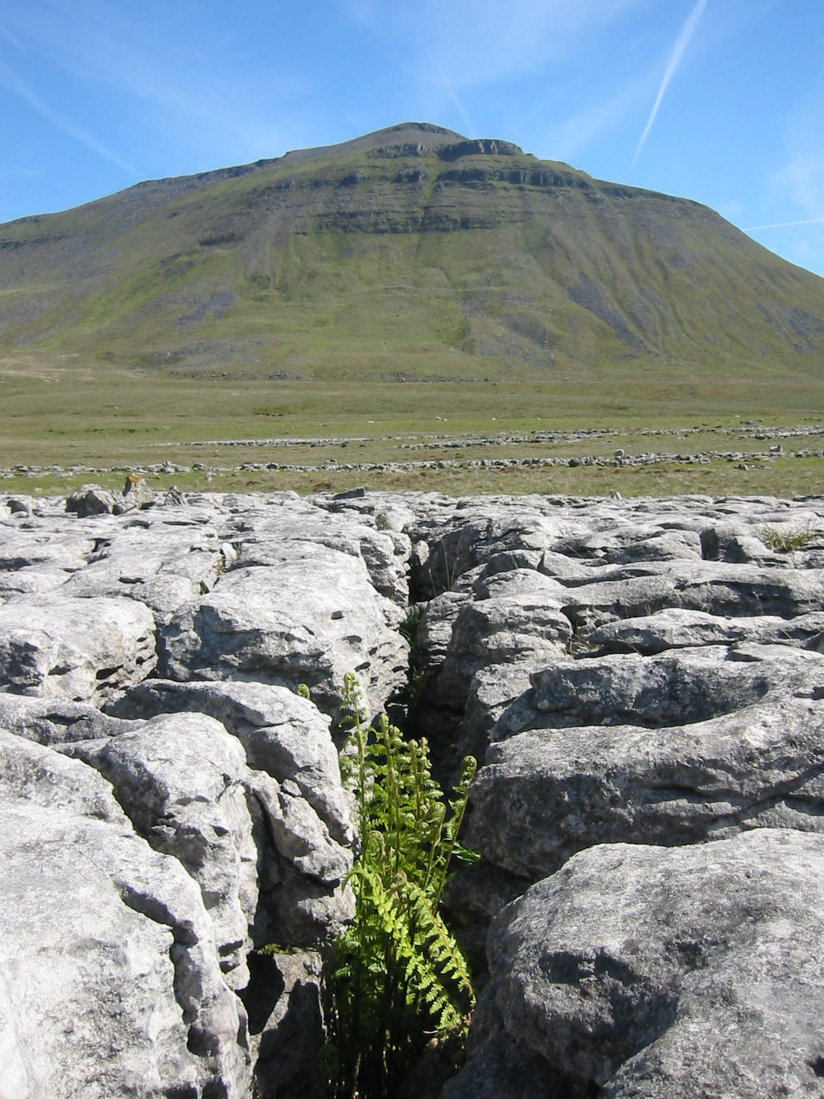
It’s undoubtedly true that Ingleborough is one of Yorkshire’s most popular, if not the most popular, hills. Wainwright valued it for its ability to sustain interest and said it was every Yorkshireman’s duty to summit the peak at least once in his lifetime. Women didn’t seem to figure large in Wainwright’s estimation as peakbaggers, but grough thinks it’s every Yorkshirewoman’s duty to climb the venerable old hill at least once. You can bring your bloke too.
grough can’t guarantee you a crowd-free summit, unless you walk at midnight on a foul November’s day perhaps, but you shouldn’t meet many people on our route on the way up. For that reason, it’s important you go properly equipped, both in terms of clothing and gear and navigation knowledge. You won’t be on paths for much of the route, so self-sufficiency is the key.
Park in the lay-by on the Ingleton to Ribblehead road (B6255) on the left, about half a mile past the White Scar showcave. Cross the road carefully – it’s long, straight and a favourite with motorcyclists testing their nerve – and cross the stile in the metal gate.
There are two derelict buildings, one of which still has old remnants from its quarrying use inside. Pass between the two and cross the old water course to find a faint path leading up the hillside. Head to the top side of a small cave with a stream issuing from it and then head uphill.
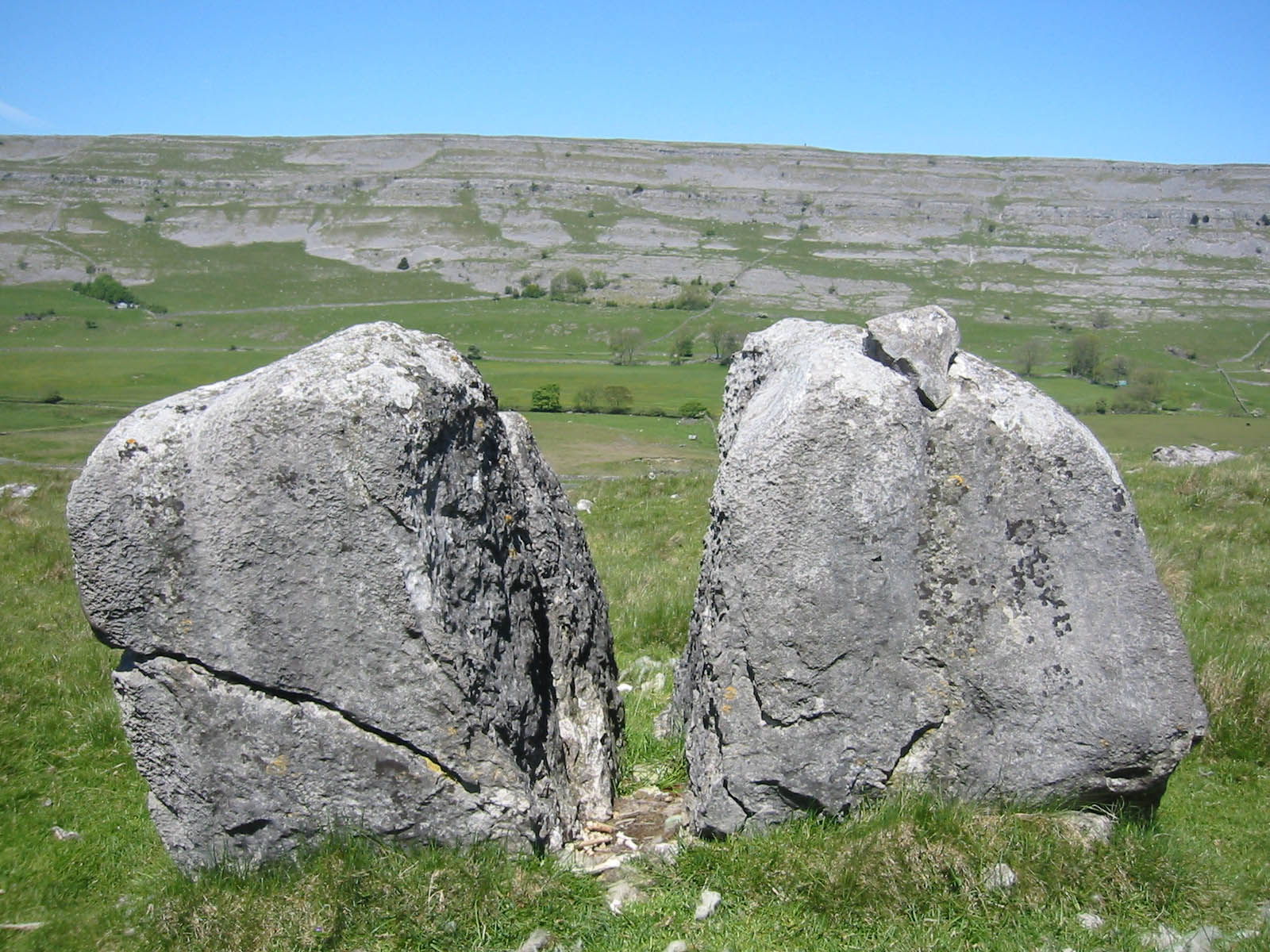 There’s a cleft boulder (see picture, left) a little further, which contained the skeletal remnants of a sheep when grough passed it. Swing to the right again, gaining more height. Raven Scar has continual bands of limestone crag and, while none of them are particularly high, they’re big enough to cause injury if you fall off, so it’s important to find a safe route through them.
The way through the limestone scar is now visible: a grassy tongue piercing the pale grey rock. Keep to the top side of the lone tree and continue up to the base of the scree. A diagonal stony path leads up to the grass tongue and through the scar (see below).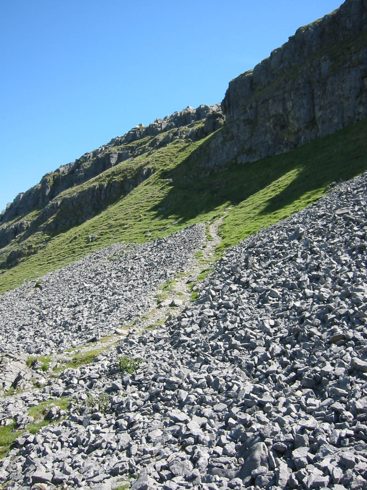
We’re firmly in limestone territory here and the paths, many of them faint, are cavers’ and potholers’ routes to the many subterranean delights. Our path passes up through a nick in the rock, marked by two trees at SD 724 751, and up to the wall below the next scar.
If you’re lucky enough to enjoy a clear day, take a moment to look back, to take in the views of Whernside, Gragareth and the rockclimbers’ playground of Twisleton Scars. Morecambe Bay is visible to the South-West.
A notch in the wall indicates throughstones which give an easy route over. A diagonal path leads to prominent scar boulders. A grassy slope then opens up to where Ingleborough’s western crags come into sight.
Contour to the left along the top of the scar for just less than 300m to find a re-entrant with a pile of boulders. This is our route upwards, leading to a nick. Continue up the grassy depression between the limestone pavements. We’re now on top of the layer of Great Scar Limestone that forms the lower escarpments of the hill. Unfortunately, that means we’re about to cross the impermeable sandstones and that’s where the water collects. When grough visited, it was a dry period and we had no difficulty crossing the tussocky grass between the shakeholes, but this section can be decidedly boggy.
We’re heading for Tatham Wife Hole, a pothole hidden at the bottom of a sizable shakehole. The 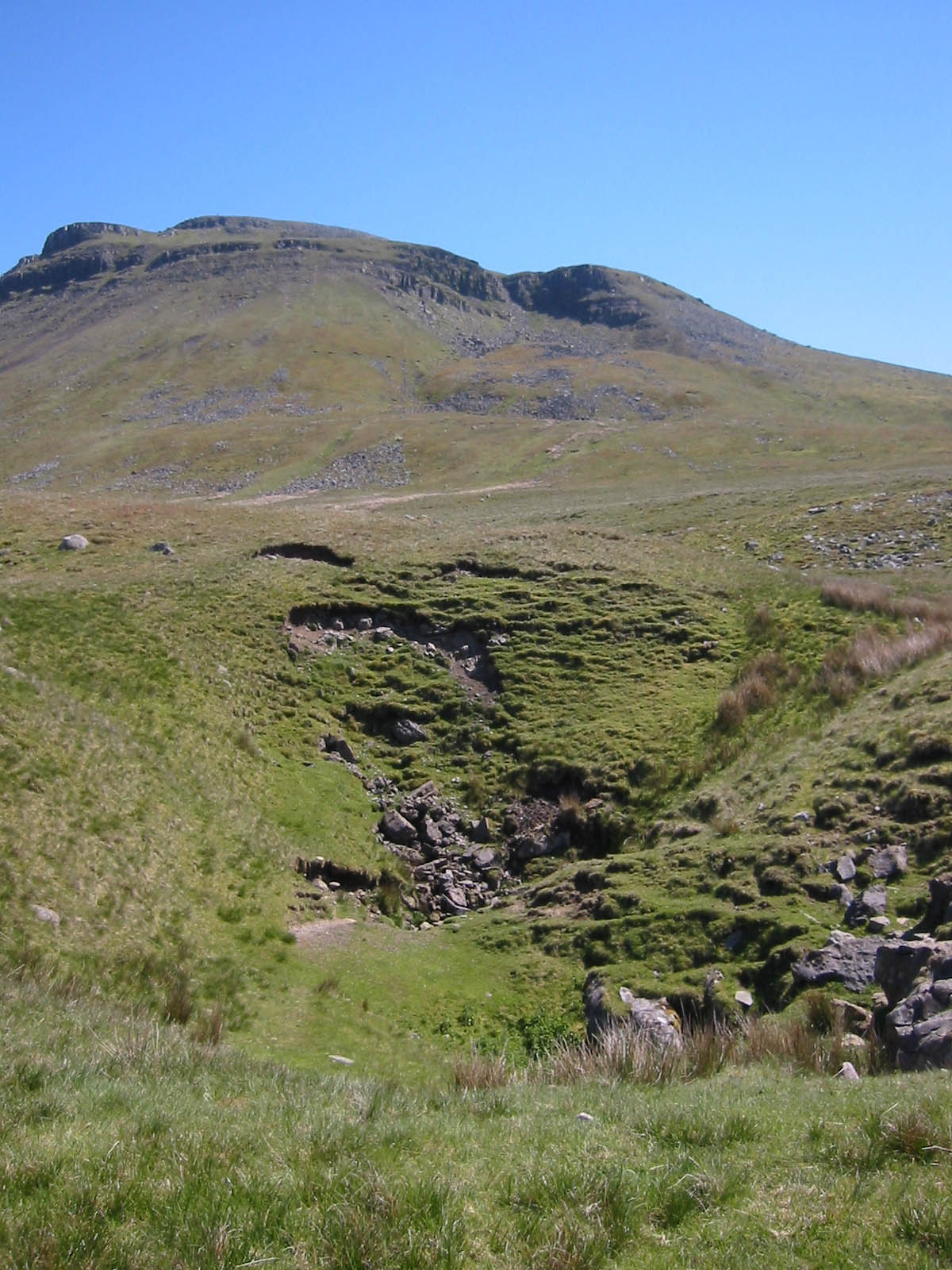 underground passages are 155m deep, but there’s little indication of that depth from the small entrance hole. Unless you’re an accomplished caver, gaze in and move on.
Picture, left, shows Tatham Wife Hole, with the corrie of Falls Foot clearly visible behind, set in Ingleborough's western crags
The route now heads for the debris at the base of Falls Foot, Ingleborough’s own little corrie. From a distance, this obvious scoop in the cliffs or the hill looks daunting, but as you approach, it gets less intimidating. The corrie is obviously the result of a massive rockfall, whether natural or man-induced is not known, but there are definite signs of human activity among the debris that blocks the base of the cauldron.
Those of us who have ever submitted to the Mountain Leader Training assessment will no doubt have come across the question that seems to occur in all their written papers: which bird do you sometimes see flying upside down? Well, chances are you’ll have that one answered here, as the birds in question delight in their aerobatic display. Hint: they’re big and they’re black.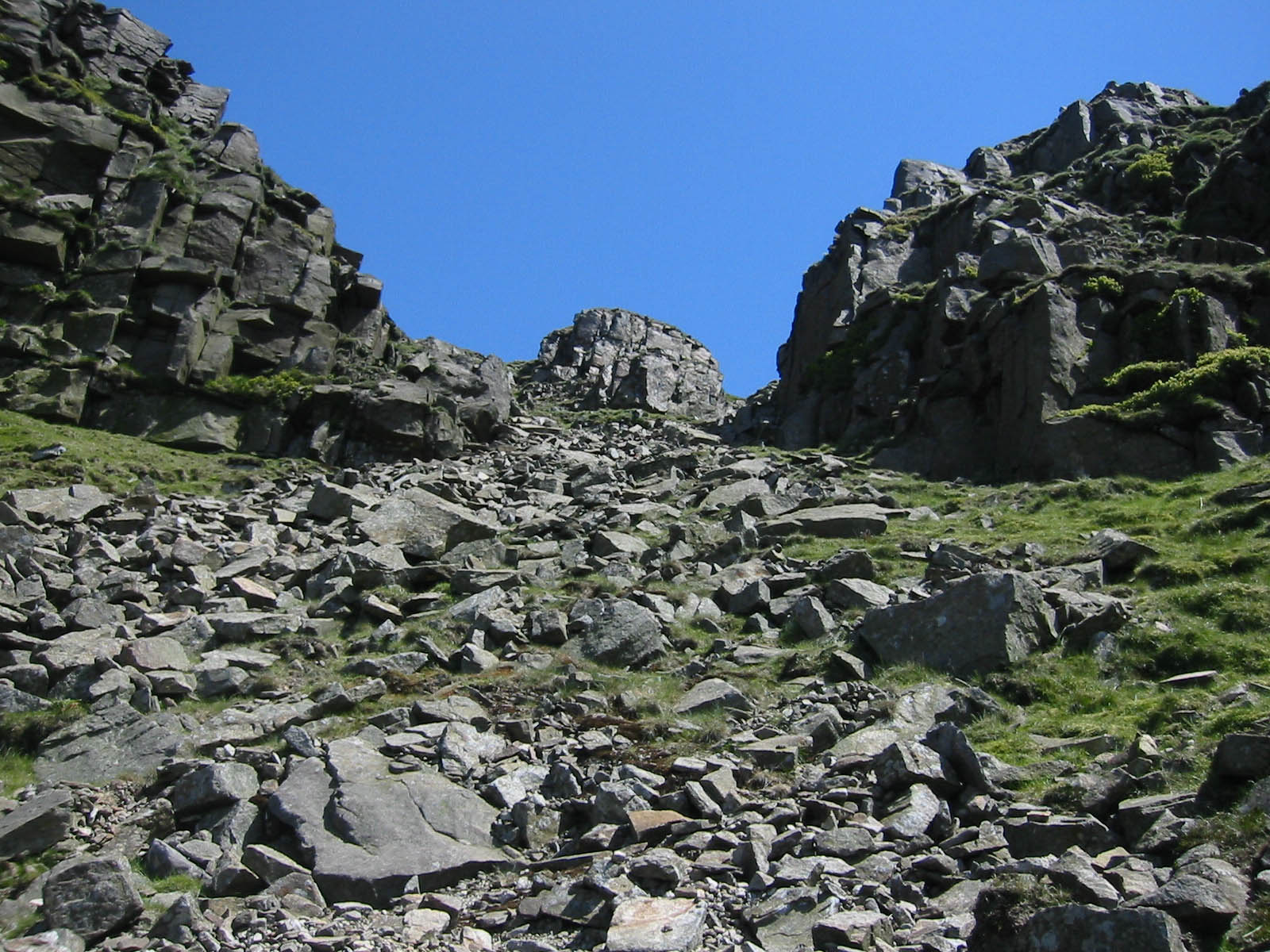
We need to pick a route either to one side or over the top of the hummocks and spoil heap at the base of the valley. Clamber up into the corrie: it’s steep, but there’s nothing technical here. In the wet, the grass and the scree may be slippery enough to dictate a hands-on ascent, but in the dry, it’s a doddle, though hard on the heart and lungs. There’s a faint but discernable path leading up the right-hand side of the central scree fan, then a small, central buttress is met (see right), which can be passed either to the left or right with no difficulty. Step off the top and give yourself a pat on the back. Get your breath back and admire the view. If you’re peckish, a small wind shelter 20m above the top of the gully is an ideal place to stop for lunch (or supper if you really did set off determined to miss the crowds).
It’s at this point you may realise how perilously close you were to the main footpath up the hill from Crina Bottom. It’s only 150m to the right, and the sound of voices may take you aback after your trip through the wilderness. Tackle the next escarpment, keeping left to avoid straying on to the path. Aim for a grass trod to the right of two small rocky buttresses and gain the summit plateau with a smug, individualistic smirk while your fellow summiteers wonder where the hell you sprang from.
The next half hour is when you will need to share the rest of the mountain with fellow humans. Ingleborough has a fine summit cross-shelter, an obligatory trig point, a large and growing pile of stones that seems to have been started in an attempt to raise it above its surveyed 723m and the very interesting remains of the hospice (see pic below), or circular tower overlooking our ascent route that, according to Wainwright, was built in 1830 and survived intact only until part way through its first official day, during which a large amount of alcohol was consum ed leading to the dismantling of and throwing down the hill its upper parts, the rest of which was later razed. The curved base stones survive with what amounts now to a large cairn on top of them.
You may half expect, on a fine day, to see candy-floss sellers, trams and kiss-me-quick hats. In the best grough fashion, find yourself some space (we’re beginning to sound like a primary school PE teacher) and explore the expansive plateau.
There are grand views on a clear day, with the Howgills and Lake District fells in view, Morecambe Bay and the whole of the southern vista to the Bowland fells and Peak district high country. If the mist is down, try and imagine how it must have been to have been one of the Roman soldiers garrisoned on the hill top here, or the British tribes scratching a living on this bleak upland home 2 000 years ago. There are still extensive remnants of the old military defence wall on the east and north-east edge of the plateau and faint bases of stone circles.
Even in the clearest visibility, the summit plateau of Ingleborough can fox the unwary into leaving by the wrong route. grough has witnessed a walker proudly demonstrating his shiny new GPS receiver to impressed partner as they walked confidently off away from the cross shelter, only to return two minutes later and walk in exactly the opposite direction. So be warned. If you’re in any doubt, get the compass out. Three fairly obvious paths leave the broad slope of the summit. We’re going to use the one that takes the north-west spur down to the top of the Humphrey Bottom path.
Take care over the slightly scrambly top section, which gets quite wet during rainy periods and try to avoid knocking over the poor souls gasping the last section of the path from the Hill Inn at Chapel-le-Dale. Take to the flagged path down as far as 742 755, to where it crosses a small beck. Follow the north bank of the stream to 742 755, where it meets a wall, then follow the fence above the surprisingly deep Mere Gill. A stile in the wall allows us to cross and view Meregill Hole, a deep series of three chasms partly hidden by trees, so step carefully. You won’t stop for more than 500 feet if you slip down them.
Our next objective is the large cairn set on the limestone pavement on Harry Hallam’s Moss. A large, tumbledown sheepfold at 735 756 is a useful attack point on the walk across the clints and grykes. At times, sight of the cairn is lost as we dip down into shallow hollows, but if you’re navigation’s good, or it’s a clear day, it’s hard to miss the well constructed cairn, which is at 731 755 (see pic below).
We’re on the home stretch now, but we need to pick our way through the escarp ments we climbed through at the start of the walk. 100m south of the cairn, make your way down a gap in the scar at 730 754 which gives an easy way through on to scree which is negotiated to join the terrace below.
At the boulder-chocked gully we used earlier at 728 753, go right and descend to the next terrace. And make your way back to the starting point.
My Homepage
26 July 2012... [Trackback]...
[...] Read More here: grough.co.uk/magazine/2006/08/03/ingleboroughs-little-corrie [...]...
Roofing Repair Houston
10 October 2014If you're taking into consideration putting a brand new roof in your residence, then you want to understand lots of data about the roofing method. Not that you are going to have up around the roof and do-it-yourself, but you wish to make sure you know what is going on. Do you know what components are employed? Do you realize what to appear for inside a contractor? Maintain reading to find out a lot more.
David D
30 September 2022Hey! It was hard finding you online but you have a great business! I have a TON of experience with local businesses and building websites. I would like to offer my time and give you a FREE Audit and Consultation. You should be getting a lot more online traffic and crushing your competitors. Call or text me and I'll show you how! 718-673-9411 - David