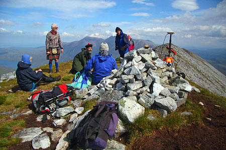
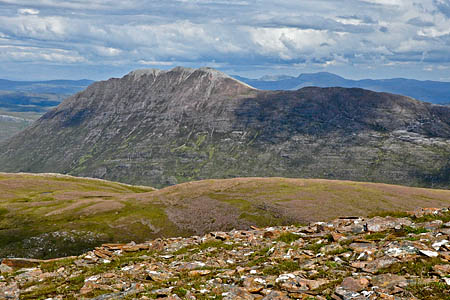
Munrobaggers close to finishing their round with an eye on the remote Fisherfield Forest may wish to delay their project as uncertainty surrounds the status of one of the listed peaks.
The number of officially recognised 3,000ft Scottish mountains may be about to drop by one following a surveying expedition by the pair of hill sleuths responsible for the last demotion of a munro.
The Scottish Mountaineering Club, which claims the rights to decide what is and what is not a munro, said it will ‘consider the implications’ of the findings of John Barnard and Graham Jackson whose GPS survey of Beinn a’Chlaidheimh found the mountain lacking – by 44cm.
There are currently 283 recognised munros, including Beinn a’Chlaidheimh, which has an Ordnance Survey spot height of 916m on maps. Previously, the Mountaineering Club of Scotland immediately accepted the surveyors’ figures, by demoting Sgurr nan Ceannaichean in 2009.
The acceptance of Scottish mountains as munros is partly subjective – there is a separate list of subsidiary tops that are not considered munros in their own right – but the primary criterion is height: 914.4m in metric terms. And Barnard and Jackson’s survey of the triple peaked hill 10km south of Dundonnell is clear: Beinn a’Chlaidheimh is 913.96m high.
The surveys were commissioned by The Munro Society, membership of which is restricted to those who have completed a round of the 283 – or is that 282? – munros under the patronage of Labour peer Lord Haworth of Fisherfield, himself a Munro Society member and took place in July on three mountains: Beinn Dearg Mòr, which retained its status as a corbett at 906.28m; Ruadh Stac Mòr, which almost exactly measured up to the OS figure with a munro-confirming height of 918.67m, and the unfortunate Beinn a’Chlaidheimh.
A statement by The Munro Society said: “The measurement process involved the latest satellite technology and the surveying party had to carry an extra 12kg of equipment in addition to the normal mountain kit on each of the three measuring expeditions.
“Because the satellite data must be recorded for a minimum of two hours – actually three hours on Beinn a’Chlaidheimh – none of the expeditions took less than 12 hours. There were two days of sun and showers and one day of rain and mist.”
A spokesperson added: “In measuring the heights of mountains just below and just above 3,000ft (914.4m), we believe we are following in the tradition of accurate measurement established by Sir Hugh Munro who first produced the Munro’s Tables in 1891.
“Munro and his friends relied on aneroid barometers, the technology of the time. In 2011 we use satellite technology to achieve yet greater accuracy, but we seek the same objective. Munro never set down complete criteria for Munro status before his death in 1919, but it has always been accepted that 3,000ft (914.4m) was the primary requirement.”
Both Jackson and Barnard are members of The Munro Society. Heights were measured using a Leica Geosystems 530 GPS receiver which locks on to 12 satellites and receives two signals from each satellite, reducing inaccuracies from atmospheric conditions, according to the society.
The Munro Society statement added: “By the use of satellite technology The Munro Society hopes that any residual doubt or speculation regarding the heights of the nine mountains it has had surveyed since 2007 has been removed.
“It seems unlikely that the thousands who enjoy the Scottish mountains will be in any way deterred from climbing them if and when their status in the tables changes. All remain fine mountains in their own right and the experience enjoyed in ascending their slopes is in no way diminished.”
The official keepers of Munro’s Tables said: “The Scottish Mountaineering Club has been notified of these survey results and has undertaken to consider the implications for Munro’s and Corbett’s tables when the Ordnance Survey updates its map of the area.”
As Dave Hewitt, outdoors correspondent of the Caledonian Mercury points out, the terse SMC quote may demonstrate the tension between the venerable club, established in 1889, and the Johnny-come-lately members of The Munro Society, which has been in existence for only nine years.
Writer and photographer Chris Townsend, the outgoing president of the Mountaineering Council of Scotland, points out the arbitrary nature of the munro designation, now maps are metric. Writing on his blog, he said: “In keeping with metric maps the new measurements are metric, which means that line is 914.4m, a wonderful measurement that beautifully illustrates the craziness of the munro game – which I love. I mean, who would compile a list of hills over 914.4 metres?
“If Beinn a’Chlaidheimh is demoted it will mean the famous (or infamous) Fisherfield Six Munros, one of the toughest munro days out, will become the Fisherfield Five (and my Scotland book will be wrong – damn!).
“So what is the poor munrobagger to do? As always, climb them all. They’re all fine hills and all worth the effort.”
For the time being, ‘completists’ may have to climb a hill that is officially a munro but doesn’t satisfy the requirements.


Ian Jones
13 August 2011Full report at
http://www.themunrosociety.com/fisherfieldheighting.html
Peter Evans
13 August 2011There are no dull hills, there are only dull people. Munros or not it doesn't matter. Wherever the spirit leads you, go there. And that's from someone with three Munros left to do and two of them in Fisherfield. But neither of them is Beinn a’Chlaidheimh - that was climbed a long time ago. A fine hill, Munro or not.
Steve Illingworth
14 August 2011People tackling the Fisherfield round from Shenavall will still go over Beinn a Chladeimh anyway on their way to Sgurr Ban. The only difference will be which list they tick it off in.
And anyone who wants to beat Stephen Pyke's record for the continuous round will also have to include it for the record to have any meaning. Spyke himself included Sgurr nan Cennaichean in his round for that reason.
R Webb
14 August 2011What this has to do with actually wanting to visit this fine hill or not, I cannot see. Climb it, it's great.
ANDREW ECCLES
15 August 2011The Munros were a subjective list in some cases to begin with (ie as to what constitutes a separate mountain) and fiddling about with petty calculations is best avoided. I found the joy of doing the Munros was that it took me into an appreciation of the Highland landscape from a variety of interlocking viewpoints. I think the List should just remain as it is, and the Highlands will be just as beautiful.
These people should go play with their technology elsewhere
Simon Caldwell
15 August 2011"For the time being, ‘completists’ may have to climb a hill that is officially a munro but doesn’t satisfy the requirements."
Poor them.
Of course, those who only go into the hills because they're on a list could equally spend their time compiling lists of train numbers.
Ian Jones
15 August 2011This is more to do with just defining what something actually is, I am sure every one of the 'tamperers' loves this hill as much as any of us but surely if a self appointed organisation who have a monopoly on calling things munros wants to call something a munro, and it isn't a munro on geometric, geographic, empirical evidence then it needs to be said.
Pluto is no longer a planet.
Iain Mitchell
16 August 2011Can someone clarify if the cairn on the summit of a hill is included in the height? If the cairn can be included then Beinn a Chladeimh can easily be genuine 3000 footer by adding a few stones.
I climbed this hill on its own from Corrie Hallie last year. What a long walk in and out, but the experience of the ridge and the view was just fantastic. I remember the summit cairn actually being quite small. This hill has to be included as a Munro as you are above Munro height when you stand on the summit unless you are 18 inches tall.
Dave Hewitt
17 August 2011Cairns tend not to be counted for height purposes – at least not by this modern group of Munro Society surveyors. There’s a theory that the trend for ground surveys to produce heights that are 2m or 3m lower than the OS aerial surveys is due to the aerial photography having focused on the tops of cairns. In the case of Beinn a’Chlaidheimh, however, the highest point was said to be “a rock adjacent to the cairn” – see the surveyors’ report: http://www.themunrosociety.com/fisherfieldheighting.html
I’ve written another piece on all this for CalMerc, with some analysis of the current state of play (both the Munro Soc and the SMC have issued new statements in the past couple of days), and also including some interesting thoughts from Alan Haworth from a Munro Soc perspective. http://outdoors.caledonianmercury.com/2011/08/16/done-deal-or-open-to-doubt-still-no-clarity-on-beinn-a%E2%80%99chlaidheimh/002413
Richard Webb
17 August 2011Never mind the SMC's , I am glad that another marilyn is correctly measured. Not that its status was ever in doubt.
I take it it has been removed from the Murdos list by now?